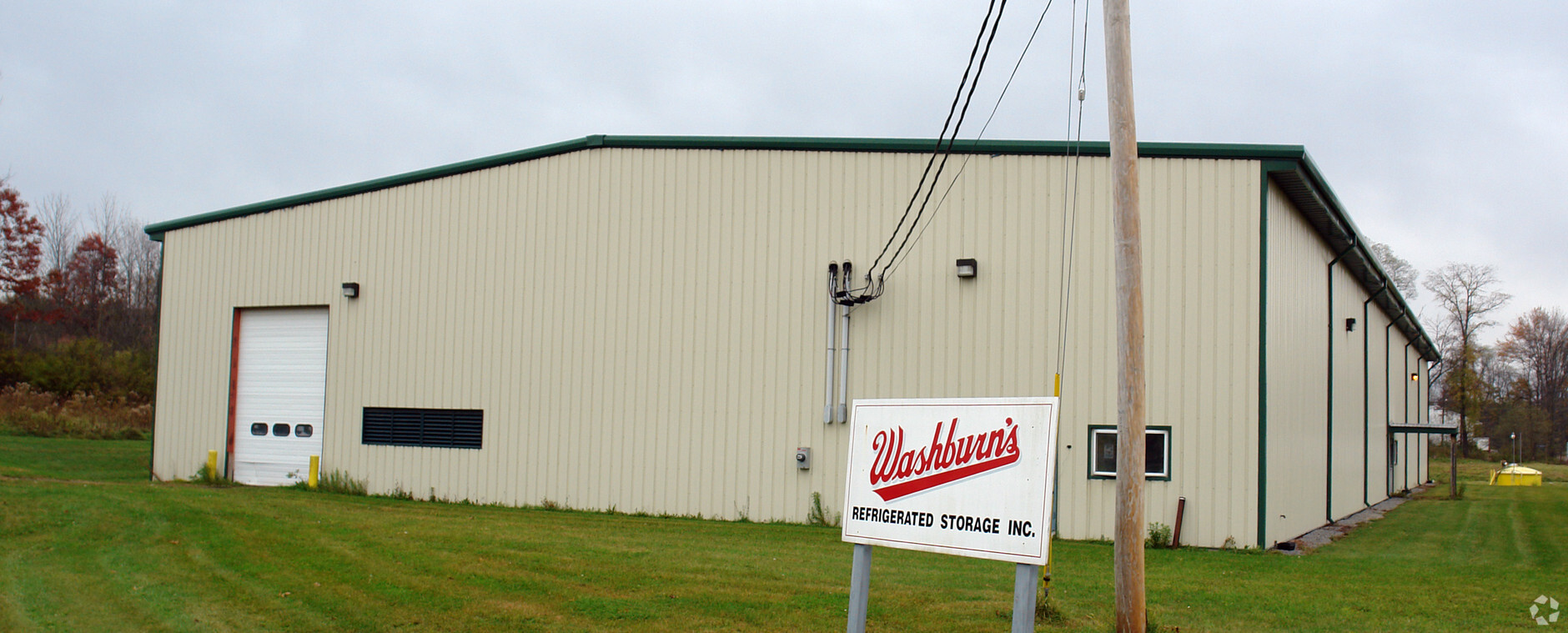
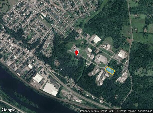
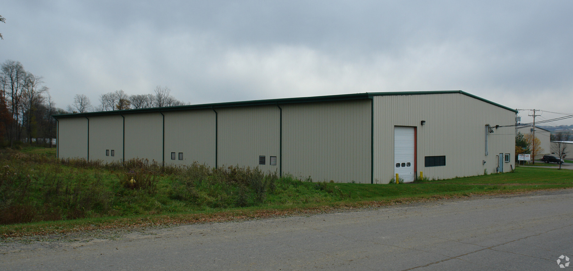
Property Record
20 Sam Stratton Rd, Amsterdam, NY 12010
NEARBY LISTINGS FOR SALE OR LEASE
Property Detail
20 Sam Stratton Rd
270100-056-014-0002-002-021-0000
Montgomery
Manufacturinglight
New York
X
2.021
36057C0216E
1.92 AC
2021
Montgomery County
2023
Albany/Schenectady/Troy
070800
Amsterdam, NY
20,000 SF
DEMOGRAPHICS near 20 Sam Stratton Rd
1 Mile
3 Mile
5 Mile
2024 Total Population
4,007
21,138
26,176
2029 Population
4,028
21,120
26,168
Pop Growth 2024-2029
+ 0.52%
(0.09%)
(0.03%)
Average Age
37
40
42
2024 Total Households
1,600
8,811
10,943
HH Growth 2024-2029
+ 0.50%
(0.05%)
0.00%
Median Household Inc
$38,030
$45,776
$49,988
Avg Household Size
2.40
2.30
2.30
2024 Avg HH Vehicles
1.00
1.00
2.00
Median Home Value
$90,447
$117,575
$133,495
Median Year Built
1948
1948
1948
Nearby Places
- Restaurants
- Banks
- Shops
- Fitness
- Groceries
PUBLIC TRANSPORTATION
COMMUTER RAIL
Amsterdam (Toronto - New York - VIA Rail)
DRIVE
WALK
Distance
Amsterdam (Toronto - New York - VIA Rail)
8 min
3.5 mi
Amsterdam Amtrak Station (Empire Service - Amtrak, Maple Leaf - Amtrak)
DRIVE
WALK
Distance
Amsterdam Amtrak Station (Empire Service - Amtrak, Maple Leaf - Amtrak)
8 min
3.5 mi
AIRPORT
Albany International
DRIVE
WALK
Distance
Albany International
44 min
27.1 mi
Freight Ports
Albany, NY Port
DRIVE
WALK
Distance
Albany, NY Port
50 min
35.3 mi
Nearby Properties
Address
Land Use
TOTAL SIZE
Lot Size
Zoning
Address
Land Use
TOTAL SIZE
Lot Size
Zoning
568,407 SF
95.30 AC
Address
Land Use
TOTAL SIZE
Lot Size
Zoning
226,614 SF
4.80 AC
05 - COMME
Address
Land Use
TOTAL SIZE
Lot Size
Zoning
197,790 SF
13.90 AC
07 - MIXED
Address
Land Use
TOTAL SIZE
Lot Size
Zoning
22,477 SF
22.20 AC
05 - COMME
Address
Land Use
TOTAL SIZE
Lot Size
Zoning
6.90 AC
Address
Land Use
TOTAL SIZE
Lot Size
Zoning
27,576 SF
42.80 AC
07 - MIXED
Address
Land Use
TOTAL SIZE
Lot Size
Zoning
76,721 SF
2.80 AC
05 - COMME
Address
Land Use
TOTAL SIZE
Lot Size
Zoning
26.20 AC
Address
Land Use
TOTAL SIZE
Lot Size
Zoning
66,137 SF
45.40 AC
05 - COMME
Address
Land Use
TOTAL SIZE
Lot Size
Zoning
80,111 SF
4.50 AC
05 - COMME
Address
Land Use
TOTAL SIZE
Lot Size
Zoning
54,169 SF
35 AC
07 - MIXED
Address
Land Use
TOTAL SIZE
Lot Size
Zoning
69,166 SF
22.90 AC
05 - COMME
Address
Land Use
TOTAL SIZE
Lot Size
Zoning
Address
Land Use
TOTAL SIZE
Lot Size
Zoning
86,164 SF
1.20 AC
05 - COMME
Address
Land Use
TOTAL SIZE
Lot Size
Zoning
14,730 SF
8.70 AC
03 - MULTI
Address
Land Use
TOTAL SIZE
Lot Size
Zoning
37,618 SF
1.20 AC
05 - COMME
Address
Land Use
TOTAL SIZE
Lot Size
Zoning
51,667 SF
82 AC
07 - MIXED
Address
Land Use
TOTAL SIZE
Lot Size
Zoning
226,614 SF
1 AC
07 - MIXED
Address
Land Use
TOTAL SIZE
Lot Size
Zoning
Address
Land Use
TOTAL SIZE
Lot Size
Zoning
38,350 SF
6.50 AC
06 - INDUS
Address
Land Use
TOTAL SIZE
Lot Size
Zoning
98,388 SF
11.10 AC
06 - INDUS
Address
Land Use
TOTAL SIZE
Lot Size
Zoning
29,588 SF
2.40 AC
07 - MIXED
Address
Land Use
TOTAL SIZE
Lot Size
Zoning
4,160 SF
1.80 AC
07 - MIXED
Address
Land Use
TOTAL SIZE
Lot Size
Zoning
99.30 AC
B1
Address
Land Use
TOTAL SIZE
Lot Size
Zoning
Address
Land Use
TOTAL SIZE
Lot Size
Zoning
59,556 SF
1 AC
07 - MIXED
Address
Land Use
TOTAL SIZE
Lot Size
Zoning
70 AC
02
Address
Land Use
TOTAL SIZE
Lot Size
Zoning
200,774 SF
13 AC
05 - COMME
Address
Land Use
TOTAL SIZE
Lot Size
Zoning
23,724 SF
6.80 AC
05 - COMME
Address
Land Use
TOTAL SIZE
Lot Size
Zoning
The World's #1 Commercial Real Estate Marketplace
Connect with us
© 2025 CoStar Group
The information above has been obtained from sources believed reliable. While we do not doubt its accuracy we have not verified it and make no guarantee, warranty or representation about it. It is your responsibility to independently confirm its accuracy and completeness. Any projections, opinions, assumptions, or estimates used are for example only and do not represent the current or future performance of the property. The value of this transaction to you depends on tax and other factors which should be evaluated by your tax, financial, and legal advisors. You and your advisors should conduct a careful, independent investigation of the property to determine to your satisfaction the suitability of the property for your needs.