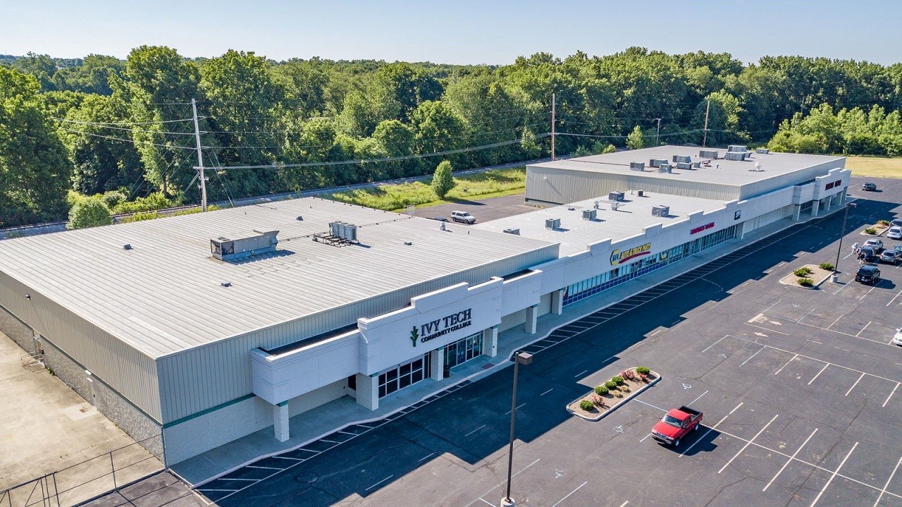
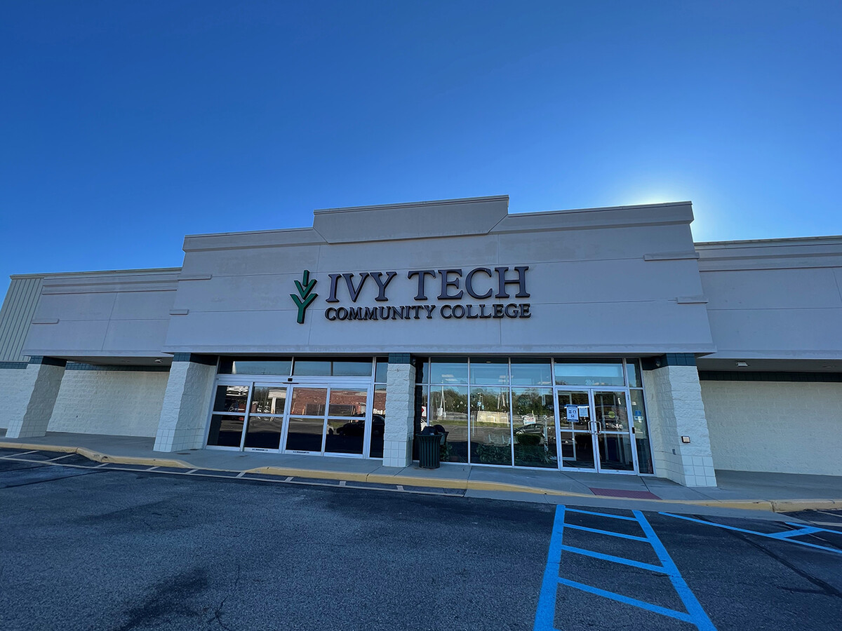
Property Record
Private Rd-Southbridge St, Mooresville, IN 46158
NEARBY LISTINGS FOR SALE OR LEASE
Property Detail
Private Rd-Southbridge St
Indianapolis-Carmel-Anderson, IN
Southridge Crossing Pud 6Th Amended Plat
55-01-36-300-004.003-005
PRIVATE RD IN SOUTHBRIDGE CROSSING PUD 6TH AMENDED PLAT 2.28 A (SOUTHBRIDGE ST)
Institutionalgeneral
Morgan
AE
Indiana
18109C0151E
2.28 AC
0
Morgan County
2023
Indianapolis
510202
DEMOGRAPHICS near Private Rd-Southbridge St
1 Mile
3 Mile
5 Mile
2024 Total Population
3,229
14,854
40,207
2029 Population
3,253
15,162
41,284
Pop Growth 2024-2029
+ 0.74%
+ 2.07%
+ 2.68%
Average Age
41
42
40
2024 Total Households
1,311
5,912
15,076
HH Growth 2024-2029
+ 0.69%
+ 1.95%
+ 2.65%
Median Household Inc
$60,781
$68,308
$75,512
Avg Household Size
2.30
2.40
2.60
2024 Avg HH Vehicles
2.00
2.00
2.00
Median Home Value
$174,409
$184,873
$199,943
Median Year Built
1972
1980
1991
Nearby Places
- Restaurants
- Banks
- Shops
- Fitness
- Groceries
PUBLIC TRANSPORTATION
AIRPORT
Indianapolis International
DRIVE
WALK
Distance
Indianapolis International
20 min
12.2 mi
Freight Ports
Port of Toledo
DRIVE
WALK
Distance
Port of Toledo
294 min
243.7 mi
SALE & LEASE HISTORY
LISTING DATE
SALE/LEASE

Sep 27, 2022
For Lease
May 18, 2017
For Lease
Jul 22, 2020
For Lease
Jul 19, 2019
For Lease
Feb 14, 2019
For Sale
Nearby Properties
Address
Land Use
TOTAL SIZE
Lot Size
Zoning
Address
Land Use
TOTAL SIZE
Lot Size
Zoning
86,017 SF
26.95 AC
Address
Land Use
TOTAL SIZE
Lot Size
Zoning
319,260 SF
Address
Land Use
TOTAL SIZE
Lot Size
Zoning
225,450 SF
98.28 AC
Address
Land Use
TOTAL SIZE
Lot Size
Zoning
76,295 SF
6.22 AC
Address
Land Use
TOTAL SIZE
Lot Size
Zoning
111,000 SF
29.08 AC
Address
Land Use
TOTAL SIZE
Lot Size
Zoning
35,643 SF
16.16 AC
Address
Land Use
TOTAL SIZE
Lot Size
Zoning
48,454 SF
6.70 AC
Address
Land Use
TOTAL SIZE
Lot Size
Zoning
77,216 SF
9.13 AC
Address
Land Use
TOTAL SIZE
Lot Size
Zoning
138,838 SF
16.27 AC
Address
Land Use
TOTAL SIZE
Lot Size
Zoning
98,014 SF
30.50 AC
Address
Land Use
TOTAL SIZE
Lot Size
Zoning
6,184 SF
8.53 AC
Address
Land Use
TOTAL SIZE
Lot Size
Zoning
90,157 SF
64.62 AC
Address
Land Use
TOTAL SIZE
Lot Size
Zoning
7,000 SF
70.99 AC
Address
Land Use
TOTAL SIZE
Lot Size
Zoning
50,672 SF
0.71 AC
Address
Land Use
TOTAL SIZE
Lot Size
Zoning
105,381 SF
Address
Land Use
TOTAL SIZE
Lot Size
Zoning
136,620 SF
15.37 AC
Address
Land Use
TOTAL SIZE
Lot Size
Zoning
58,630 SF
53.42 AC
Address
Land Use
TOTAL SIZE
Lot Size
Zoning
13,452 SF
6.13 AC
Address
Land Use
TOTAL SIZE
Lot Size
Zoning
54,944 SF
2.50 AC
Address
Land Use
TOTAL SIZE
Lot Size
Zoning
2,112 SF
21.14 AC
Address
Land Use
TOTAL SIZE
Lot Size
Zoning
54,228 SF
10.63 AC
Address
Land Use
TOTAL SIZE
Lot Size
Zoning
98,702 SF
Address
Land Use
TOTAL SIZE
Lot Size
Zoning
30,500 SF
16.29 AC
Address
Land Use
TOTAL SIZE
Lot Size
Zoning
51,800 SF
Address
Land Use
TOTAL SIZE
Lot Size
Zoning
46,560 SF
10.15 AC
Address
Land Use
TOTAL SIZE
Lot Size
Zoning
44,178 SF
21.80 AC
Address
Land Use
TOTAL SIZE
Lot Size
Zoning
143,336 SF
25.70 AC
Address
Land Use
TOTAL SIZE
Lot Size
Zoning
40,250 SF
23.62 AC
Address
Land Use
TOTAL SIZE
Lot Size
Zoning
36,400 SF
6.10 AC
Address
Land Use
TOTAL SIZE
Lot Size
Zoning
37,560 SF
15.26 AC
The World's #1 Commercial Real Estate Marketplace
Connect with us
© 2025 CoStar Group
The information above has been obtained from sources believed reliable. While we do not doubt its accuracy we have not verified it and make no guarantee, warranty or representation about it. It is your responsibility to independently confirm its accuracy and completeness. Any projections, opinions, assumptions, or estimates used are for example only and do not represent the current or future performance of the property. The value of this transaction to you depends on tax and other factors which should be evaluated by your tax, financial, and legal advisors. You and your advisors should conduct a careful, independent investigation of the property to determine to your satisfaction the suitability of the property for your needs.