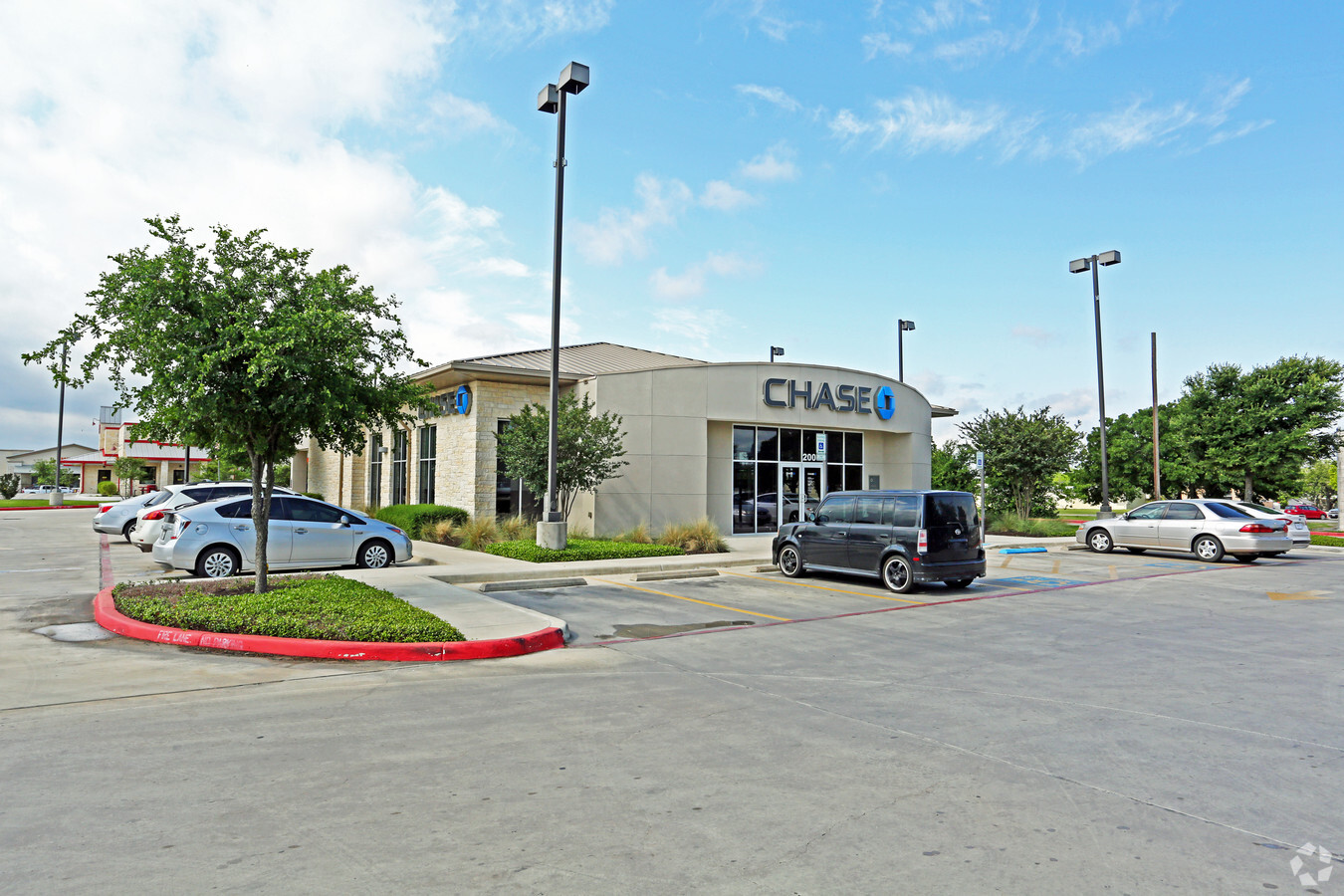
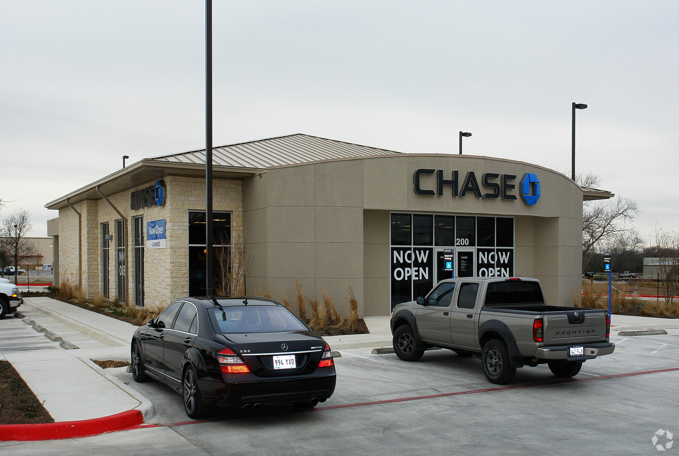
Property Record
200 E Highway 290, Dripping Springs, TX 78620
NEARBY LISTINGS FOR SALE OR LEASE
Property Detail
200 E Highway 290
Austin-Round Rock, TX
Dripping Springs Retail Center
R130272
DRIPPING SPRINGS RETAIL CENTER, BLOCK A, LOT 3A, ACRES 1.131 TAX CODES:GHA,RSP,SDS,TDS1
Commercialnec
Hays
X
Texas
48209C0105F
3a
2023
1.13 AC
2024
Hays County
010806
Austin
4,206 SF
DEMOGRAPHICS near 200 E Highway 290
1 Mile
3 Mile
5 Mile
2024 Total Population
2,392
13,391
19,507
2029 Population
3,206
17,897
26,020
Pop Growth 2024-2029
+ 34.03%
+ 33.65%
+ 33.39%
Average Age
41
41
41
2024 Total Households
861
4,776
6,990
HH Growth 2024-2029
+ 34.96%
+ 34.65%
+ 34.39%
Median Household Inc
$129,725
$128,571
$127,513
Avg Household Size
2.80
2.80
2.80
2024 Avg HH Vehicles
2.00
2.00
2.00
Median Home Value
$603,197
$659,840
$658,475
Median Year Built
2010
2009
2008
Nearby Places
- Restaurants
- Banks
- Shops
- Fitness
- Groceries
PUBLIC TRANSPORTATION
AIRPORT
Austin-Bergstrom International
DRIVE
WALK
Distance
Austin-Bergstrom International
46 min
29.3 mi
Freight Ports
Calhoun Port
DRIVE
WALK
Distance
Calhoun Port
207 min
167.8 mi
Nearby Properties
Address
Land Use
TOTAL SIZE
Lot Size
Zoning
Address
Land Use
TOTAL SIZE
Lot Size
Zoning
55,998 SF
4.79 AC
Address
Land Use
TOTAL SIZE
Lot Size
Zoning
266.20 AC
Address
Land Use
TOTAL SIZE
Lot Size
Zoning
Address
Land Use
TOTAL SIZE
Lot Size
Zoning
75.15 AC
Address
Land Use
TOTAL SIZE
Lot Size
Zoning
Address
Land Use
TOTAL SIZE
Lot Size
Zoning
40,588 SF
5.09 AC
Address
Land Use
TOTAL SIZE
Lot Size
Zoning
75,842 SF
23.87 AC
Address
Land Use
TOTAL SIZE
Lot Size
Zoning
56.63 AC
Address
Land Use
TOTAL SIZE
Lot Size
Zoning
1,200 SF
14.51 AC
Address
Land Use
TOTAL SIZE
Lot Size
Zoning
27,828 SF
2.18 AC
Address
Land Use
TOTAL SIZE
Lot Size
Zoning
38.01 AC
Address
Land Use
TOTAL SIZE
Lot Size
Zoning
Address
Land Use
TOTAL SIZE
Lot Size
Zoning
56,828 SF
5.23 AC
Address
Land Use
TOTAL SIZE
Lot Size
Zoning
59,572 SF
1.56 AC
Address
Land Use
TOTAL SIZE
Lot Size
Zoning
Address
Land Use
TOTAL SIZE
Lot Size
Zoning
15,750 SF
1.94 AC
Address
Land Use
TOTAL SIZE
Lot Size
Zoning
212.08 AC
Address
Land Use
TOTAL SIZE
Lot Size
Zoning
7,080 SF
13.44 AC
Address
Land Use
TOTAL SIZE
Lot Size
Zoning
20,860 SF
5.13 AC
Address
Land Use
TOTAL SIZE
Lot Size
Zoning
Address
Land Use
TOTAL SIZE
Lot Size
Zoning
Address
Land Use
TOTAL SIZE
Lot Size
Zoning
2,116 SF
8.55 AC
Address
Land Use
TOTAL SIZE
Lot Size
Zoning
Address
Land Use
TOTAL SIZE
Lot Size
Zoning
103,275 SF
16.53 AC
Address
Land Use
TOTAL SIZE
Lot Size
Zoning
12,506 SF
5.31 AC
Address
Land Use
TOTAL SIZE
Lot Size
Zoning
12,000 SF
10 AC
Address
Land Use
TOTAL SIZE
Lot Size
Zoning
32,564 SF
5.79 AC
Address
Land Use
TOTAL SIZE
Lot Size
Zoning
3,147 SF
6.82 AC
Address
Land Use
TOTAL SIZE
Lot Size
Zoning
Address
Land Use
TOTAL SIZE
Lot Size
Zoning
32,642 SF
9.17 AC
The World's #1 Commercial Real Estate Marketplace
Connect with us
© 2025 CoStar Group
The information above has been obtained from sources believed reliable. While we do not doubt its accuracy we have not verified it and make no guarantee, warranty or representation about it. It is your responsibility to independently confirm its accuracy and completeness. Any projections, opinions, assumptions, or estimates used are for example only and do not represent the current or future performance of the property. The value of this transaction to you depends on tax and other factors which should be evaluated by your tax, financial, and legal advisors. You and your advisors should conduct a careful, independent investigation of the property to determine to your satisfaction the suitability of the property for your needs.