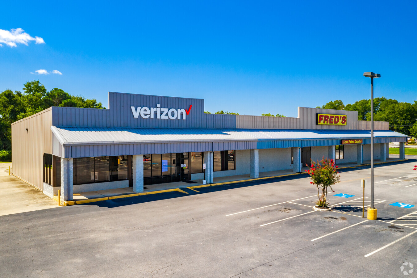
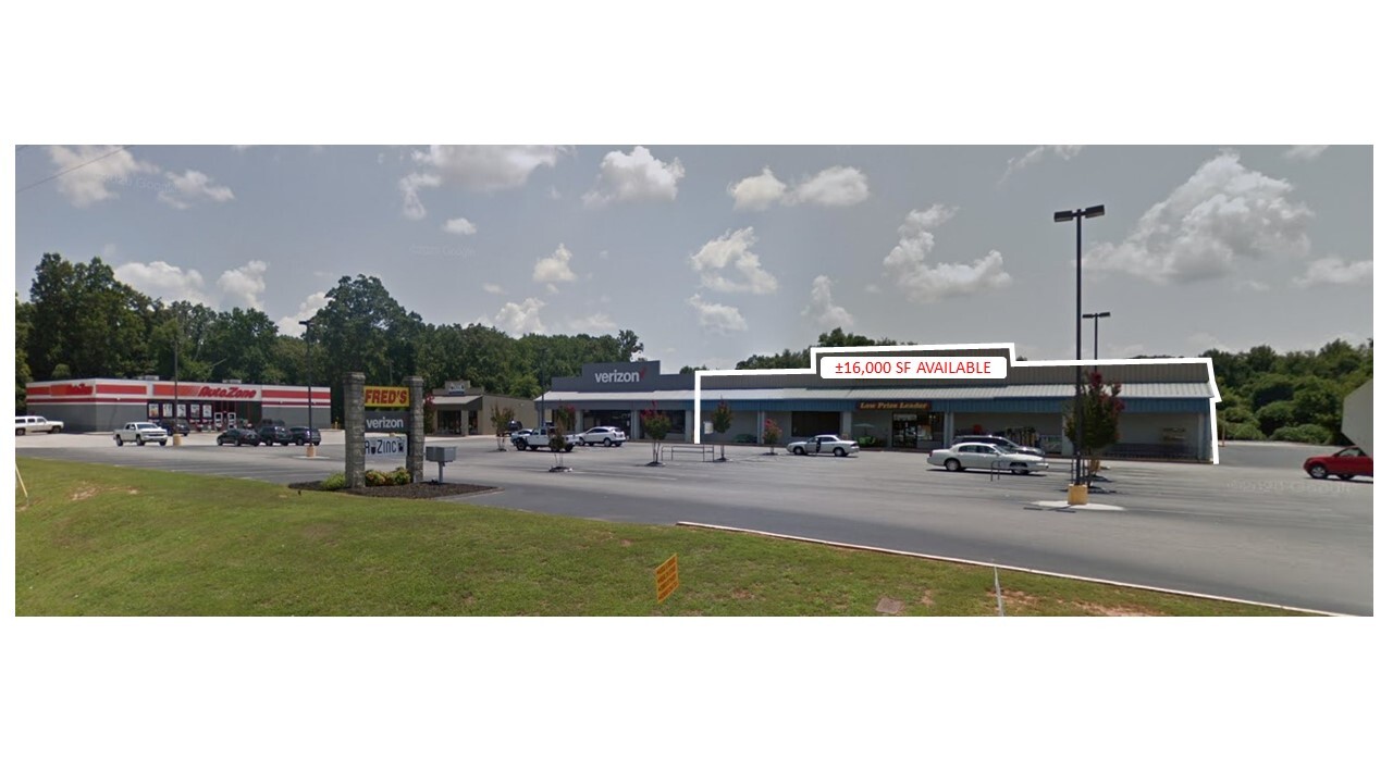
Property Record
200 E Louise St, Clarkesville, GA 30523

NEARBY LISTINGS FOR SALE OR LEASE
Property Detail
200 E Louise St
104-140B
10-3 PB 56-186 MOVIE GAL DB 1303-999
Stripcommercialcenter
Habersham
X
Georgia
13137C0207D
1.96 AC
2024
Georgia Northeast
2024
Other Market Areas
000300
Cornelia, GA
18,036 SF
DEMOGRAPHICS near 200 E Louise St
1 Mile
3 Mile
5 Mile
2024 Total Population
2,177
8,118
18,861
2029 Population
2,373
8,840
20,556
Pop Growth 2024-2029
+ 9.00%
+ 8.89%
+ 8.99%
Average Age
41
41
41
2024 Total Households
860
3,098
7,045
HH Growth 2024-2029
+ 8.72%
+ 8.59%
+ 8.72%
Median Household Inc
$64,657
$64,787
$65,057
Avg Household Size
2.40
2.50
2.50
2024 Avg HH Vehicles
2.00
2.00
2.00
Median Home Value
$225,748
$216,077
$200,213
Median Year Built
1986
1990
1991
Nearby Places
- Restaurants
- Banks
- Shops
- Fitness
- Groceries
SALE & LEASE HISTORY
LISTING DATE
SALE/LEASE

Sep 27, 2019
For Lease
Nearby Properties
Address
Land Use
TOTAL SIZE
Lot Size
Zoning
Address
Land Use
TOTAL SIZE
Lot Size
Zoning
190,000 SF
22 AC
INST
Address
Land Use
TOTAL SIZE
Lot Size
Zoning
79,955 SF
159.83 AC
INST
Address
Land Use
TOTAL SIZE
Lot Size
Zoning
9,393 SF
303.19 AC
LI
Address
Land Use
TOTAL SIZE
Lot Size
Zoning
75,612 SF
41.34 AC
LI
Address
Land Use
TOTAL SIZE
Lot Size
Zoning
55,023 SF
69.23 AC
INST
Address
Land Use
TOTAL SIZE
Lot Size
Zoning
35,444 SF
10.63 AC
INST
Address
Land Use
TOTAL SIZE
Lot Size
Zoning
44,508 SF
9.54 AC
MI
Address
Land Use
TOTAL SIZE
Lot Size
Zoning
40,485 SF
35.35 AC
LI
Address
Land Use
TOTAL SIZE
Lot Size
Zoning
4,582 SF
25.58 AC
MI
Address
Land Use
TOTAL SIZE
Lot Size
Zoning
241,844 SF
26.58 AC
MI
Address
Land Use
TOTAL SIZE
Lot Size
Zoning
73,157 SF
9.66 AC
HB
Address
Land Use
TOTAL SIZE
Lot Size
Zoning
18,855 SF
12 AC
INS
Address
Land Use
TOTAL SIZE
Lot Size
Zoning
18,958 SF
16.49 AC
INS
Address
Land Use
TOTAL SIZE
Lot Size
Zoning
7,113 SF
16.42 AC
LI
Address
Land Use
TOTAL SIZE
Lot Size
Zoning
27,215 SF
7.44 AC
HI
Address
Land Use
TOTAL SIZE
Lot Size
Zoning
44,885 SF
33.44 AC
INS
Address
Land Use
TOTAL SIZE
Lot Size
Zoning
27,018 SF
8.45 AC
HB
Address
Land Use
TOTAL SIZE
Lot Size
Zoning
6,948 SF
1.50 AC
INS
Address
Land Use
TOTAL SIZE
Lot Size
Zoning
1,304 SF
7.06 AC
R2
Address
Land Use
TOTAL SIZE
Lot Size
Zoning
61,590 SF
18.86 AC
LI
Address
Land Use
TOTAL SIZE
Lot Size
Zoning
32,271 SF
0.86 AC
INST
Address
Land Use
TOTAL SIZE
Lot Size
Zoning
37,498 SF
25.25 AC
HI
Address
Land Use
TOTAL SIZE
Lot Size
Zoning
29,308 SF
12.94 AC
HI
Address
Land Use
TOTAL SIZE
Lot Size
Zoning
33,450 SF
2.20 AC
INS
Address
Land Use
TOTAL SIZE
Lot Size
Zoning
2,560 SF
8.49 AC
MI
Address
Land Use
TOTAL SIZE
Lot Size
Zoning
11,181 SF
1.35 AC
HB
Address
Land Use
TOTAL SIZE
Lot Size
Zoning
44,237 SF
2.30 AC
DB
Address
Land Use
TOTAL SIZE
Lot Size
Zoning
7,600 SF
15.69 AC
HI
Address
Land Use
TOTAL SIZE
Lot Size
Zoning
15,322 SF
41.70 AC
LI
Address
Land Use
TOTAL SIZE
Lot Size
Zoning
53,899 SF
0.80 AC
DB
The World's #1 Commercial Real Estate Marketplace
Connect with us
© 2025 CoStar Group
The information above has been obtained from sources believed reliable. While we do not doubt its accuracy we have not verified it and make no guarantee, warranty or representation about it. It is your responsibility to independently confirm its accuracy and completeness. Any projections, opinions, assumptions, or estimates used are for example only and do not represent the current or future performance of the property. The value of this transaction to you depends on tax and other factors which should be evaluated by your tax, financial, and legal advisors. You and your advisors should conduct a careful, independent investigation of the property to determine to your satisfaction the suitability of the property for your needs.