Property Record
200 Highwood Ct, Knoxville, TN 37920
NEARBY LISTINGS FOR SALE OR LEASE
Property Detail
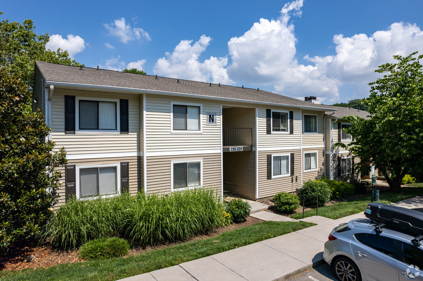
200 Highwood Ct
Knoxville, TN
Woodmeade South Apt S/D
109HB-006
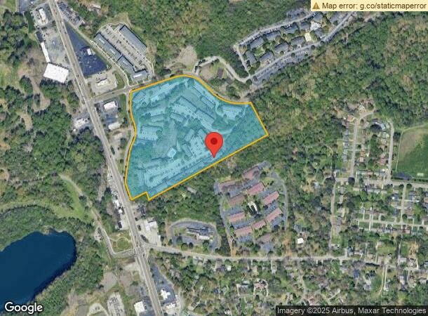
SUBDIVISIONNAME WOODMEADE SOUTH APT S/D MAPPLATB 73S MA PPLATP 43 DIMENSIONS 828.01 X 1181.98 X IRR
Multifamilydwelling
Knox
X
Tennessee
47093C0283G
1
2024
20.10 AC
2024
South Knoxville
002300
Knoxville
1,684 SF
DEMOGRAPHICS near 200 Highwood Ct
1 Mile
3 Mile
5 Mile
2024 Total Population
10,016
70,558
136,956
2029 Population
11,229
77,680
150,220
Pop Growth 2024-2029
+ 12.11%
+ 10.09%
+ 9.68%
Average Age
34
34
36
2024 Total Households
4,881
29,313
58,401
HH Growth 2024-2029
+ 12.11%
+ 11.18%
+ 10.28%
Median Household Inc
$41,615
$35,820
$40,166
Avg Household Size
2.00
2.10
2.10
2024 Avg HH Vehicles
2.00
2.00
2.00
Median Home Value
$170,402
$184,834
$187,257
Median Year Built
1983
1971
1968
Nearby Places
- Restaurants
- Banks
- Shops
- Fitness
- Groceries
PUBLIC TRANSPORTATION
AIRPORT
McGhee Tyson
DRIVE
WALK
Distance
McGhee Tyson
28 min
14.5 mi
Freight Ports
North Charleston Terminal
DRIVE
WALK
Distance
North Charleston Terminal
422 min
365.4 mi
Nearby Properties
Address
Land Use
TOTAL SIZE
Lot Size
Zoning
Address
Land Use
TOTAL SIZE
Lot Size
Zoning
285,481 SF
1.77 AC
Address
Land Use
TOTAL SIZE
Lot Size
Zoning
254,407 SF
1.08 AC
Address
Land Use
TOTAL SIZE
Lot Size
Zoning
320,324 SF
2.83 AC
Address
Land Use
TOTAL SIZE
Lot Size
Zoning
404,996 SF
Address
Land Use
TOTAL SIZE
Lot Size
Zoning
154,163 SF
3.48 AC
Address
Land Use
TOTAL SIZE
Lot Size
Zoning
210,640 SF
1.90 AC
Address
Land Use
TOTAL SIZE
Lot Size
Zoning
38,438 SF
2.04 AC
Address
Land Use
TOTAL SIZE
Lot Size
Zoning
742,968 SF
2.95 AC
Address
Land Use
TOTAL SIZE
Lot Size
Zoning
207,067 SF
11.79 AC
Address
Land Use
TOTAL SIZE
Lot Size
Zoning
117,375 SF
1.82 AC
Address
Land Use
TOTAL SIZE
Lot Size
Zoning
120,331 SF
5.62 AC
Address
Land Use
TOTAL SIZE
Lot Size
Zoning
177,685 SF
4.20 AC
Address
Land Use
TOTAL SIZE
Lot Size
Zoning
359,624 SF
60.94 AC
Address
Land Use
TOTAL SIZE
Lot Size
Zoning
173,567 SF
1.10 AC
Address
Land Use
TOTAL SIZE
Lot Size
Zoning
131,702 SF
0.68 AC
Address
Land Use
TOTAL SIZE
Lot Size
Zoning
395,134 SF
1.35 AC
Address
Land Use
TOTAL SIZE
Lot Size
Zoning
325,704 SF
1.30 AC
Address
Land Use
TOTAL SIZE
Lot Size
Zoning
60,782 SF
6.12 AC
Address
Land Use
TOTAL SIZE
Lot Size
Zoning
76,620 SF
0.64 AC
Address
Land Use
TOTAL SIZE
Lot Size
Zoning
291,550 SF
2.47 AC
Address
Land Use
TOTAL SIZE
Lot Size
Zoning
325,704 SF
1.30 AC
Address
Land Use
TOTAL SIZE
Lot Size
Zoning
2,800 SF
5.32 AC
Address
Land Use
TOTAL SIZE
Lot Size
Zoning
62,114 SF
3.60 AC
Address
Land Use
TOTAL SIZE
Lot Size
Zoning
79,427 SF
1.74 AC
Address
Land Use
TOTAL SIZE
Lot Size
Zoning
84,171 SF
1.88 AC
Address
Land Use
TOTAL SIZE
Lot Size
Zoning
3,850 SF
23.59 AC
Address
Land Use
TOTAL SIZE
Lot Size
Zoning
110,402 SF
5.28 AC
Address
Land Use
TOTAL SIZE
Lot Size
Zoning
1,950 SF
8.60 AC
Address
Land Use
TOTAL SIZE
Lot Size
Zoning
594,455 SF
3.74 AC
Address
Land Use
TOTAL SIZE
Lot Size
Zoning
66,060 SF
1.57 AC
The World's #1 Commercial Real Estate Marketplace
Connect with us
© 2025 CoStar Group
The information above has been obtained from sources believed reliable. While we do not doubt its accuracy we have not verified it and make no guarantee, warranty or representation about it. It is your responsibility to independently confirm its accuracy and completeness. Any projections, opinions, assumptions, or estimates used are for example only and do not represent the current or future performance of the property. The value of this transaction to you depends on tax and other factors which should be evaluated by your tax, financial, and legal advisors. You and your advisors should conduct a careful, independent investigation of the property to determine to your satisfaction the suitability of the property for your needs.