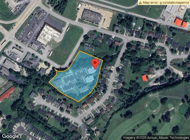
Property Record
200 Hubbard Rd, Winchester, KY 40391
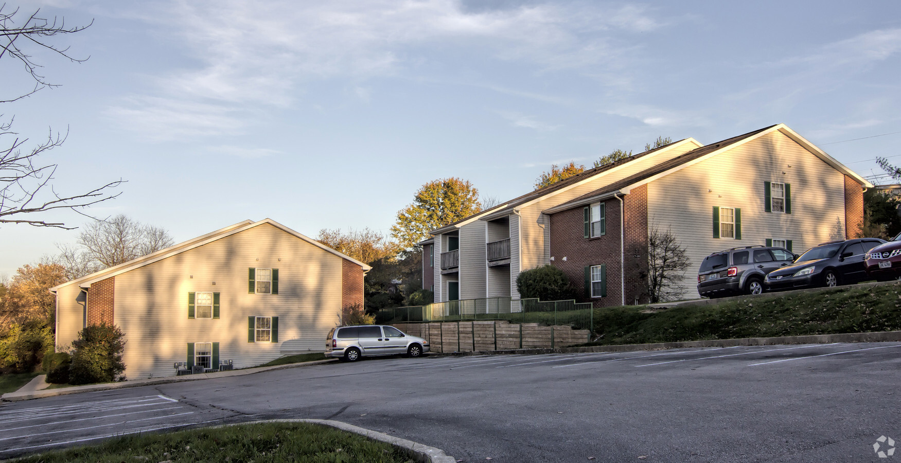
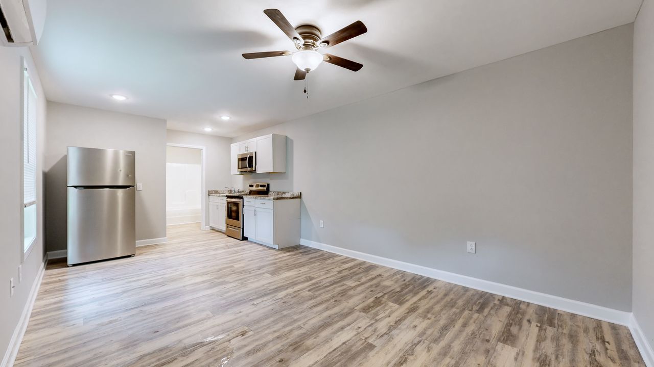

This Property Is For Sale
NEARBY LISTINGS FOR SALE OR LEASE
-
-
View all Winchester listings for sale on LoopNet.com
Property Detail
200 Hubbard Rd
Lexington-Fayette, KY
Country Club Estates
044-3009-02500
TRACT 1 PLAT 1117B
Commercialnec
Clark
AE
Kentucky
21151C0075C
33a,33b
2024
3.37 AC
2024
Clark County
020105
Lexington/Fayette
DEMOGRAPHICS near 200 Hubbard Rd
1 Mile
3 Mile
5 Mile
2024 Total Population
3,788
25,609
29,810
2029 Population
3,798
25,854
30,104
Pop Growth 2024-2029
+ 0.26%
+ 0.96%
+ 0.99%
Average Age
42
40
41
2024 Total Households
1,544
10,563
12,144
HH Growth 2024-2029
+ 0.26%
+ 0.96%
+ 0.99%
Median Household Inc
$79,391
$56,420
$57,490
Avg Household Size
2.40
2.40
2.40
2024 Avg HH Vehicles
2.00
2.00
2.00
Median Home Value
$202,853
$170,819
$174,255
Median Year Built
1975
1978
1979
Nearby Places
- Restaurants
- Banks
- Shops
- Fitness
- Groceries
PUBLIC TRANSPORTATION
AIRPORT
Blue Grass
DRIVE
WALK
Distance
Blue Grass
42 min
29.9 mi
Freight Ports
Port of Toledo
DRIVE
WALK
Distance
Port of Toledo
350 min
303.1 mi
Nearby Properties
Address
Land Use
TOTAL SIZE
Lot Size
Zoning
Address
Land Use
TOTAL SIZE
Lot Size
Zoning
45,000 SF
30.26 AC
AGRICULTUR
Address
Land Use
TOTAL SIZE
Lot Size
Zoning
792 SF
5.71 AC
SINGLE FAM
Address
Land Use
TOTAL SIZE
Lot Size
Zoning
Address
Land Use
TOTAL SIZE
Lot Size
Zoning
Address
Land Use
TOTAL SIZE
Lot Size
Zoning
Address
Land Use
TOTAL SIZE
Lot Size
Zoning
Address
Land Use
TOTAL SIZE
Lot Size
Zoning
Address
Land Use
TOTAL SIZE
Lot Size
Zoning
179,856 SF
20.42 AC
PLANNED DE
Address
Land Use
TOTAL SIZE
Lot Size
Zoning
Address
Land Use
TOTAL SIZE
Lot Size
Zoning
6.65 AC
I1
Address
Land Use
TOTAL SIZE
Lot Size
Zoning
6.50 AC
PD
Address
Land Use
TOTAL SIZE
Lot Size
Zoning
0.98 AC
DOWNTOWN B
Address
Land Use
TOTAL SIZE
Lot Size
Zoning
24.23 AC
I1
Address
Land Use
TOTAL SIZE
Lot Size
Zoning
121,809 SF
19.44 AC
LIGHT INDU
Address
Land Use
TOTAL SIZE
Lot Size
Zoning
Address
Land Use
TOTAL SIZE
Lot Size
Zoning
76,440 SF
15.67 AC
PLANNED DE
Address
Land Use
TOTAL SIZE
Lot Size
Zoning
4.53 AC
Address
Land Use
TOTAL SIZE
Lot Size
Zoning
64,000 SF
8.45 AC
HIGHWAY BU
Address
Land Use
TOTAL SIZE
Lot Size
Zoning
3.15 AC
Address
Land Use
TOTAL SIZE
Lot Size
Zoning
60,060 SF
6.04 AC
HIGHWAY BU
Address
Land Use
TOTAL SIZE
Lot Size
Zoning
5.88 AC
PLANNED DE
Address
Land Use
TOTAL SIZE
Lot Size
Zoning
69,834 SF
8.82 AC
PLANNED DE
Address
Land Use
TOTAL SIZE
Lot Size
Zoning
1.07 AC
PD
Address
Land Use
TOTAL SIZE
Lot Size
Zoning
1.21 AC
B3
Address
Land Use
TOTAL SIZE
Lot Size
Zoning
45,220 SF
5.03 AC
HIGHWAY BU
Address
Land Use
TOTAL SIZE
Lot Size
Zoning
1.90 AC
B3
Address
Land Use
TOTAL SIZE
Lot Size
Zoning
7.80 AC
R4
Address
Land Use
TOTAL SIZE
Lot Size
Zoning
150,042 SF
11.70 AC
HIGHWAY BU
Address
Land Use
TOTAL SIZE
Lot Size
Zoning
20 AC
MH
Address
Land Use
TOTAL SIZE
Lot Size
Zoning
5.20 AC
B3
The World's #1 Commercial Real Estate Marketplace
Connect with us
© 2025 CoStar Group
The information above has been obtained from sources believed reliable. While we do not doubt its accuracy we have not verified it and make no guarantee, warranty or representation about it. It is your responsibility to independently confirm its accuracy and completeness. Any projections, opinions, assumptions, or estimates used are for example only and do not represent the current or future performance of the property. The value of this transaction to you depends on tax and other factors which should be evaluated by your tax, financial, and legal advisors. You and your advisors should conduct a careful, independent investigation of the property to determine to your satisfaction the suitability of the property for your needs.