Property Record
200 Lee Rd, Watsonville, CA 95076


Property Detail
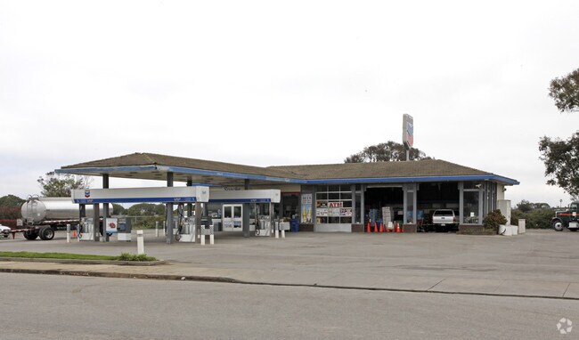
200 Lee Rd
Servicestation
Santa Cruz
CT-W
California
AO River or stream flood hazard areas, and areas with a 1% or greater chance of shallow flooding each year. These areas have a 26% chance of flooding over the life of a 30-year mortgage.
1.11 AC
2024
Watsonville
2025
Santa Cruz/Watsonville
122300
Santa Cruz-Watsonville, CA
5,593 SF
052-271-03-000
NEARBY LISTINGS FOR SALE OR LEASE
DEMOGRAPHICS near 200 Lee Rd
1 mile
3 mile
5 mile
2024 Total Population
2,197
55,253
73,282
2029 Population
2,180
53,635
71,051
Pop Growth 2024-2029
(0.77%)
(2.93%)
(3.04%)
Average Age
34
36
37
2024 Total Households
513
14,447
19,397
HH Growth 2024-2029
(1.17%)
(3.41%)
(3.49%)
Median Household Inc
$97,465
$75,997
$79,758
Avg Household Size
3.90
3.60
3.50
2024 Avg HH Vehicles
3.00
2.00
2.00
Median Home Value
$728,114
$710,172
$738,385
Median Year Built
2004
1974
1974
Nearby Places
Map Layers
Map Styles
 Street
 Aerial
Transit
 Traffic
 Biking
Places
Listings with unknown addresses are not visible on the map
- Restaurants
- Banks
- Shops
- Fitness
- Groceries
PUBLIC TRANSPORTATION
AIRPORT
Monterey Regional
Drive
Walk
Distance
Monterey Regional
33 min
25.8 mi
Norman Y Mineta San Jose International
Drive
Walk
Distance
Norman Y Mineta San Jose International
62 min
47.5 mi
Freight Ports
Port of Redwood City
Drive
Walk
Distance
Port of Redwood City
82 min
63.3 mi
SALE & LEASE HISTORY
LISTING DATE
SALE/LEASE

Mar 25, 2023
For Lease
Nearby Properties
Address
Land Use
TOTAL SIZE
Lot Size
Zoning
Address
Land Use
TOTAL SIZE
Lot Size
Zoning
163,824 SF
13.98 AC
Address
Land Use
TOTAL SIZE
Lot Size
Zoning
155,402 SF
11.53 AC
Address
Land Use
TOTAL SIZE
Lot Size
Zoning
193,645 SF
25.70 AC
Address
Land Use
TOTAL SIZE
Lot Size
Zoning
77,449 SF
14.38 AC
R-1-6
Address
Land Use
TOTAL SIZE
Lot Size
Zoning
64,650 SF
6.04 AC
Address
Land Use
TOTAL SIZE
Lot Size
Zoning
146,574 SF
9.97 AC
Address
Land Use
TOTAL SIZE
Lot Size
Zoning
Address
Land Use
TOTAL SIZE
Lot Size
Zoning
94,674 SF
3.38 AC
Address
Land Use
TOTAL SIZE
Lot Size
Zoning
2.34 AC
Address
Land Use
TOTAL SIZE
Lot Size
Zoning
373,950 SF
16.47 AC
Address
Land Use
TOTAL SIZE
Lot Size
Zoning
8.45 AC
Address
Land Use
TOTAL SIZE
Lot Size
Zoning
8.64 AC
Address
Land Use
TOTAL SIZE
Lot Size
Zoning
7.94 AC
Address
Land Use
TOTAL SIZE
Lot Size
Zoning
59,897 SF
1.54 AC
Address
Land Use
TOTAL SIZE
Lot Size
Zoning
58,495 SF
1.77 AC
Address
Land Use
TOTAL SIZE
Lot Size
Zoning
10.47 AC
CAW
Address
Land Use
TOTAL SIZE
Lot Size
Zoning
Address
Land Use
TOTAL SIZE
Lot Size
Zoning
40,585 SF
2.40 AC
R-1-6
Address
Land Use
TOTAL SIZE
Lot Size
Zoning
53,672 SF
5.14 AC
Address
Land Use
TOTAL SIZE
Lot Size
Zoning
45,000 SF
1.56 AC
Address
Land Use
TOTAL SIZE
Lot Size
Zoning
64,472 SF
3.27 AC
Address
Land Use
TOTAL SIZE
Lot Size
Zoning
7.02 AC
Address
Land Use
TOTAL SIZE
Lot Size
Zoning
65,782 SF
3.60 AC
Address
Land Use
TOTAL SIZE
Lot Size
Zoning
75,884 SF
2.03 AC
Address
Land Use
TOTAL SIZE
Lot Size
Zoning
2.56 AC
Address
Land Use
TOTAL SIZE
Lot Size
Zoning
16,396 SF
5.57 AC
Address
Land Use
TOTAL SIZE
Lot Size
Zoning
133,208 SF
4.53 AC
Address
Land Use
TOTAL SIZE
Lot Size
Zoning
36,320 SF
3.20 AC
Address
Land Use
TOTAL SIZE
Lot Size
Zoning
61,561 SF
6.38 AC
Address
Land Use
TOTAL SIZE
Lot Size
Zoning
39,711 SF
3.88 AC
The World's #1 Commercial Real Estate Marketplace
Connect with us
© 2026 CoStar Group
The information above has been obtained from sources believed reliable. While we do not doubt its accuracy we have not verified it and make no guarantee, warranty or representation about it. It is your responsibility to independently confirm its accuracy and completeness. Any projections, opinions, assumptions, or estimates used are for example only and do not represent the current or future performance of the property. The value of this transaction to you depends on tax and other factors which should be evaluated by your tax, financial, and legal advisors. You and your advisors should conduct a careful, independent investigation of the property to determine to your satisfaction the suitability of the property for your needs.