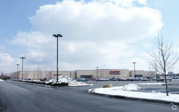
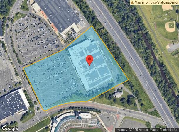
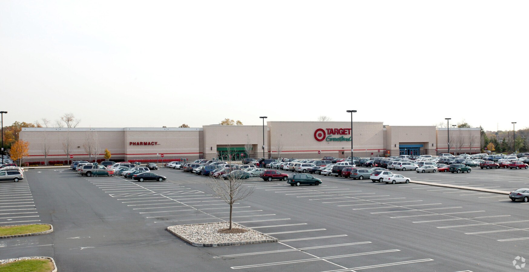
Property Record
200 Promenade Blvd, Bridgewater, NJ 08807

NEARBY LISTINGS FOR SALE OR LEASE
Property Detail
200 Promenade Blvd
Northern New Jersey
Bridgewater Promenade
Newark, NJ-PA
Somerset
06-00350-0000-00003
New Jersey
Storemultistory
3
2024
11.36 AC
2024
Route 287 West
051000
DEMOGRAPHICS near 200 Promenade Blvd
1 Mile
3 Mile
5 Mile
2024 Total Population
9,494
63,771
159,243
2029 Population
9,285
63,453
158,986
Pop Growth 2024-2029
(2.20%)
(0.50%)
(0.16%)
Average Age
38
42
42
2024 Total Households
3,212
23,739
58,454
HH Growth 2024-2029
(2.18%)
(0.47%)
(0.12%)
Median Household Inc
$74,721
$98,835
$107,534
Avg Household Size
2.90
2.60
2.60
2024 Avg HH Vehicles
2.00
2.00
2.00
Median Home Value
$332,371
$379,333
$395,192
Median Year Built
1955
1965
1972
Nearby Places
- Restaurants
- Banks
- Shops
- Fitness
- Groceries
PUBLIC TRANSPORTATION
COMMUTER RAIL
Bridgewater (Raritan Valley Line - NJ Transit Commuter Rail (NJ Transit))
DRIVE
WALK
Distance
Bridgewater (Raritan Valley Line - NJ Transit Commuter Rail (NJ Transit))
2 min
7 min
0.4 mi
Bound Brook (Raritan Valley Line - NJ Transit Commuter Rail (NJ Transit))
DRIVE
WALK
Distance
Bound Brook (Raritan Valley Line - NJ Transit Commuter Rail (NJ Transit))
5 min
1.6 mi
AIRPORT
Newark Liberty International
DRIVE
WALK
Distance
Newark Liberty International
43 min
29.2 mi
Trenton Mercer
DRIVE
WALK
Distance
Trenton Mercer
57 min
36.8 mi
Freight Ports
New York Container Terminal
DRIVE
WALK
Distance
New York Container Terminal
39 min
29.6 mi
Nearby Properties
Address
Land Use
TOTAL SIZE
Lot Size
Zoning
Address
Land Use
TOTAL SIZE
Lot Size
Zoning
13.59 AC
H
Address
Land Use
TOTAL SIZE
Lot Size
Zoning
6,625 SF
22.51 AC
B-I
Address
Land Use
TOTAL SIZE
Lot Size
Zoning
70.22 AC
M1
Address
Land Use
TOTAL SIZE
Lot Size
Zoning
17.01 AC
M1
Address
Land Use
TOTAL SIZE
Lot Size
Zoning
19.46 AC
M2
Address
Land Use
TOTAL SIZE
Lot Size
Zoning
31.50 AC
M1
Address
Land Use
TOTAL SIZE
Lot Size
Zoning
39.10 AC
C3
Address
Land Use
TOTAL SIZE
Lot Size
Zoning
22.74 AC
LC
Address
Land Use
TOTAL SIZE
Lot Size
Zoning
26.23 AC
M1
Address
Land Use
TOTAL SIZE
Lot Size
Zoning
Address
Land Use
TOTAL SIZE
Lot Size
Zoning
Address
Land Use
TOTAL SIZE
Lot Size
Zoning
24.34 AC
IND
Address
Land Use
TOTAL SIZE
Lot Size
Zoning
153 AC
Address
Land Use
TOTAL SIZE
Lot Size
Zoning
82.79 AC
M-2
Address
Land Use
TOTAL SIZE
Lot Size
Zoning
26.53 AC
M1
Address
Land Use
TOTAL SIZE
Lot Size
Zoning
4.05 AC
Address
Land Use
TOTAL SIZE
Lot Size
Zoning
13.38 AC
B2
Address
Land Use
TOTAL SIZE
Lot Size
Zoning
17.65 AC
M1
Address
Land Use
TOTAL SIZE
Lot Size
Zoning
19.63 AC
M1
Address
Land Use
TOTAL SIZE
Lot Size
Zoning
7,580 SF
22 AC
M1
Address
Land Use
TOTAL SIZE
Lot Size
Zoning
34.20 AC
CB
Address
Land Use
TOTAL SIZE
Lot Size
Zoning
43.63 AC
M1B
Address
Land Use
TOTAL SIZE
Lot Size
Zoning
19.95 AC
M1B
Address
Land Use
TOTAL SIZE
Lot Size
Zoning
34.43 AC
CB
Address
Land Use
TOTAL SIZE
Lot Size
Zoning
30.43 AC
HEC
Address
Land Use
TOTAL SIZE
Lot Size
Zoning
394 SF
36.05 AC
M105
Address
Land Use
TOTAL SIZE
Lot Size
Zoning
329,614 SF
23.82 AC
CB
Address
Land Use
TOTAL SIZE
Lot Size
Zoning
Address
Land Use
TOTAL SIZE
Lot Size
Zoning
605 SF
26.79 AC
M1
Address
Land Use
TOTAL SIZE
Lot Size
Zoning
14.24 AC
RM
The World's #1 Commercial Real Estate Marketplace
Connect with us
© 2025 CoStar Group
The information above has been obtained from sources believed reliable. While we do not doubt its accuracy we have not verified it and make no guarantee, warranty or representation about it. It is your responsibility to independently confirm its accuracy and completeness. Any projections, opinions, assumptions, or estimates used are for example only and do not represent the current or future performance of the property. The value of this transaction to you depends on tax and other factors which should be evaluated by your tax, financial, and legal advisors. You and your advisors should conduct a careful, independent investigation of the property to determine to your satisfaction the suitability of the property for your needs.