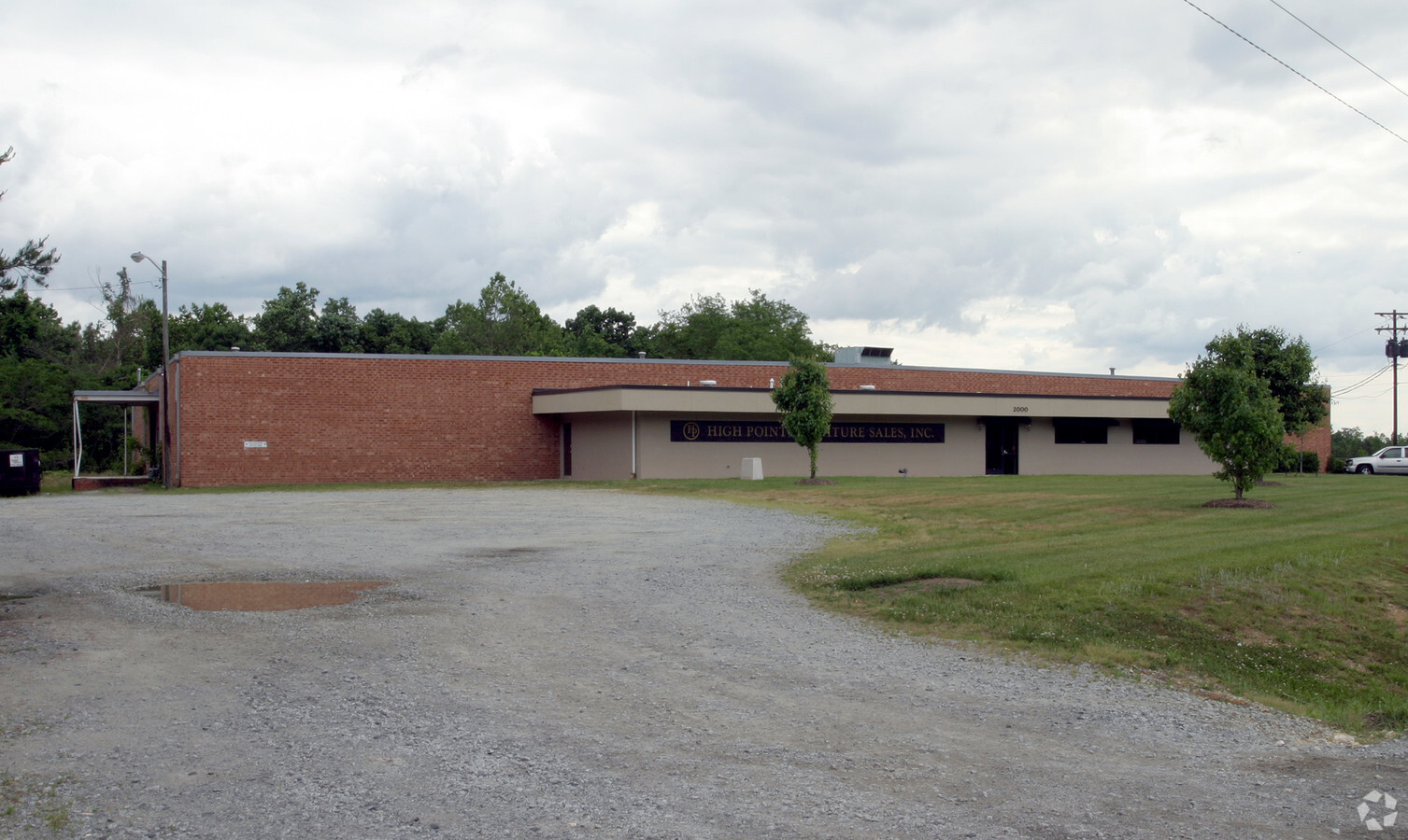
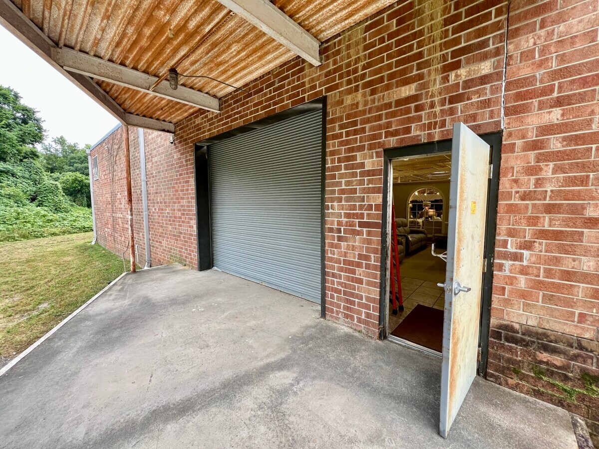
Property Record
2000 Baker Rd, High Point, NC 27260

NEARBY LISTINGS FOR SALE OR LEASE
Property Detail
2000 Baker Rd
Greensboro-High Point, NC
Baker Rd
0181034
PART PB7-25 BAKER RD
Industrialgeneral
Guilford
X
North Carolina
3710781000J
5
2024
6.25 AC
2023
High Point/SW Guilford Cty
016410
Greensboro/Winston-Salem
23,408 SF
DEMOGRAPHICS near 2000 Baker Rd
1 Mile
3 Mile
5 Mile
2024 Total Population
4,230
44,870
98,519
2029 Population
4,198
45,155
99,247
Pop Growth 2024-2029
(0.76%)
+ 0.64%
+ 0.74%
Average Age
38
37
39
2024 Total Households
1,620
16,331
38,362
HH Growth 2024-2029
(0.80%)
+ 0.72%
+ 0.76%
Median Household Inc
$51,386
$41,422
$49,702
Avg Household Size
2.60
2.50
2.40
2024 Avg HH Vehicles
2.00
2.00
2.00
Median Home Value
$118,518
$119,365
$162,085
Median Year Built
1976
1972
1975
Nearby Places
- Restaurants
- Banks
- Shops
- Fitness
- Groceries
PUBLIC TRANSPORTATION
COMMUTER RAIL
High Point Station (Piedmont - North Carolina by Train (NC Train))
DRIVE
WALK
Distance
High Point Station (Piedmont - North Carolina by Train (NC Train))
7 min
3.2 mi
AIRPORT
Piedmont Triad International
DRIVE
WALK
Distance
Piedmont Triad International
27 min
13.5 mi
Freight Ports
Port of Wilmington
DRIVE
WALK
Distance
Port of Wilmington
249 min
210.9 mi
SALE & LEASE HISTORY
LISTING DATE
SALE/LEASE

Nov 15, 2024
For Lease
Jul 16, 2024
For Sale
Nearby Properties
Address
Land Use
TOTAL SIZE
Lot Size
Zoning
Address
Land Use
TOTAL SIZE
Lot Size
Zoning
264,860 SF
62.75 AC
PI
Address
Land Use
TOTAL SIZE
Lot Size
Zoning
1,277,656 SF
2.47 AC
CB
Address
Land Use
TOTAL SIZE
Lot Size
Zoning
464,134 SF
11.28 AC
PI
Address
Land Use
TOTAL SIZE
Lot Size
Zoning
484,289 SF
6.41 AC
CB
Address
Land Use
TOTAL SIZE
Lot Size
Zoning
802,214 SF
0.01 AC
CB
Address
Land Use
TOTAL SIZE
Lot Size
Zoning
805,958 SF
61.42 AC
CU-LI
Address
Land Use
TOTAL SIZE
Lot Size
Zoning
1,259,149 SF
46.12 AC
CU-HB
Address
Land Use
TOTAL SIZE
Lot Size
Zoning
136,202 SF
30.02 AC
CZ-I
Address
Land Use
TOTAL SIZE
Lot Size
Zoning
457,534 SF
2.13 AC
CB
Address
Land Use
TOTAL SIZE
Lot Size
Zoning
30,322 SF
964.25 AC
PI
Address
Land Use
TOTAL SIZE
Lot Size
Zoning
142,800 SF
1.04 AC
CU-CB
Address
Land Use
TOTAL SIZE
Lot Size
Zoning
285,094 SF
3.23 AC
CB
Address
Land Use
TOTAL SIZE
Lot Size
Zoning
299,349 SF
21.76 AC
RM-16
Address
Land Use
TOTAL SIZE
Lot Size
Zoning
322,779 SF
0.88 AC
CB
Address
Land Use
TOTAL SIZE
Lot Size
Zoning
90,060 SF
3.15 AC
CZ-I
Address
Land Use
TOTAL SIZE
Lot Size
Zoning
297,676 SF
0.48 AC
CB
Address
Land Use
TOTAL SIZE
Lot Size
Zoning
319,603 SF
1.34 AC
CB
Address
Land Use
TOTAL SIZE
Lot Size
Zoning
196,353 SF
13.76 AC
RC
Address
Land Use
TOTAL SIZE
Lot Size
Zoning
250,573 SF
48.53 AC
R-5
Address
Land Use
TOTAL SIZE
Lot Size
Zoning
369,312 SF
0.75 AC
CB
Address
Land Use
TOTAL SIZE
Lot Size
Zoning
473,040 SF
63.60 AC
AG
Address
Land Use
TOTAL SIZE
Lot Size
Zoning
174,529 SF
2.87 AC
CB
Address
Land Use
TOTAL SIZE
Lot Size
Zoning
81,450 SF
1.38 AC
CB
Address
Land Use
TOTAL SIZE
Lot Size
Zoning
324,986 SF
24.19 AC
CU-HI
Address
Land Use
TOTAL SIZE
Lot Size
Zoning
233,398 SF
0.48 AC
CB
Address
Land Use
TOTAL SIZE
Lot Size
Zoning
200,288 SF
2.58 AC
CB
Address
Land Use
TOTAL SIZE
Lot Size
Zoning
286,940 SF
1.97 AC
CB
Address
Land Use
TOTAL SIZE
Lot Size
Zoning
72,851 SF
9.13 AC
LI
Address
Land Use
TOTAL SIZE
Lot Size
Zoning
113,866 SF
11.53 AC
CU-LI
Address
Land Use
TOTAL SIZE
Lot Size
Zoning
245,194 SF
23.44 AC
LI
The World's #1 Commercial Real Estate Marketplace
Connect with us
© 2025 CoStar Group
The information above has been obtained from sources believed reliable. While we do not doubt its accuracy we have not verified it and make no guarantee, warranty or representation about it. It is your responsibility to independently confirm its accuracy and completeness. Any projections, opinions, assumptions, or estimates used are for example only and do not represent the current or future performance of the property. The value of this transaction to you depends on tax and other factors which should be evaluated by your tax, financial, and legal advisors. You and your advisors should conduct a careful, independent investigation of the property to determine to your satisfaction the suitability of the property for your needs.