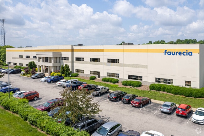
Property Record
2000 Stanley Gault Pky, Louisville, KY 40223


NEARBY LISTINGS FOR SALE OR LEASE
Property Detail
2000 Stanley Gault Pky
Louisville-Jefferson County, KY-IN
On Plat
001502720000
17.42 ACRES LOT 237 ON PLAT 7272X584
Manufacturinglight
Jefferson
X
Kentucky
21111C0033F
237
2025
17.42 AC
2025
Hurstbourne/Lyndon
010406
Louisville
235,428 SF
DEMOGRAPHICS near 2000 Stanley Gault Pky
1 Mile
3 Mile
5 Mile
2024 Total Population
1,376
49,128
129,072
2029 Population
1,356
48,879
129,117
Pop Growth 2024-2029
(1.45%)
(0.51%)
+ 0.03%
Average Age
40
41
41
2024 Total Households
499
20,119
53,014
HH Growth 2024-2029
(1.60%)
(0.60%)
(0.18%)
Median Household Inc
$144,778
$96,238
$95,348
Avg Household Size
2.70
2.40
2.40
2024 Avg HH Vehicles
2.00
2.00
2.00
Median Home Value
$593,421
$343,996
$327,951
Median Year Built
1987
1994
1992
Nearby Places
Map Layers
Map Styles
 Street
 Aerial
- Restaurants
- Banks
- Shops
- Fitness
- Groceries
PUBLIC TRANSPORTATION
AIRPORT
Louisville Muhammad Ali International
DRIVE
WALK
Distance
Louisville Muhammad Ali International
34 min
21.8 mi
Freight Ports
Port of Toledo
DRIVE
WALK
Distance
Port of Toledo
346 min
294.8 mi
Nearby Properties
Address
Land Use
TOTAL SIZE
Lot Size
Zoning
Address
Land Use
TOTAL SIZE
Lot Size
Zoning
8,200 SF
25.23 AC
Address
Land Use
TOTAL SIZE
Lot Size
Zoning
160,000 SF
421.24 AC
PEC-PLANNE
Address
Land Use
TOTAL SIZE
Lot Size
Zoning
9.74 AC
Address
Land Use
TOTAL SIZE
Lot Size
Zoning
3,172 SF
17.51 AC
R1-RESIDEN
Address
Land Use
TOTAL SIZE
Lot Size
Zoning
9.68 AC
Address
Land Use
TOTAL SIZE
Lot Size
Zoning
4,940 SF
17.11 AC
R4-RESIDEN
Address
Land Use
TOTAL SIZE
Lot Size
Zoning
20.07 AC
Address
Land Use
TOTAL SIZE
Lot Size
Zoning
31.03 AC
C1-COMMERC
Address
Land Use
TOTAL SIZE
Lot Size
Zoning
17,628 SF
19.19 AC
R7-RESIDEN
Address
Land Use
TOTAL SIZE
Lot Size
Zoning
Address
Land Use
TOTAL SIZE
Lot Size
Zoning
4,560 SF
24.41 AC
R6-RESIDEN
Address
Land Use
TOTAL SIZE
Lot Size
Zoning
2,793 SF
12.49 AC
R4-RESIDEN
Address
Land Use
TOTAL SIZE
Lot Size
Zoning
15.48 AC
R4-RESIDEN
Address
Land Use
TOTAL SIZE
Lot Size
Zoning
142,751 SF
48.49 AC
PEC-PLANNE
Address
Land Use
TOTAL SIZE
Lot Size
Zoning
11,484 SF
13.83 AC
R7-RESIDEN
Address
Land Use
TOTAL SIZE
Lot Size
Zoning
2,094 SF
20.57 AC
R4-RESIDEN
Address
Land Use
TOTAL SIZE
Lot Size
Zoning
62,500 SF
59.16 AC
PEC-PLANNE
Address
Land Use
TOTAL SIZE
Lot Size
Zoning
699,508 SF
55.04 AC
PEC-PLANNE
Address
Land Use
TOTAL SIZE
Lot Size
Zoning
20.36 AC
PEC-PLANNE
Address
Land Use
TOTAL SIZE
Lot Size
Zoning
27,471 SF
13.24 AC
R7-RESIDEN
Address
Land Use
TOTAL SIZE
Lot Size
Zoning
17,352 SF
10.86 AC
R7-RESIDEN
Address
Land Use
TOTAL SIZE
Lot Size
Zoning
17.80 AC
Address
Land Use
TOTAL SIZE
Lot Size
Zoning
1,093 SF
8.62 AC
R4-RESIDEN
Address
Land Use
TOTAL SIZE
Lot Size
Zoning
121,707 SF
8.95 AC
Address
Land Use
TOTAL SIZE
Lot Size
Zoning
Address
Land Use
TOTAL SIZE
Lot Size
Zoning
2,028 SF
39.89 AC
R4-RESIDEN
Address
Land Use
TOTAL SIZE
Lot Size
Zoning
4,267 SF
10.13 AC
R6-RESIDEN
Address
Land Use
TOTAL SIZE
Lot Size
Zoning
62,840 SF
29.42 AC
PEC-PLANNE
Address
Land Use
TOTAL SIZE
Lot Size
Zoning
5,010 SF
27.51 AC
(R4)RESIDE
Address
Land Use
TOTAL SIZE
Lot Size
Zoning
The World's #1 Commercial Real Estate Marketplace
Connect with us
© 2026 CoStar Group
The information above has been obtained from sources believed reliable. While we do not doubt its accuracy we have not verified it and make no guarantee, warranty or representation about it. It is your responsibility to independently confirm its accuracy and completeness. Any projections, opinions, assumptions, or estimates used are for example only and do not represent the current or future performance of the property. The value of this transaction to you depends on tax and other factors which should be evaluated by your tax, financial, and legal advisors. You and your advisors should conduct a careful, independent investigation of the property to determine to your satisfaction the suitability of the property for your needs.