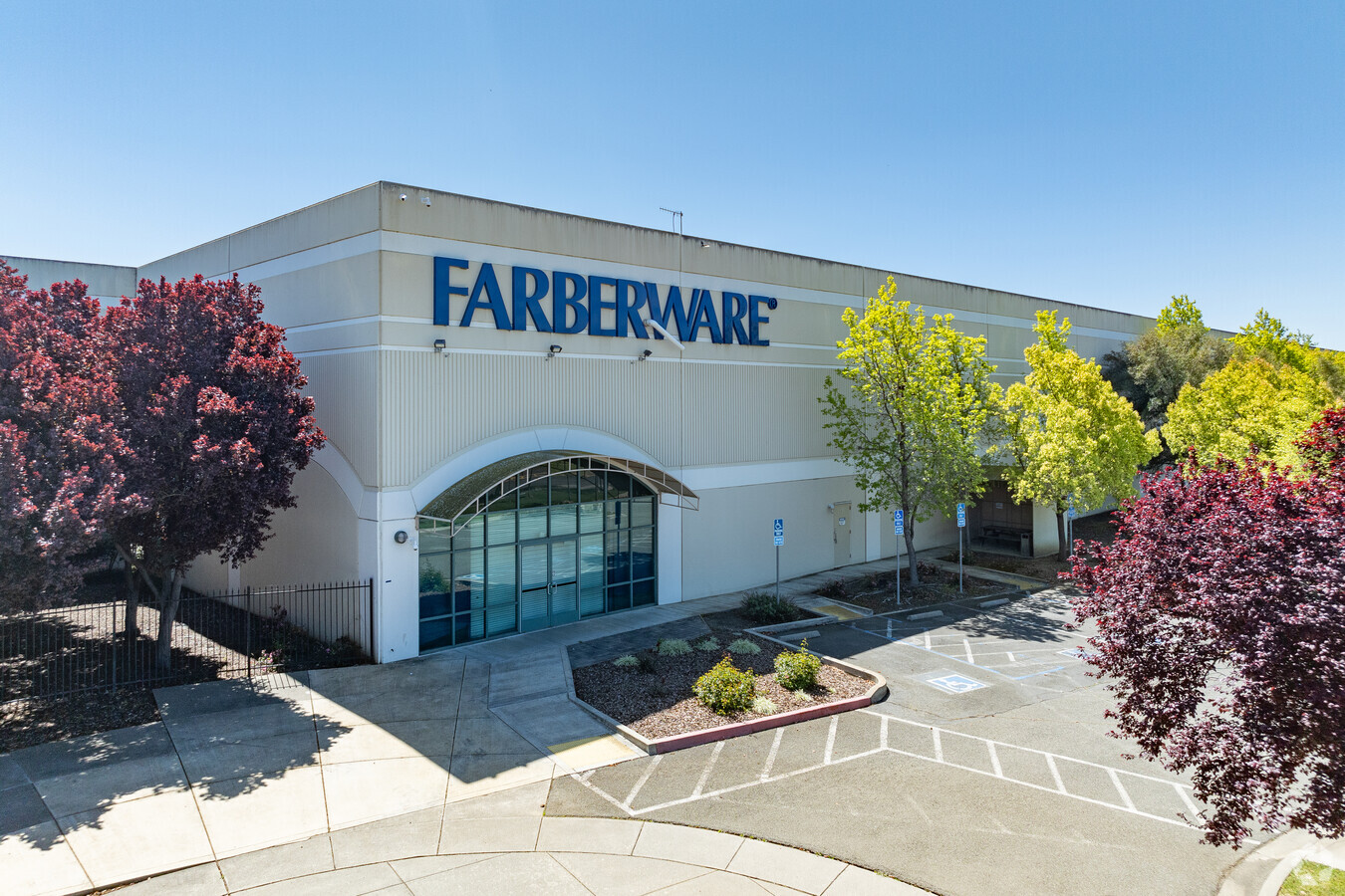
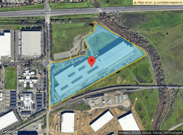
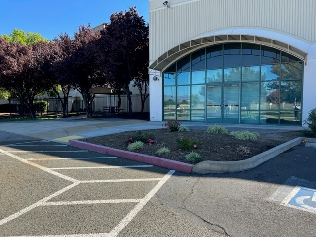
Property Record
2001 Meyer Way, Fairfield, CA 94533
NEARBY LISTINGS FOR SALE OR LEASE
Property Detail
2001 Meyer Way
0032-010-480
Notice Of Minor Lot Line Adjustment
Lightindustrial
BK-BG 00-00
AO
Solano
06095C0452F
California
2023
33.29 AC
2023
Fairfield
252402
North Bay/Santa Rosa
527,279 SF
Vallejo-Fairfield, CA
DEMOGRAPHICS near 2001 Meyer Way
1 Mile
3 Mile
5 Mile
2024 Total Population
6,116
58,359
123,715
2029 Population
5,999
57,647
122,060
Pop Growth 2024-2029
(1.91%)
(1.22%)
(1.34%)
Average Age
37
38
39
2024 Total Households
1,955
19,266
40,982
HH Growth 2024-2029
(1.89%)
(1.25%)
(1.39%)
Median Household Inc
$76,702
$73,449
$89,685
Avg Household Size
3.00
2.90
2.90
2024 Avg HH Vehicles
2.00
2.00
2.00
Median Home Value
$402,110
$452,182
$508,684
Median Year Built
1980
1975
1982
Nearby Places
- Restaurants
- Banks
- Shops
- Fitness
- Groceries
PUBLIC TRANSPORTATION
COMMUTER RAIL
Suisun-Fairfield (Capitol Corridor - Capitol Corridor Joint Powers Authority)
DRIVE
WALK
Distance
Suisun-Fairfield (Capitol Corridor - Capitol Corridor Joint Powers Authority)
5 min
2.4 mi
Fairfield-Vacaville (Capitol Corridor - Amtrak)
DRIVE
WALK
Distance
Fairfield-Vacaville (Capitol Corridor - Amtrak)
16 min
8.7 mi
Freight Ports
Port of Richmond
DRIVE
WALK
Distance
Port of Richmond
48 min
35.1 mi
SALE & LEASE HISTORY
LISTING DATE
SALE/LEASE

Nov 01, 2022
For Lease
Nearby Properties
Address
Land Use
TOTAL SIZE
Lot Size
Zoning
Address
Land Use
TOTAL SIZE
Lot Size
Zoning
75.45 AC
Address
Land Use
TOTAL SIZE
Lot Size
Zoning
Address
Land Use
TOTAL SIZE
Lot Size
Zoning
317,493 SF
21.54 AC
Address
Land Use
TOTAL SIZE
Lot Size
Zoning
9,945 SF
51.21 AC
Address
Land Use
TOTAL SIZE
Lot Size
Zoning
172,856 SF
10.11 AC
Address
Land Use
TOTAL SIZE
Lot Size
Zoning
204,928 SF
8.87 AC
MR
Address
Land Use
TOTAL SIZE
Lot Size
Zoning
22.49 AC
Address
Land Use
TOTAL SIZE
Lot Size
Zoning
430,500 SF
20.85 AC
Address
Land Use
TOTAL SIZE
Lot Size
Zoning
430,500 SF
15.70 AC
Address
Land Use
TOTAL SIZE
Lot Size
Zoning
290,560 SF
12.73 AC
Address
Land Use
TOTAL SIZE
Lot Size
Zoning
473,135 SF
24.25 AC
Address
Land Use
TOTAL SIZE
Lot Size
Zoning
151,537 SF
8.66 AC
Address
Land Use
TOTAL SIZE
Lot Size
Zoning
23,820 SF
1.43 AC
Address
Land Use
TOTAL SIZE
Lot Size
Zoning
76,195 SF
8.43 AC
Address
Land Use
TOTAL SIZE
Lot Size
Zoning
102,528 SF
4.87 AC
Address
Land Use
TOTAL SIZE
Lot Size
Zoning
10,140 SF
1.30 AC
Address
Land Use
TOTAL SIZE
Lot Size
Zoning
318,402 SF
18.73 AC
Address
Land Use
TOTAL SIZE
Lot Size
Zoning
53,960 SF
8.22 AC
Address
Land Use
TOTAL SIZE
Lot Size
Zoning
7.82 AC
Address
Land Use
TOTAL SIZE
Lot Size
Zoning
191,132 SF
9.01 AC
Address
Land Use
TOTAL SIZE
Lot Size
Zoning
59,427 SF
2.90 AC
Address
Land Use
TOTAL SIZE
Lot Size
Zoning
95,800 SF
8.95 AC
Address
Land Use
TOTAL SIZE
Lot Size
Zoning
348,271 SF
16.05 AC
Address
Land Use
TOTAL SIZE
Lot Size
Zoning
0.68 AC
Address
Land Use
TOTAL SIZE
Lot Size
Zoning
39,170 SF
4.33 AC
LT IND/COM
Address
Land Use
TOTAL SIZE
Lot Size
Zoning
201,973 SF
11.83 AC
LT IND
Address
Land Use
TOTAL SIZE
Lot Size
Zoning
66,447 SF
3.61 AC
Address
Land Use
TOTAL SIZE
Lot Size
Zoning
74,406 SF
3.21 AC
Address
Land Use
TOTAL SIZE
Lot Size
Zoning
167,051 SF
11.97 AC
The World's #1 Commercial Real Estate Marketplace
Connect with us
© 2025 CoStar Group
The information above has been obtained from sources believed reliable. While we do not doubt its accuracy we have not verified it and make no guarantee, warranty or representation about it. It is your responsibility to independently confirm its accuracy and completeness. Any projections, opinions, assumptions, or estimates used are for example only and do not represent the current or future performance of the property. The value of this transaction to you depends on tax and other factors which should be evaluated by your tax, financial, and legal advisors. You and your advisors should conduct a careful, independent investigation of the property to determine to your satisfaction the suitability of the property for your needs.