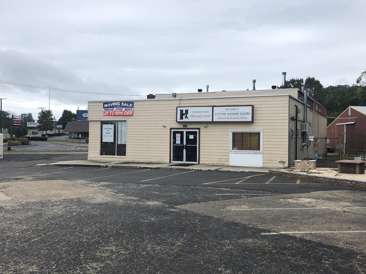
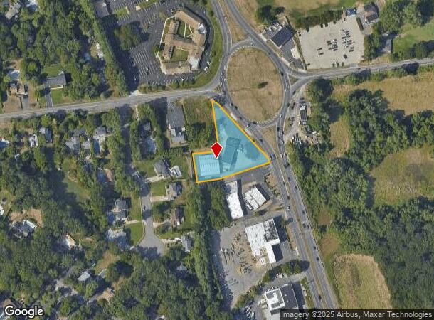
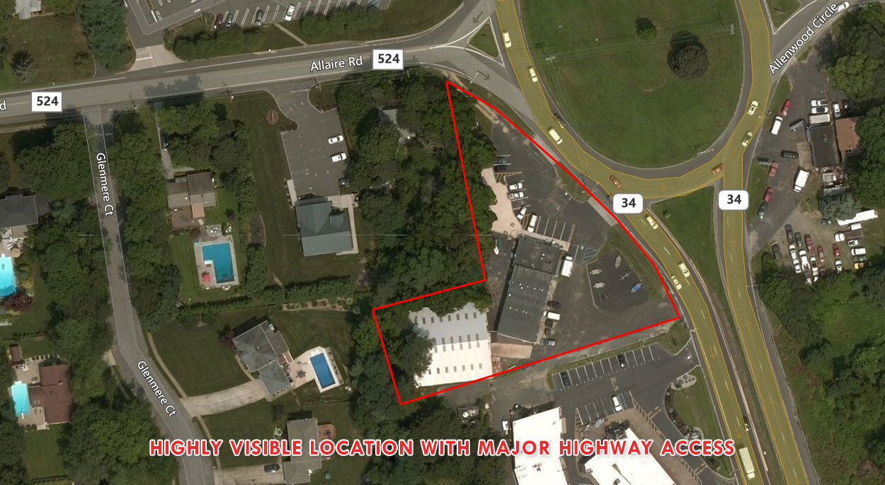
Property Record
2001 State Route 34, Wall Township, NJ 07719
NEARBY LISTINGS FOR SALE OR LEASE
Property Detail
2001 State Route 34
52-00823-0000-00021
Monmouth
Commercialnec
New Jersey
X
21
34025C0340F
1.08 AC
2023
Eastern Monmouth
2024
Northern New Jersey
808702
New York-Jersey City-White Plains, NY-NJ
4,271 SF
DEMOGRAPHICS near 2001 State Route 34
1 Mile
3 Mile
5 Mile
2024 Total Population
1,651
33,269
126,894
2029 Population
1,634
33,594
130,230
Pop Growth 2024-2029
(1.03%)
+ 0.98%
+ 2.63%
Average Age
45
45
44
2024 Total Households
542
12,829
51,096
HH Growth 2024-2029
(1.29%)
+ 0.80%
+ 2.46%
Median Household Inc
$160,124
$124,779
$103,609
Avg Household Size
2.80
2.50
2.40
2024 Avg HH Vehicles
3.00
2.00
2.00
Median Home Value
$654,605
$623,511
$479,402
Median Year Built
1979
1977
1972
Nearby Places
- Restaurants
- Banks
- Shops
- Fitness
- Groceries
PUBLIC TRANSPORTATION
COMMUTER RAIL
Manasquan (North Jersey Coast Line - NJ Transit Commuter Rail (NJ Transit))
DRIVE
WALK
Distance
Manasquan (North Jersey Coast Line - NJ Transit Commuter Rail (NJ Transit))
6 min
4.7 mi
Spring Lake (North Jersey Coast Line - NJ Transit Commuter Rail (NJ Transit))
DRIVE
WALK
Distance
Spring Lake (North Jersey Coast Line - NJ Transit Commuter Rail (NJ Transit))
8 min
5.2 mi
Freight Ports
New York Container Terminal
DRIVE
WALK
Distance
New York Container Terminal
60 min
46.3 mi
SALE & LEASE HISTORY
LISTING DATE
SALE/LEASE

Oct 08, 2019
For Sale
Nearby Properties
Address
Land Use
TOTAL SIZE
Lot Size
Zoning
Address
Land Use
TOTAL SIZE
Lot Size
Zoning
23,868 SF
137.35 AC
R-1
Address
Land Use
TOTAL SIZE
Lot Size
Zoning
190,893 SF
36.69 AC
POS
Address
Land Use
TOTAL SIZE
Lot Size
Zoning
64,757 SF
11.81 AC
MLHB
Address
Land Use
TOTAL SIZE
Lot Size
Zoning
49,657 SF
11.22 AC
HB80
Address
Land Use
TOTAL SIZE
Lot Size
Zoning
7.79 AC
MLCC
Address
Land Use
TOTAL SIZE
Lot Size
Zoning
49,170 SF
8.38 AC
HB80
Address
Land Use
TOTAL SIZE
Lot Size
Zoning
17,586 SF
386.01 AC
POS
Address
Land Use
TOTAL SIZE
Lot Size
Zoning
84,297 SF
42.37 AC
CR40
Address
Land Use
TOTAL SIZE
Lot Size
Zoning
145,918 SF
20.31 AC
OR-5
Address
Land Use
TOTAL SIZE
Lot Size
Zoning
93,572 SF
8.04 AC
HB12
Address
Land Use
TOTAL SIZE
Lot Size
Zoning
45,236 SF
48.30 AC
POS
Address
Land Use
TOTAL SIZE
Lot Size
Zoning
86,051 SF
9.41 AC
HB12
Address
Land Use
TOTAL SIZE
Lot Size
Zoning
111,580 SF
25 AC
POS
Address
Land Use
TOTAL SIZE
Lot Size
Zoning
3,400 SF
262.97 AC
AI
Address
Land Use
TOTAL SIZE
Lot Size
Zoning
8,749 SF
5.73 AC
OPML
Address
Land Use
TOTAL SIZE
Lot Size
Zoning
2,976 SF
336.41 AC
POS
Address
Land Use
TOTAL SIZE
Lot Size
Zoning
8.83 AC
R-2
Address
Land Use
TOTAL SIZE
Lot Size
Zoning
13,094 SF
HB80
Address
Land Use
TOTAL SIZE
Lot Size
Zoning
192 SF
12.50 AC
HD12
Address
Land Use
TOTAL SIZE
Lot Size
Zoning
81,656 SF
8.15 AC
HB80
Address
Land Use
TOTAL SIZE
Lot Size
Zoning
15.94 AC
R-2
Address
Land Use
TOTAL SIZE
Lot Size
Zoning
5.53 AC
R-5
Address
Land Use
TOTAL SIZE
Lot Size
Zoning
115,960 SF
17.93 AC
OR-5
Address
Land Use
TOTAL SIZE
Lot Size
Zoning
13.21 AC
HD12
Address
Land Use
TOTAL SIZE
Lot Size
Zoning
63,277 SF
3.03 AC
POS
Address
Land Use
TOTAL SIZE
Lot Size
Zoning
5.37 AC
R-5
Address
Land Use
TOTAL SIZE
Lot Size
Zoning
1,982 SF
2.47 AC
OR-2
Address
Land Use
TOTAL SIZE
Lot Size
Zoning
14,874 SF
12.49 AC
OP10
Address
Land Use
TOTAL SIZE
Lot Size
Zoning
2,656 SF
95.46 AC
POS
Address
Land Use
TOTAL SIZE
Lot Size
Zoning
6,838 SF
9.97 AC
HB80
The World's #1 Commercial Real Estate Marketplace
Connect with us
© 2025 CoStar Group
The information above has been obtained from sources believed reliable. While we do not doubt its accuracy we have not verified it and make no guarantee, warranty or representation about it. It is your responsibility to independently confirm its accuracy and completeness. Any projections, opinions, assumptions, or estimates used are for example only and do not represent the current or future performance of the property. The value of this transaction to you depends on tax and other factors which should be evaluated by your tax, financial, and legal advisors. You and your advisors should conduct a careful, independent investigation of the property to determine to your satisfaction the suitability of the property for your needs.