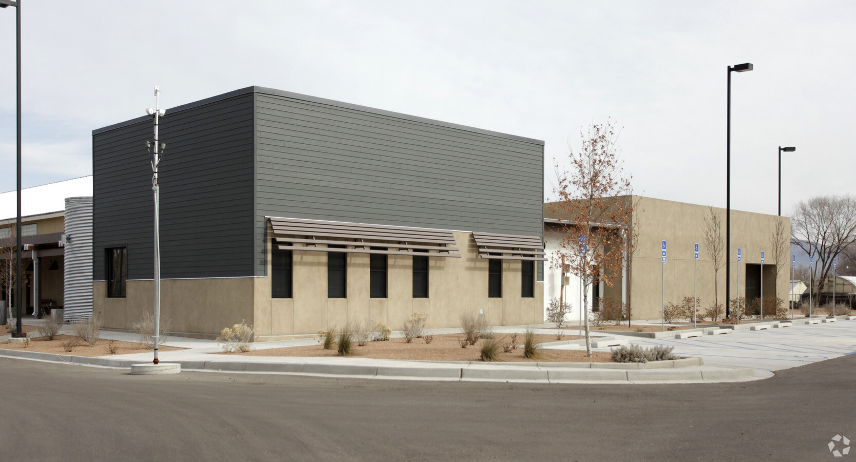
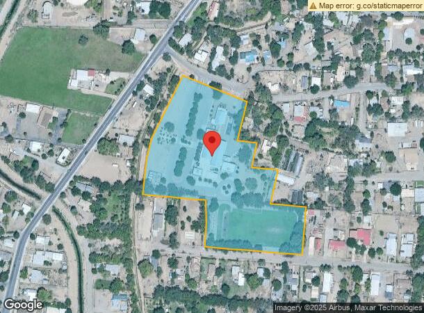
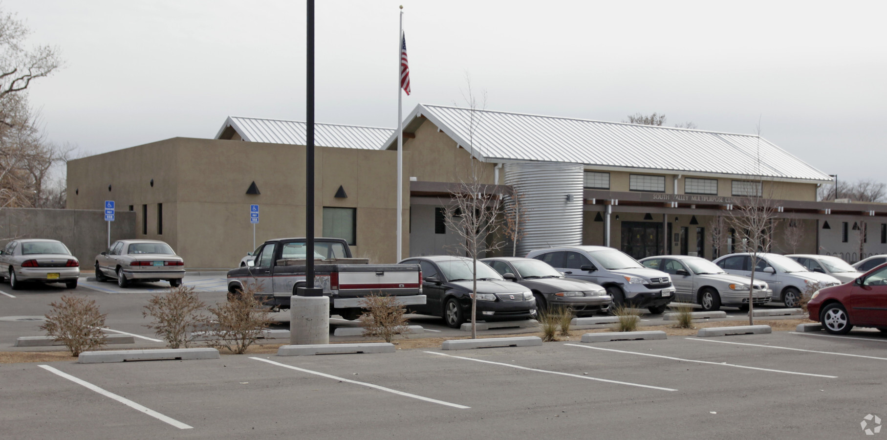
Property Record
2008 Larrazolo Rd Sw, Albuquerque, NM 87105
NEARBY LISTINGS FOR SALE OR LEASE
Property Detail
2008 Larrazolo Rd Sw
1-012-056-139426-2-06-03
TR A PLAT OF TRACT A LARRAZOLO MULTI-PURPOSE CENTER CONT 7.7429 AC
Culturalhistorical
Bernalillo
AH
New Mexico
35001C0329H
7.74 AC
0
South Valley
2024
Albuquerque
002303
Albuquerque, NM
18,588 SF
DEMOGRAPHICS near 2008 Larrazolo Rd Sw
1 Mile
3 Mile
5 Mile
2024 Total Population
12,750
101,528
224,240
2029 Population
12,686
100,904
223,066
Pop Growth 2024-2029
(0.50%)
(0.61%)
(0.52%)
Average Age
39
38
38
2024 Total Households
4,465
38,434
86,939
HH Growth 2024-2029
(0.60%)
(0.63%)
(0.45%)
Median Household Inc
$43,249
$44,636
$51,167
Avg Household Size
2.70
2.50
2.50
2024 Avg HH Vehicles
2.00
2.00
2.00
Median Home Value
$184,116
$181,492
$207,437
Median Year Built
1967
1979
1983
Nearby Places
- Restaurants
- Banks
- Shops
- Fitness
- Groceries
PUBLIC TRANSPORTATION
COMMUTER RAIL
Downtown Albuquerque (Rail Runner Express - New Mexico Rail Runner Express)
DRIVE
WALK
Distance
Downtown Albuquerque (Rail Runner Express - New Mexico Rail Runner Express)
9 min
3.5 mi
Bernalillo County-International Sunport (Rail Runner Express - New Mexico Rail Runner Express)
DRIVE
WALK
Distance
Bernalillo County-International Sunport (Rail Runner Express - New Mexico Rail Runner Express)
13 min
5.6 mi
AIRPORT
Albuquerque International Sunport
DRIVE
WALK
Distance
Albuquerque International Sunport
29 min
11.1 mi
Freight Ports
Tulsa Port Of Catoosa
DRIVE
WALK
Distance
Tulsa Port Of Catoosa
696 min
666.6 mi
Nearby Properties
Address
Land Use
TOTAL SIZE
Lot Size
Zoning
Address
Land Use
TOTAL SIZE
Lot Size
Zoning
Address
Land Use
TOTAL SIZE
Lot Size
Zoning
37,700 SF
4.43 AC
Address
Land Use
TOTAL SIZE
Lot Size
Zoning
312,090 SF
35 AC
Address
Land Use
TOTAL SIZE
Lot Size
Zoning
196,154 SF
14.81 AC
Address
Land Use
TOTAL SIZE
Lot Size
Zoning
355,645 SF
11.98 AC
Address
Land Use
TOTAL SIZE
Lot Size
Zoning
287,781 SF
38.18 AC
Address
Land Use
TOTAL SIZE
Lot Size
Zoning
370,665 SF
1.66 AC
Address
Land Use
TOTAL SIZE
Lot Size
Zoning
256,918 SF
50.96 AC
Address
Land Use
TOTAL SIZE
Lot Size
Zoning
Address
Land Use
TOTAL SIZE
Lot Size
Zoning
267,101 SF
3.40 AC
Address
Land Use
TOTAL SIZE
Lot Size
Zoning
20.08 AC
Address
Land Use
TOTAL SIZE
Lot Size
Zoning
41.40 AC
Address
Land Use
TOTAL SIZE
Lot Size
Zoning
Address
Land Use
TOTAL SIZE
Lot Size
Zoning
313,812 SF
0.77 AC
Address
Land Use
TOTAL SIZE
Lot Size
Zoning
1.89 AC
Address
Land Use
TOTAL SIZE
Lot Size
Zoning
63,424 SF
9.98 AC
Address
Land Use
TOTAL SIZE
Lot Size
Zoning
149,648 SF
8.70 AC
Address
Land Use
TOTAL SIZE
Lot Size
Zoning
16.59 AC
Address
Land Use
TOTAL SIZE
Lot Size
Zoning
201,777 SF
1.08 AC
Address
Land Use
TOTAL SIZE
Lot Size
Zoning
Address
Land Use
TOTAL SIZE
Lot Size
Zoning
115,099 SF
2.63 AC
Address
Land Use
TOTAL SIZE
Lot Size
Zoning
45,207 SF
9.08 AC
Address
Land Use
TOTAL SIZE
Lot Size
Zoning
96,196 SF
3.14 AC
Address
Land Use
TOTAL SIZE
Lot Size
Zoning
103,484 SF
51.60 AC
Address
Land Use
TOTAL SIZE
Lot Size
Zoning
60,636 SF
8.93 AC
Address
Land Use
TOTAL SIZE
Lot Size
Zoning
381,985 SF
1.84 AC
Address
Land Use
TOTAL SIZE
Lot Size
Zoning
159,098 SF
0.72 AC
Address
Land Use
TOTAL SIZE
Lot Size
Zoning
27.32 AC
Address
Land Use
TOTAL SIZE
Lot Size
Zoning
221,245 SF
18.23 AC
Address
Land Use
TOTAL SIZE
Lot Size
Zoning
144,650 SF
2.47 AC
The World's #1 Commercial Real Estate Marketplace
Connect with us
© 2025 CoStar Group
The information above has been obtained from sources believed reliable. While we do not doubt its accuracy we have not verified it and make no guarantee, warranty or representation about it. It is your responsibility to independently confirm its accuracy and completeness. Any projections, opinions, assumptions, or estimates used are for example only and do not represent the current or future performance of the property. The value of this transaction to you depends on tax and other factors which should be evaluated by your tax, financial, and legal advisors. You and your advisors should conduct a careful, independent investigation of the property to determine to your satisfaction the suitability of the property for your needs.