Property Record
201 73Rd St, South Haven, MI 49090

Property Detail
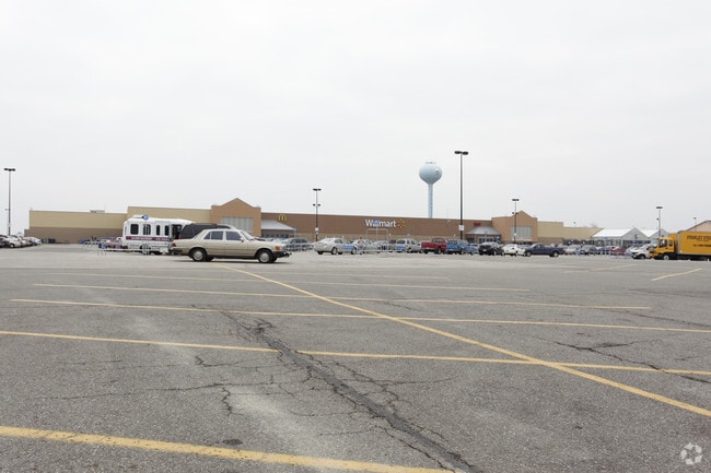
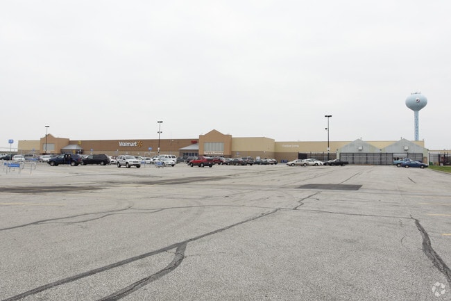
201 73Rd St
Wholesaleoutletdiscountstore
C927 2-1-17 903-387 912-750 927-922 945-811 998-640 1034-79 1338-877 1355-272 COM AT SE COR OF SEC, TH S 88 DEG 04'22"W ON S
B-4
Van Buren
B and X Area of moderate flood hazard, usually the area between the limits of the 100-year and 500-year floods.
Michigan
2025
28.26 AC
2025
Van Buren County
010500
West Michigan
199,297 SF
80-53-869-027-03
NEARBY LISTINGS FOR SALE OR LEASE
-
-
View all South Haven listings for sale on LoopNet.com
DEMOGRAPHICS near 201 73Rd St
1 mile
3 mile
5 mile
2025 Total Population
1,616
10,187
14,145
2030 Population
1,660
10,702
14,801
Pop Growth 2025-2030
+ 2.72%
+ 5.06%
+ 4.64%
Average Age
45
48
47
2025 Total Households
716
4,716
6,333
HH Growth 2025-2030
+ 3.21%
+ 5.62%
+ 5.13%
Median Household Inc
$58,676
$70,252
$70,626
Avg Household Size
2.20
2.10
2.20
2025 Avg HH Vehicles
2.00
2.00
2.00
Median Home Value
$299,350
$339,482
$322,055
Median Year Built
1976
1972
1974
Nearby Places
Map Layers
Map Styles
 Street
 Aerial
Layers
 Traffic
 Biking
Places
Listings with unknown addresses are not visible on the map
- Restaurants
- Banks
- Shops
- Fitness
- Groceries
Nearby Properties
Address
Land Use
TOTAL SIZE
Lot Size
Zoning
Address
Land Use
TOTAL SIZE
Lot Size
Zoning
190,640 SF
12.53 AC
Address
Land Use
TOTAL SIZE
Lot Size
Zoning
5,878 SF
21.47 AC
Address
Land Use
TOTAL SIZE
Lot Size
Zoning
223,972 SF
14.11 AC
B-2
Address
Land Use
TOTAL SIZE
Lot Size
Zoning
50,000 SF
3.11 AC
Address
Land Use
TOTAL SIZE
Lot Size
Zoning
36,203 SF
4.40 AC
RM-1
Address
Land Use
TOTAL SIZE
Lot Size
Zoning
1,428 SF
5.80 AC
HIGH DENSE
Address
Land Use
TOTAL SIZE
Lot Size
Zoning
121,966 SF
19.66 AC
I-2
Address
Land Use
TOTAL SIZE
Lot Size
Zoning
4,874 SF
15.82 AC
Address
Land Use
TOTAL SIZE
Lot Size
Zoning
26,272 SF
Address
Land Use
TOTAL SIZE
Lot Size
Zoning
152,748 SF
16.10 AC
I-1
Address
Land Use
TOTAL SIZE
Lot Size
Zoning
39,372 SF
6.84 AC
RM-1
Address
Land Use
TOTAL SIZE
Lot Size
Zoning
38,967 SF
3.90 AC
RM-1
Address
Land Use
TOTAL SIZE
Lot Size
Zoning
38,500 SF
Address
Land Use
TOTAL SIZE
Lot Size
Zoning
4,194 SF
0.53 AC
B-3
Address
Land Use
TOTAL SIZE
Lot Size
Zoning
32,268 SF
2.62 AC
R-2
Address
Land Use
TOTAL SIZE
Lot Size
Zoning
8,340 SF
12.53 AC
Address
Land Use
TOTAL SIZE
Lot Size
Zoning
37,152 SF
5.25 AC
Address
Land Use
TOTAL SIZE
Lot Size
Zoning
2,640 SF
7.80 AC
B-4
Address
Land Use
TOTAL SIZE
Lot Size
Zoning
36,800 SF
2.20 AC
B-3
Address
Land Use
TOTAL SIZE
Lot Size
Zoning
19,602 SF
0.23 AC
CBD
Address
Land Use
TOTAL SIZE
Lot Size
Zoning
32,040 SF
1.60 AC
PUD
Address
Land Use
TOTAL SIZE
Lot Size
Zoning
6,961 SF
0.23 AC
B-3
Address
Land Use
TOTAL SIZE
Lot Size
Zoning
43,920 SF
5.63 AC
RM-1
Address
Land Use
TOTAL SIZE
Lot Size
Zoning
8,976 SF
5.90 AC
RM-1
Address
Land Use
TOTAL SIZE
Lot Size
Zoning
6,705 SF
0.37 AC
RM-1
Address
Land Use
TOTAL SIZE
Lot Size
Zoning
6,129 SF
84.25 AC
AGRICU
Address
Land Use
TOTAL SIZE
Lot Size
Zoning
14.14 AC
RM-1
Address
Land Use
TOTAL SIZE
Lot Size
Zoning
26,666 SF
1.56 AC
RM-1
Address
Land Use
TOTAL SIZE
Lot Size
Zoning
20,144 SF
86,684 AC
B-3
The World's #1 Commercial Real Estate Marketplace
Connect with us
© 2026 CoStar Group
The information above has been obtained from sources believed reliable. While we do not doubt its accuracy we have not verified it and make no guarantee, warranty or representation about it. It is your responsibility to independently confirm its accuracy and completeness. Any projections, opinions, assumptions, or estimates used are for example only and do not represent the current or future performance of the property. The value of this transaction to you depends on tax and other factors which should be evaluated by your tax, financial, and legal advisors. You and your advisors should conduct a careful, independent investigation of the property to determine to your satisfaction the suitability of the property for your needs.