Property Record
201 Keith St Sw, Cleveland, TN 37311
NEARBY LISTINGS FOR SALE OR LEASE
Property Detail
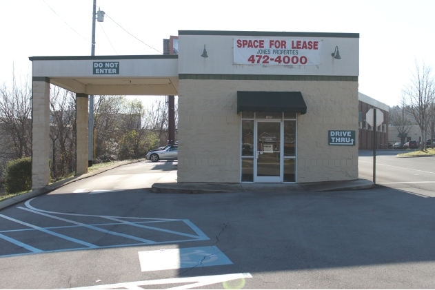
201 Keith St Sw
Cleveland, TN
Village Shopping Cen
049N-O-002.00
VILLAGE SHOPPING CEN PB: 11 PG: 76A LOT: 2 VILLAGE GREEN CENTER
Commercialnec
Bradley
AE
Tennessee
47065C0300G
2
2024
14.15 AC
2024
Downtown Cleveland
010500
Other Market Areas
197,504 SF
DEMOGRAPHICS near 201 Keith St Sw
1 Mile
3 Mile
5 Mile
2024 Total Population
8,713
43,597
76,262
2029 Population
9,136
46,021
80,438
Pop Growth 2024-2029
+ 4.85%
+ 5.56%
+ 5.48%
Average Age
35
39
39
2024 Total Households
3,308
17,128
29,717
HH Growth 2024-2029
+ 5.41%
+ 5.80%
+ 5.66%
Median Household Inc
$41,919
$44,714
$52,441
Avg Household Size
2.20
2.40
2.50
2024 Avg HH Vehicles
2.00
2.00
2.00
Median Home Value
$212,174
$198,218
$213,257
Median Year Built
1968
1978
1984
Nearby Places
- Restaurants
- Banks
- Shops
- Fitness
- Groceries
PUBLIC TRANSPORTATION
AIRPORT
Lovell Field
DRIVE
WALK
Distance
Lovell Field
36 min
24.2 mi
Freight Ports
Georgia Ports - Savannah
DRIVE
WALK
Distance
Georgia Ports - Savannah
422 min
367.0 mi
Nearby Properties
Address
Land Use
TOTAL SIZE
Lot Size
Zoning
Address
Land Use
TOTAL SIZE
Lot Size
Zoning
400,000 SF
123.44 AC
IH
Address
Land Use
TOTAL SIZE
Lot Size
Zoning
178,664 SF
14.80 AC
IH
Address
Land Use
TOTAL SIZE
Lot Size
Zoning
267,460 SF
8.30 AC
IL
Address
Land Use
TOTAL SIZE
Lot Size
Zoning
400,562 SF
15.26 AC
PI
Address
Land Use
TOTAL SIZE
Lot Size
Zoning
357,110 SF
52.96 AC
FAR
Address
Land Use
TOTAL SIZE
Lot Size
Zoning
68,785 SF
8.70 AC
R1
Address
Land Use
TOTAL SIZE
Lot Size
Zoning
93,264 SF
17.60 AC
CH
Address
Land Use
TOTAL SIZE
Lot Size
Zoning
620,857 SF
34.28 AC
IH
Address
Land Use
TOTAL SIZE
Lot Size
Zoning
170,518 SF
4.96 AC
CH
Address
Land Use
TOTAL SIZE
Lot Size
Zoning
530,452 SF
30 AC
IL
Address
Land Use
TOTAL SIZE
Lot Size
Zoning
724,048 SF
20.29 AC
IL
Address
Land Use
TOTAL SIZE
Lot Size
Zoning
50,400 SF
1.04 AC
CBD
Address
Land Use
TOTAL SIZE
Lot Size
Zoning
203,778 SF
13.46 AC
R3
Address
Land Use
TOTAL SIZE
Lot Size
Zoning
30,526 SF
0.92 AC
CBD
Address
Land Use
TOTAL SIZE
Lot Size
Zoning
96,527 SF
5.15 AC
CH
Address
Land Use
TOTAL SIZE
Lot Size
Zoning
305,064 SF
36.84 AC
IL
Address
Land Use
TOTAL SIZE
Lot Size
Zoning
48,494 SF
4.70 AC
R3
Address
Land Use
TOTAL SIZE
Lot Size
Zoning
74,229 SF
1 AC
R1
Address
Land Use
TOTAL SIZE
Lot Size
Zoning
56,725 SF
13.06 AC
R1
Address
Land Use
TOTAL SIZE
Lot Size
Zoning
265,226 SF
25.90 AC
CH
Address
Land Use
TOTAL SIZE
Lot Size
Zoning
86,435 SF
7.68 AC
CH
Address
Land Use
TOTAL SIZE
Lot Size
Zoning
37,430 SF
5.75 AC
CH
Address
Land Use
TOTAL SIZE
Lot Size
Zoning
205,800 SF
30.93 AC
CH
Address
Land Use
TOTAL SIZE
Lot Size
Zoning
15,044 SF
93.90 AC
IH
Address
Land Use
TOTAL SIZE
Lot Size
Zoning
24,948 SF
4.95 AC
PI
Address
Land Use
TOTAL SIZE
Lot Size
Zoning
104,319 SF
2.63 AC
IH
Address
Land Use
TOTAL SIZE
Lot Size
Zoning
43,812 SF
9.80 AC
CH
Address
Land Use
TOTAL SIZE
Lot Size
Zoning
44.30 AC
IH
Address
Land Use
TOTAL SIZE
Lot Size
Zoning
82,190 SF
6.53 AC
PI
Address
Land Use
TOTAL SIZE
Lot Size
Zoning
196,358 SF
16.50 AC
A
The World's #1 Commercial Real Estate Marketplace
Connect with us
© 2025 CoStar Group
The information above has been obtained from sources believed reliable. While we do not doubt its accuracy we have not verified it and make no guarantee, warranty or representation about it. It is your responsibility to independently confirm its accuracy and completeness. Any projections, opinions, assumptions, or estimates used are for example only and do not represent the current or future performance of the property. The value of this transaction to you depends on tax and other factors which should be evaluated by your tax, financial, and legal advisors. You and your advisors should conduct a careful, independent investigation of the property to determine to your satisfaction the suitability of the property for your needs.