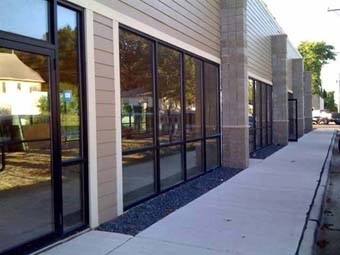
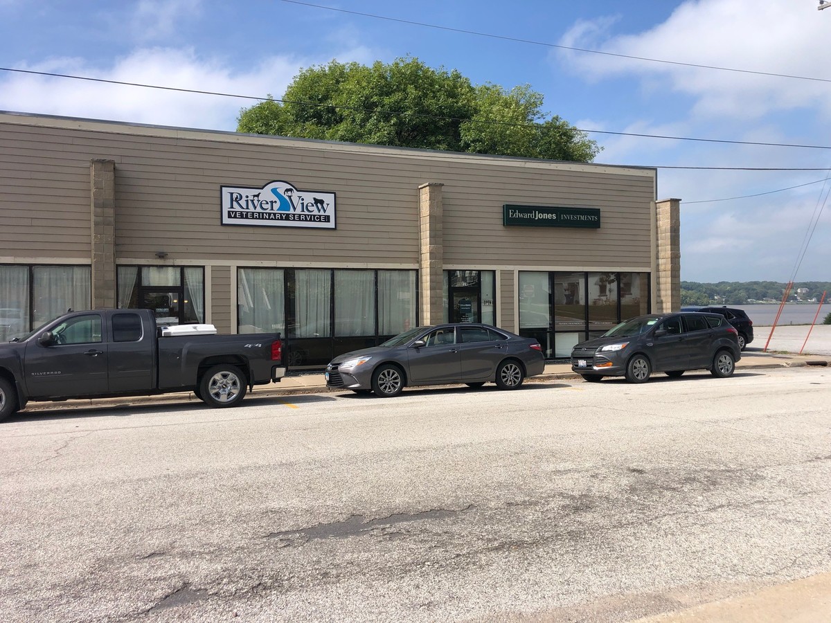
Property Record
201 N Main St, Port Byron, IL 61275
NEARBY LISTINGS FOR SALE OR LEASE
-
-
View all Port Byron listings for sale on LoopNet.com
Property Detail
201 N Main St
05-0201610-2361
Park
Commercialnec
UNIT 2 RIVER BEND BUSINESS PARK CONDOS SH 14
AE
Rock Island
19163C0402G
Illinois
2023
0.31 AC
2023
Outlying Rock Island Cnty
0201004010
Davenport/Moline/Rock Island
1,887 SF
Davenport-Moline-Rock Island, IA-IL
DEMOGRAPHICS near 201 N Main St
1 Mile
3 Mile
5 Mile
2024 Total Population
2,181
7,886
13,852
2029 Population
2,133
7,691
13,475
Pop Growth 2024-2029
(2.20%)
(2.47%)
(2.72%)
Average Age
41
42
42
2024 Total Households
868
3,143
5,452
HH Growth 2024-2029
(2.30%)
(2.55%)
(2.84%)
Median Household Inc
$85,978
$82,652
$88,086
Avg Household Size
2.50
2.50
2.50
2024 Avg HH Vehicles
2.00
2.00
2.00
Median Home Value
$249,433
$265,818
$266,891
Median Year Built
1975
1976
1976
Nearby Places
- Restaurants
- Banks
- Shops
- Fitness
- Groceries
PUBLIC TRANSPORTATION
AIRPORT
Quad Cities International
Drive
Walk
Distance
Quad Cities International
30 min
18.4 mi
Freight Ports
Port Milwaukee
Drive
Walk
Distance
Port Milwaukee
227 min
193.0 mi
SALE & LEASE HISTORY
LISTING DATE
SALE/LEASE

Mar 23, 2017
For Lease
Jan 07, 2020
For Sale
Dec 24, 2019
For Sale
Nearby Properties
Address
Land Use
TOTAL SIZE
Lot Size
Zoning
Address
Land Use
TOTAL SIZE
Lot Size
Zoning
135007
58 AC
Address
Land Use
TOTAL SIZE
Lot Size
Zoning
3623
2.54 AC
Address
Land Use
TOTAL SIZE
Lot Size
Zoning
913
8.44 AC
Address
Land Use
TOTAL SIZE
Lot Size
Zoning
63272
15.49 AC
Address
Land Use
TOTAL SIZE
Lot Size
Zoning
54773
12.64 AC
Address
Land Use
TOTAL SIZE
Lot Size
Zoning
11960
7.53 AC
Address
Land Use
TOTAL SIZE
Lot Size
Zoning
27365
3.14 AC
Address
Land Use
TOTAL SIZE
Lot Size
Zoning
13621
2.42 AC
Address
Land Use
TOTAL SIZE
Lot Size
Zoning
5840
2.26 AC
Address
Land Use
TOTAL SIZE
Lot Size
Zoning
7455
1.49 AC
Address
Land Use
TOTAL SIZE
Lot Size
Zoning
35925
2.23 AC
Address
Land Use
TOTAL SIZE
Lot Size
Zoning
11504
2.10 AC
Address
Land Use
TOTAL SIZE
Lot Size
Zoning
13757
0.79 AC
Address
Land Use
TOTAL SIZE
Lot Size
Zoning
10460
0.50 AC
Address
Land Use
TOTAL SIZE
Lot Size
Zoning
5195
0.50 AC
Address
Land Use
TOTAL SIZE
Lot Size
Zoning
16288
22.97 AC
SIL
Address
Land Use
TOTAL SIZE
Lot Size
Zoning
2650
1.48 AC
Address
Land Use
TOTAL SIZE
Lot Size
Zoning
4264
0.66 AC
Address
Land Use
TOTAL SIZE
Lot Size
Zoning
2368
1.10 AC
Address
Land Use
TOTAL SIZE
Lot Size
Zoning
7365
0.66 AC
Address
Land Use
TOTAL SIZE
Lot Size
Zoning
8748
1.82 AC
Address
Land Use
TOTAL SIZE
Lot Size
Zoning
5400
7.96 AC
Address
Land Use
TOTAL SIZE
Lot Size
Zoning
7920
1.87 AC
Address
Land Use
TOTAL SIZE
Lot Size
Zoning
5876
1.09 AC
Address
Land Use
TOTAL SIZE
Lot Size
Zoning
10.59 AC
PB
Address
Land Use
TOTAL SIZE
Lot Size
Zoning
7774
0.62 AC
Address
Land Use
TOTAL SIZE
Lot Size
Zoning
14400
2.82 AC
Address
Land Use
TOTAL SIZE
Lot Size
Zoning
3418
1.49 AC
Address
Land Use
TOTAL SIZE
Lot Size
Zoning
4973
0.09 AC
Address
Land Use
TOTAL SIZE
Lot Size
Zoning
3342
0.10 AC
Start a new search to find other properties for sale or lease
Connect with us
© 2024 CoStar Group
The information above has been obtained from sources believed reliable. While we do not doubt its accuracy we have not verified it and make no guarantee, warranty or representation about it. It is your responsibility to independently confirm its accuracy and completeness. Any projections, opinions, assumptions, or estimates used are for example only and do not represent the current or future performance of the property. The value of this transaction to you depends on tax and other factors which should be evaluated by your tax, financial, and legal advisors. You and your advisors should conduct a careful, independent investigation of the property to determine to your satisfaction the suitability of the property for your needs.