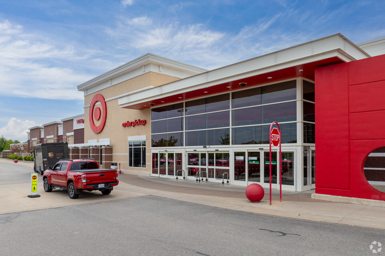
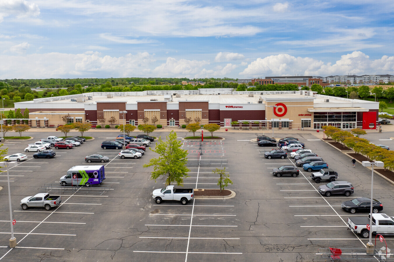
Property Record
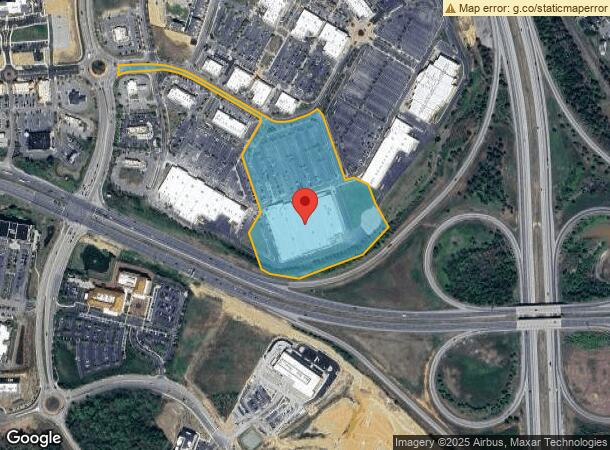
201 Perimeter Dr, Midlothian, VA 23113

NEARBY LISTINGS FOR SALE OR LEASE
Property Detail
201 Perimeter Dr
717-71-02-19-900-000
Nw Mid Tkpe & St Rt 288
Commercialnec
NW MID TKPE & ST RT 288
X
Chesterfield
51145C0165C
Virginia
2024
14.76 AC
2024
Midlothian Village
100924
Richmond VA
132,360 SF
Richmond, VA
DEMOGRAPHICS near 201 Perimeter Dr
1 Mile
3 Mile
5 Mile
2024 Total Population
3,679
27,516
72,042
2029 Population
4,108
30,535
79,411
Pop Growth 2024-2029
+ 11.66%
+ 10.97%
+ 10.23%
Average Age
40
41
41
2024 Total Households
1,360
10,376
26,970
HH Growth 2024-2029
+ 11.76%
+ 11.04%
+ 10.28%
Median Household Inc
$122,146
$118,896
$120,156
Avg Household Size
2.70
2.60
2.60
2024 Avg HH Vehicles
2.00
2.00
2.00
Median Home Value
$487,499
$470,548
$417,223
Median Year Built
2007
2004
1997
Nearby Places
- Restaurants
- Banks
- Shops
- Fitness
- Groceries
PUBLIC TRANSPORTATION
AIRPORT
Richmond International
DRIVE
WALK
Distance
Richmond International
46 min
28.1 mi
Freight Ports
Virginia Port Authority - Richmond
DRIVE
WALK
Distance
Virginia Port Authority - Richmond
36 min
18.2 mi
SALE & LEASE HISTORY
LISTING DATE
SALE/LEASE

Sep 25, 2016
For Lease
Nearby Properties
Address
Land Use
TOTAL SIZE
Lot Size
Zoning
Address
Land Use
TOTAL SIZE
Lot Size
Zoning
578,400 SF
6.77 AC
I2 - GEN I
Address
Land Use
TOTAL SIZE
Lot Size
Zoning
5,720 SF
117.22 AC
R9 - SINGL
Address
Land Use
TOTAL SIZE
Lot Size
Zoning
112,053 SF
44.11 AC
R9 - SINGL
Address
Land Use
TOTAL SIZE
Lot Size
Zoning
100 SF
4.46 AC
I2 - GEN I
Address
Land Use
TOTAL SIZE
Lot Size
Zoning
123,252 SF
48.88 AC
R7 - SINGL
Address
Land Use
TOTAL SIZE
Lot Size
Zoning
108,805 SF
21.09 AC
RMF - RES,
Address
Land Use
TOTAL SIZE
Lot Size
Zoning
100 SF
8.12 AC
C3 - COMMU
Address
Land Use
TOTAL SIZE
Lot Size
Zoning
241,433 SF
68.39 AC
R15 - SING
Address
Land Use
TOTAL SIZE
Lot Size
Zoning
174,840 SF
21.13 AC
R7 - SINGL
Address
Land Use
TOTAL SIZE
Lot Size
Zoning
99,934 SF
81.69 AC
A - AGRICU
Address
Land Use
TOTAL SIZE
Lot Size
Zoning
49,510 SF
8.86 AC
C3 - COMMU
Address
Land Use
TOTAL SIZE
Lot Size
Zoning
5,680 SF
6.74 AC
C2 - NBHD
Address
Land Use
TOTAL SIZE
Lot Size
Zoning
103,410 SF
7.62 AC
R9 - SINGL
Address
Land Use
TOTAL SIZE
Lot Size
Zoning
111,778 SF
9.23 AC
C3 - COMMU
Address
Land Use
TOTAL SIZE
Lot Size
Zoning
70,850 SF
7.31 AC
C3 - COMMU
Address
Land Use
TOTAL SIZE
Lot Size
Zoning
93,925 SF
21.04 AC
A - AGRICU
Address
Land Use
TOTAL SIZE
Lot Size
Zoning
21,211 SF
3.52 AC
R7 - SINGL
Address
Land Use
TOTAL SIZE
Lot Size
Zoning
33,817 SF
1.71 AC
I1 - LT IN
Address
Land Use
TOTAL SIZE
Lot Size
Zoning
114,616 SF
8.09 AC
R9 - SINGL
Address
Land Use
TOTAL SIZE
Lot Size
Zoning
163,704 SF
10.16 AC
I2 - GEN I
Address
Land Use
TOTAL SIZE
Lot Size
Zoning
48,275 SF
4.32 AC
C3 - COMMU
Address
Land Use
TOTAL SIZE
Lot Size
Zoning
314 AC
C3 - COMMU
Address
Land Use
TOTAL SIZE
Lot Size
Zoning
54,804 SF
0.60 AC
I2 - GEN I
Address
Land Use
TOTAL SIZE
Lot Size
Zoning
25,814 SF
2.20 AC
A - AGRICU
Address
Land Use
TOTAL SIZE
Lot Size
Zoning
49.63 AC
C3 - COMMU
Address
Land Use
TOTAL SIZE
Lot Size
Zoning
210.30 AC
C3 - COMMU
Address
Land Use
TOTAL SIZE
Lot Size
Zoning
117,515 SF
7.27 AC
I1 - LT IN
Address
Land Use
TOTAL SIZE
Lot Size
Zoning
52,614 SF
8.87 AC
A - AGRICU
Address
Land Use
TOTAL SIZE
Lot Size
Zoning
55,487 SF
5.73 AC
C3 - COMMU
The World's #1 Commercial Real Estate Marketplace
Connect with us
© 2025 CoStar Group
The information above has been obtained from sources believed reliable. While we do not doubt its accuracy we have not verified it and make no guarantee, warranty or representation about it. It is your responsibility to independently confirm its accuracy and completeness. Any projections, opinions, assumptions, or estimates used are for example only and do not represent the current or future performance of the property. The value of this transaction to you depends on tax and other factors which should be evaluated by your tax, financial, and legal advisors. You and your advisors should conduct a careful, independent investigation of the property to determine to your satisfaction the suitability of the property for your needs.