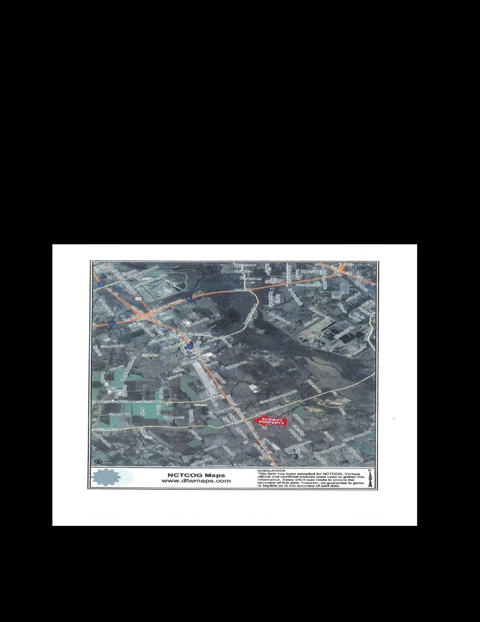
Property Record
201 S Goode Rd, Wilmer, TX 75172

NEARBY LISTINGS FOR SALE OR LEASE
Property Detail
201 S Goode Rd
65161206510120000
C A Warfield
Publicschool
C A WARFIELD ABST 1612 PG 065 TR 12 ACS 15.181 INT2010700146108 DD05242017 CO-DC 1612065101200 4NT16120651
X
Dallas
48113C0660K
Texas
2023
15.18 AC
2023
Mesquite/Forney/Terrell
016903
Dallas/Ft Worth
80,980 SF
Dallas-Fort Worth-Arlington, TX
DEMOGRAPHICS near 201 S Goode Rd
1 Mile
3 Mile
5 Mile
2024 Total Population
4,335
7,287
24,588
2029 Population
4,535
7,532
26,492
Pop Growth 2024-2029
+ 4.61%
+ 3.36%
+ 7.74%
Average Age
33
33
35
2024 Total Households
1,287
2,208
7,008
HH Growth 2024-2029
+ 4.58%
+ 3.22%
+ 8.63%
Median Household Inc
$50,885
$50,712
$50,205
Avg Household Size
3.30
3.20
3.20
2024 Avg HH Vehicles
2.00
2.00
2.00
Median Home Value
$92,960
$97,604
$134,026
Median Year Built
1999
1997
1991
Nearby Places
- Restaurants
- Banks
- Shops
- Fitness
- Groceries
PUBLIC TRANSPORTATION
AIRPORT
Dallas Love Field
DRIVE
WALK
Distance
Dallas Love Field
33 min
21.6 mi
Dallas-Fort Worth International
DRIVE
WALK
Distance
Dallas-Fort Worth International
48 min
37.5 mi
Freight Ports
Port of Shreveport
DRIVE
WALK
Distance
Port of Shreveport
213 min
197.6 mi
Nearby Properties
Address
Land Use
TOTAL SIZE
Lot Size
Zoning
Address
Land Use
TOTAL SIZE
Lot Size
Zoning
2,492,806 SF
106.20 AC
Z34
Address
Land Use
TOTAL SIZE
Lot Size
Zoning
1,409,184 SF
75.72 AC
Z31
Address
Land Use
TOTAL SIZE
Lot Size
Zoning
1,225,000 SF
69.44 AC
Z04
Address
Land Use
TOTAL SIZE
Lot Size
Zoning
1,073,520 SF
55.17 AC
Z123
Address
Land Use
TOTAL SIZE
Lot Size
Zoning
1,020,000 SF
56.30 AC
Z31
Address
Land Use
TOTAL SIZE
Lot Size
Zoning
811,110 SF
37.31 AC
Z31
Address
Land Use
TOTAL SIZE
Lot Size
Zoning
1,021,601 SF
38.29 AC
Z268
Address
Land Use
TOTAL SIZE
Lot Size
Zoning
799,765 SF
45.66 AC
Z31
Address
Land Use
TOTAL SIZE
Lot Size
Zoning
754,897 SF
42.75 AC
Z123
Address
Land Use
TOTAL SIZE
Lot Size
Zoning
660,000 SF
39.24 AC
Z31
Address
Land Use
TOTAL SIZE
Lot Size
Zoning
750,000 SF
37.13 AC
Z31
Address
Land Use
TOTAL SIZE
Lot Size
Zoning
611,040 SF
39.98 AC
Z251
Address
Land Use
TOTAL SIZE
Lot Size
Zoning
360 SF
74.05 AC
Address
Land Use
TOTAL SIZE
Lot Size
Zoning
570,000 SF
30.48 AC
Z251
Address
Land Use
TOTAL SIZE
Lot Size
Zoning
202,439 SF
12.48 AC
Z31
Address
Land Use
TOTAL SIZE
Lot Size
Zoning
349,936 SF
24.34 AC
Z31
Address
Land Use
TOTAL SIZE
Lot Size
Zoning
416,000 SF
28.69 AC
Z123
Address
Land Use
TOTAL SIZE
Lot Size
Zoning
472,836 SF
31.34 AC
Z123
Address
Land Use
TOTAL SIZE
Lot Size
Zoning
431,190 SF
46.46 AC
Z251
Address
Land Use
TOTAL SIZE
Lot Size
Zoning
481,520 SF
26.92 AC
Z31
Address
Land Use
TOTAL SIZE
Lot Size
Zoning
395,099 SF
37.29 AC
Z123
Address
Land Use
TOTAL SIZE
Lot Size
Zoning
1,027,068 SF
38.32 AC
Z31
Address
Land Use
TOTAL SIZE
Lot Size
Zoning
262.87 AC
Z31
Address
Land Use
TOTAL SIZE
Lot Size
Zoning
293,570 SF
14.36 AC
Z251
Address
Land Use
TOTAL SIZE
Lot Size
Zoning
334,800 SF
18.16 AC
Z251
Address
Land Use
TOTAL SIZE
Lot Size
Zoning
235,368 SF
21.03 AC
Z05
Address
Land Use
TOTAL SIZE
Lot Size
Zoning
143,771 SF
130.33 AC
Z123
Address
Land Use
TOTAL SIZE
Lot Size
Zoning
616,068 SF
50.95 AC
Z05
Address
Land Use
TOTAL SIZE
Lot Size
Zoning
243 SF
36.21 AC
SU
The World's #1 Commercial Real Estate Marketplace
Connect with us
© 2025 CoStar Group
The information above has been obtained from sources believed reliable. While we do not doubt its accuracy we have not verified it and make no guarantee, warranty or representation about it. It is your responsibility to independently confirm its accuracy and completeness. Any projections, opinions, assumptions, or estimates used are for example only and do not represent the current or future performance of the property. The value of this transaction to you depends on tax and other factors which should be evaluated by your tax, financial, and legal advisors. You and your advisors should conduct a careful, independent investigation of the property to determine to your satisfaction the suitability of the property for your needs.