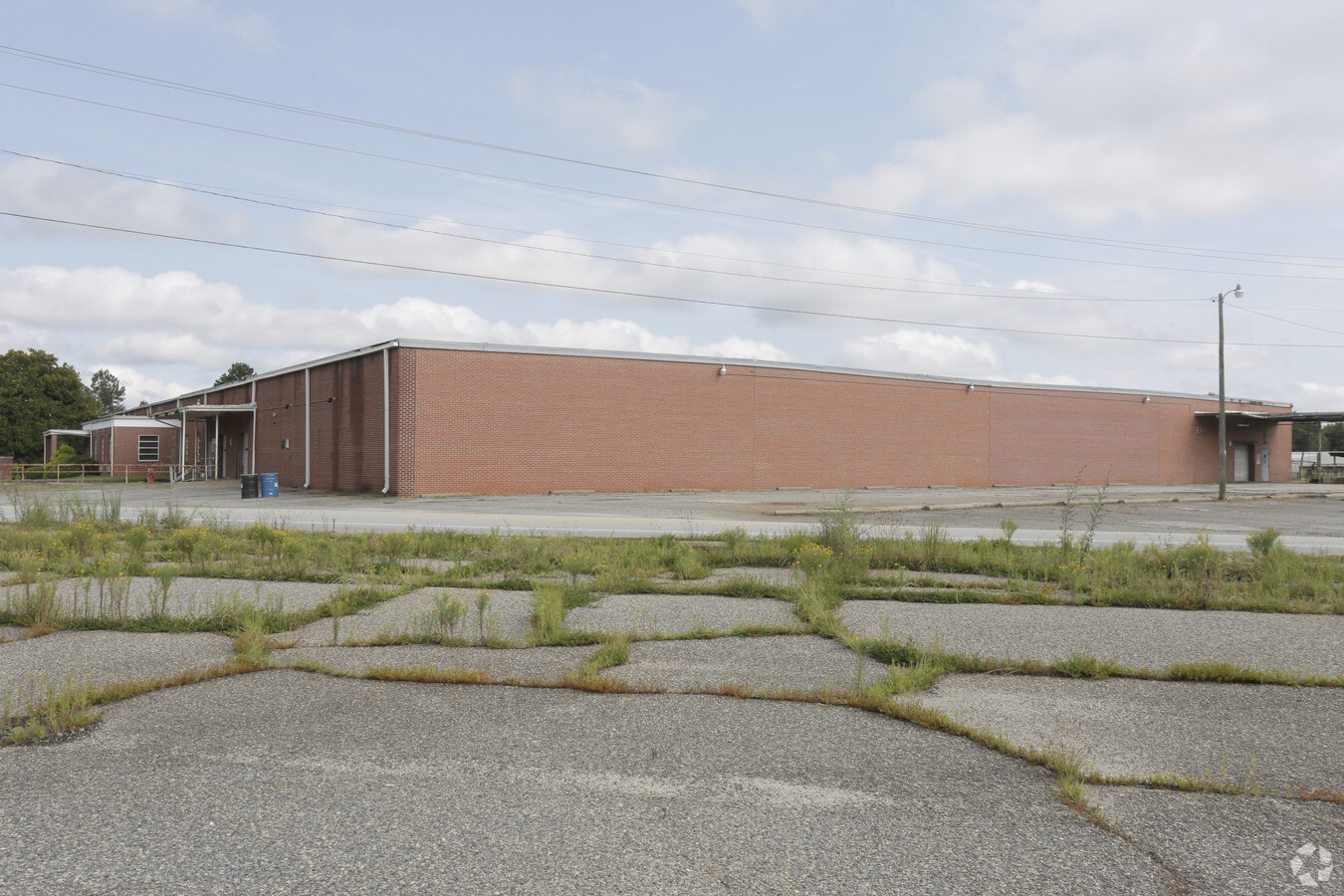
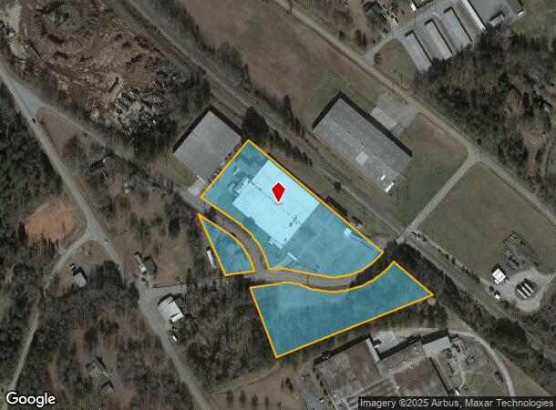
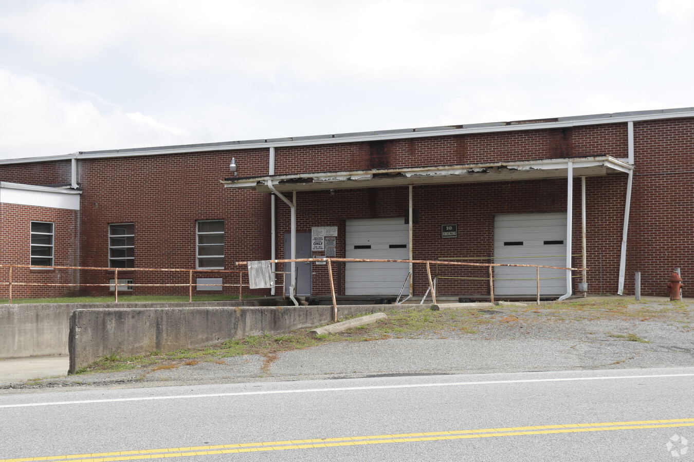
Property Record
201 Sc Elastic Rd, Landrum, SC 29356

NEARBY LISTINGS FOR SALE OR LEASE
-
-
View all Landrum listings for lease on LoopNet.com
Property Detail
201 Sc Elastic Rd
Spartanburg, SC
Terry Hyder
1-14-00-046.00
LOT 1 BOOMER HOLDINGS LLC SUR PB 180-402
Industrialgeneral
Spartanburg
X
South Carolina
45083C0016D
1
2024
8.51 AC
2023
Upper Spartanburg Cty
022500
Greenville/Spartanburg
79,246 SF
DEMOGRAPHICS near 201 Sc Elastic Rd
1 Mile
3 Mile
5 Mile
2024 Total Population
1,331
6,260
14,434
2029 Population
1,509
7,121
16,263
Pop Growth 2024-2029
+ 13.37%
+ 13.75%
+ 12.67%
Average Age
44
44
46
2024 Total Households
593
2,657
6,108
HH Growth 2024-2029
+ 13.49%
+ 13.93%
+ 12.74%
Median Household Inc
$43,333
$52,772
$56,395
Avg Household Size
2.20
2.30
2.30
2024 Avg HH Vehicles
2.00
2.00
2.00
Median Home Value
$217,557
$229,541
$266,454
Median Year Built
1974
1978
1982
Nearby Places
- Restaurants
- Banks
- Shops
- Fitness
- Groceries
PUBLIC TRANSPORTATION
AIRPORT
Greenville Spartanburg International
DRIVE
WALK
Distance
Greenville Spartanburg International
44 min
25.2 mi
Asheville Regional
DRIVE
WALK
Distance
Asheville Regional
46 min
35.5 mi
Freight Ports
North Charleston Terminal
DRIVE
WALK
Distance
North Charleston Terminal
242 min
214.9 mi
SALE & LEASE HISTORY
LISTING DATE
SALE/LEASE

Oct 18, 2017
For Sale
Jul 26, 2018
For Lease
Jul 25, 2018
For Sale
Feb 17, 2017
For Sale
Nearby Properties
Address
Land Use
TOTAL SIZE
Lot Size
Zoning
Address
Land Use
TOTAL SIZE
Lot Size
Zoning
1,972.90 AC
UNZONED
Address
Land Use
TOTAL SIZE
Lot Size
Zoning
166.74 AC
RE5
Address
Land Use
TOTAL SIZE
Lot Size
Zoning
289.30 AC
UNZONED
Address
Land Use
TOTAL SIZE
Lot Size
Zoning
304.75 AC
UNZONED
Address
Land Use
TOTAL SIZE
Lot Size
Zoning
207.70 AC
UNZONED
Address
Land Use
TOTAL SIZE
Lot Size
Zoning
2,290 SF
23.19 AC
RE5
Address
Land Use
TOTAL SIZE
Lot Size
Zoning
138.90 AC
UNZONED
Address
Land Use
TOTAL SIZE
Lot Size
Zoning
93.70 AC
UNZONED
Address
Land Use
TOTAL SIZE
Lot Size
Zoning
8.57 AC
RE5
Address
Land Use
TOTAL SIZE
Lot Size
Zoning
64.50 AC
UNZONED
Address
Land Use
TOTAL SIZE
Lot Size
Zoning
84.10 AC
UNZONED
Address
Land Use
TOTAL SIZE
Lot Size
Zoning
56,601 SF
29.83 AC
Address
Land Use
TOTAL SIZE
Lot Size
Zoning
47.05 AC
UNZONED
Address
Land Use
TOTAL SIZE
Lot Size
Zoning
4,402 SF
5.65 AC
Address
Land Use
TOTAL SIZE
Lot Size
Zoning
44 AC
UNZONED
Address
Land Use
TOTAL SIZE
Lot Size
Zoning
57.90 AC
UNZONED
Address
Land Use
TOTAL SIZE
Lot Size
Zoning
8,026 SF
2 AC
Address
Land Use
TOTAL SIZE
Lot Size
Zoning
49.80 AC
UNZONED
Address
Land Use
TOTAL SIZE
Lot Size
Zoning
4.46 AC
RE5
Address
Land Use
TOTAL SIZE
Lot Size
Zoning
98,780 SF
40.19 AC
Address
Land Use
TOTAL SIZE
Lot Size
Zoning
43.30 AC
UNZONED
Address
Land Use
TOTAL SIZE
Lot Size
Zoning
32.30 AC
UNZONED
Address
Land Use
TOTAL SIZE
Lot Size
Zoning
40.59 AC
UNZONED
Address
Land Use
TOTAL SIZE
Lot Size
Zoning
1,853 SF
0.37 AC
Address
Land Use
TOTAL SIZE
Lot Size
Zoning
1,066 SF
14.36 AC
Address
Land Use
TOTAL SIZE
Lot Size
Zoning
299 SF
34.33 AC
UNZONED
Address
Land Use
TOTAL SIZE
Lot Size
Zoning
12,120 SF
6.90 AC
Address
Land Use
TOTAL SIZE
Lot Size
Zoning
23.80 AC
UNZONED
Address
Land Use
TOTAL SIZE
Lot Size
Zoning
1 AC
UNZONED
Address
Land Use
TOTAL SIZE
Lot Size
Zoning
16.22 AC
UNZONED
The World's #1 Commercial Real Estate Marketplace
Connect with us
© 2025 CoStar Group
The information above has been obtained from sources believed reliable. While we do not doubt its accuracy we have not verified it and make no guarantee, warranty or representation about it. It is your responsibility to independently confirm its accuracy and completeness. Any projections, opinions, assumptions, or estimates used are for example only and do not represent the current or future performance of the property. The value of this transaction to you depends on tax and other factors which should be evaluated by your tax, financial, and legal advisors. You and your advisors should conduct a careful, independent investigation of the property to determine to your satisfaction the suitability of the property for your needs.