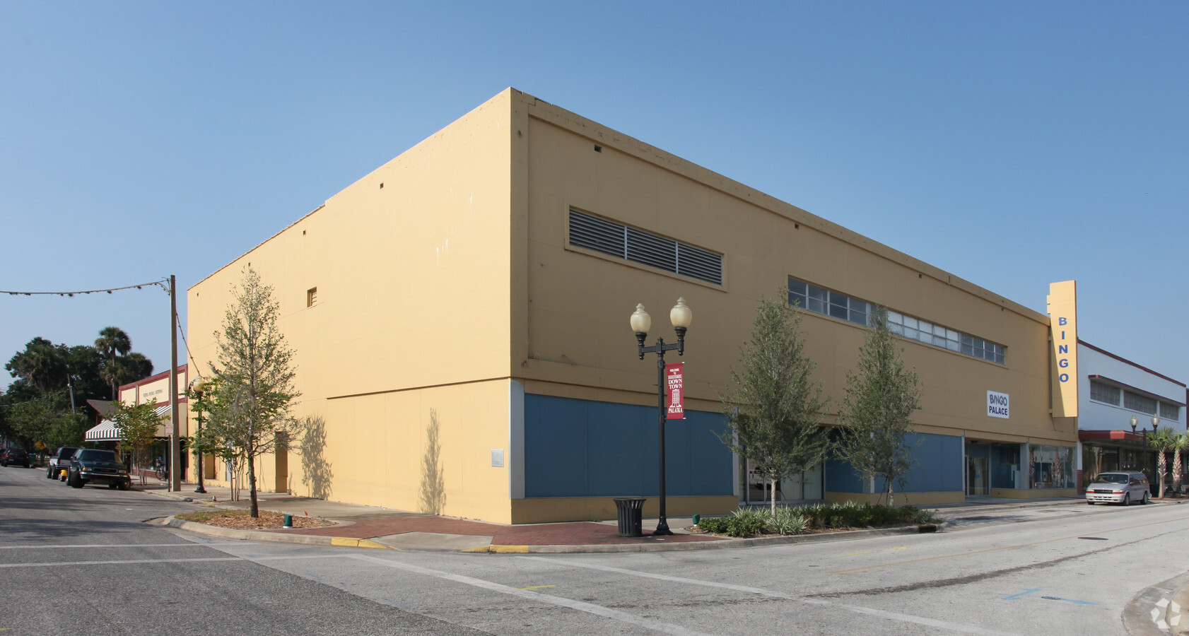
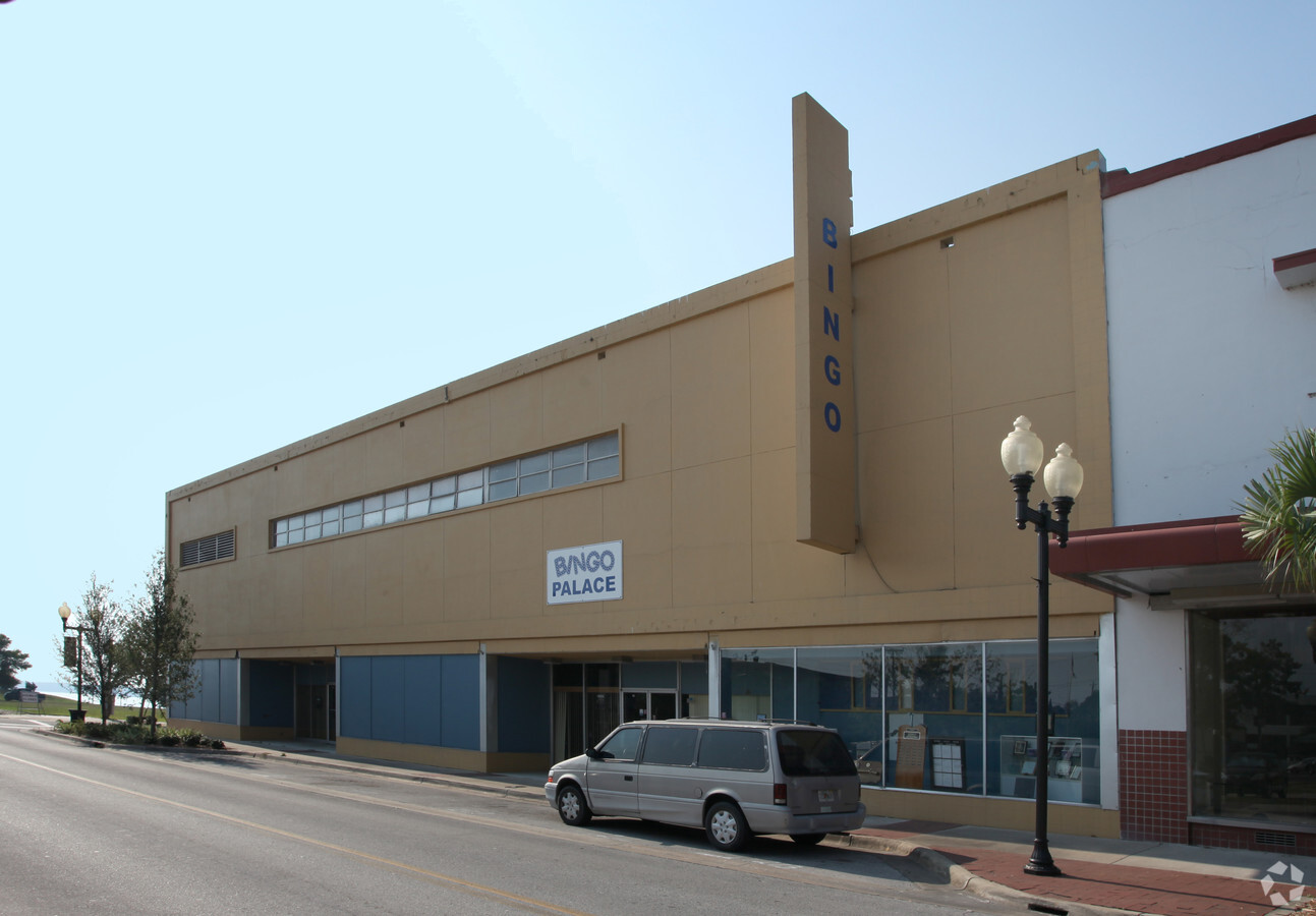
Property Record
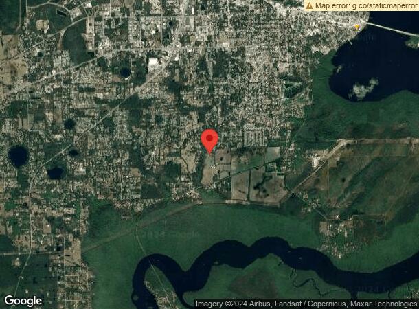
201 E St Johns St, Palatka, FL 32177
NEARBY LISTINGS FOR SALE OR LEASE
Property Detail
201 E St Johns St
Palatka, FL
Dicks
42-10-27-6850-0120-0101
DICKS MAP OF PALATKA MB2 P46 BLK 12 N 99FT 8 3/4IN OF THE E 121FT 3 1/4IN OR392 P1061
Amusementpark
Putnam
X
Florida
12107C0194C
10.1
2023
0.27 AC
2023
Florida Central North Area
950900
Other Market Areas
11,232 SF
DEMOGRAPHICS near 201 E St Johns St
1 Mile
3 Mile
5 Mile
2024 Total Population
2,240
14,936
25,041
2029 Population
2,330
15,398
25,877
Pop Growth 2024-2029
+ 4.02%
+ 3.09%
+ 3.34%
Average Age
41
41
42
2024 Total Households
925
5,898
10,017
HH Growth 2024-2029
+ 4.11%
+ 3.00%
+ 3.28%
Median Household Inc
$26,193
$29,374
$32,795
Avg Household Size
2.40
2.40
2.40
2024 Avg HH Vehicles
1.00
2.00
2.00
Median Home Value
$87,540
$125,101
$139,411
Median Year Built
1949
1970
1976
Nearby Places
- Restaurants
- Banks
- Shops
- Fitness
- Groceries
PUBLIC TRANSPORTATION
COMMUTER RAIL
Palatka Amtrak (Silver Meteor - Amtrak, Silver Star - Amtrak)
DRIVE
WALK
Distance
Palatka Amtrak (Silver Meteor - Amtrak, Silver Star - Amtrak)
9 min
3.4 mi
Freight Ports
Jacksonville Port
DRIVE
WALK
Distance
Jacksonville Port
92 min
59.2 mi
SALE & LEASE HISTORY
LISTING DATE
SALE/LEASE

Apr 09, 2018
For Sale
Nearby Properties
Address
Land Use
TOTAL SIZE
Lot Size
Zoning
Address
Land Use
TOTAL SIZE
Lot Size
Zoning
174,699 SF
41.50 AC
Address
Land Use
TOTAL SIZE
Lot Size
Zoning
7,139 SF
87.49 AC
Address
Land Use
TOTAL SIZE
Lot Size
Zoning
152,364 SF
27.76 AC
Address
Land Use
TOTAL SIZE
Lot Size
Zoning
59,233 SF
29.34 AC
Address
Land Use
TOTAL SIZE
Lot Size
Zoning
44,160 SF
8.99 AC
Address
Land Use
TOTAL SIZE
Lot Size
Zoning
43,844 SF
31.63 AC
Address
Land Use
TOTAL SIZE
Lot Size
Zoning
106,319 SF
28.86 AC
Address
Land Use
TOTAL SIZE
Lot Size
Zoning
97,240 SF
12.72 AC
Address
Land Use
TOTAL SIZE
Lot Size
Zoning
45,991 SF
1.69 AC
Address
Land Use
TOTAL SIZE
Lot Size
Zoning
39,660 SF
12.04 AC
Address
Land Use
TOTAL SIZE
Lot Size
Zoning
47,010 SF
9.43 AC
Address
Land Use
TOTAL SIZE
Lot Size
Zoning
75,330 SF
6.63 AC
Address
Land Use
TOTAL SIZE
Lot Size
Zoning
10,503 SF
1.98 AC
Address
Land Use
TOTAL SIZE
Lot Size
Zoning
1,120 SF
12.44 AC
Address
Land Use
TOTAL SIZE
Lot Size
Zoning
64,863 SF
18.29 AC
Address
Land Use
TOTAL SIZE
Lot Size
Zoning
13,825 SF
4.13 AC
Address
Land Use
TOTAL SIZE
Lot Size
Zoning
14,040 SF
14.25 AC
Address
Land Use
TOTAL SIZE
Lot Size
Zoning
67,425 SF
17.47 AC
Address
Land Use
TOTAL SIZE
Lot Size
Zoning
52,164 SF
10 AC
Address
Land Use
TOTAL SIZE
Lot Size
Zoning
3,002 SF
14.82 AC
Address
Land Use
TOTAL SIZE
Lot Size
Zoning
60,902 SF
13.07 AC
Address
Land Use
TOTAL SIZE
Lot Size
Zoning
19,344 SF
4.74 AC
Address
Land Use
TOTAL SIZE
Lot Size
Zoning
2,444 SF
29.51 AC
Address
Land Use
TOTAL SIZE
Lot Size
Zoning
4,176 SF
6.77 AC
Address
Land Use
TOTAL SIZE
Lot Size
Zoning
18,895 SF
11.20 AC
Address
Land Use
TOTAL SIZE
Lot Size
Zoning
32,222 SF
3.13 AC
Address
Land Use
TOTAL SIZE
Lot Size
Zoning
7.71 AC
Address
Land Use
TOTAL SIZE
Lot Size
Zoning
10,015 SF
2.02 AC
Address
Land Use
TOTAL SIZE
Lot Size
Zoning
33,605 SF
8.46 AC
Address
Land Use
TOTAL SIZE
Lot Size
Zoning
6,120 SF
6.32 AC
The World's #1 Commercial Real Estate Marketplace
Connect with us
© 2025 CoStar Group
The information above has been obtained from sources believed reliable. While we do not doubt its accuracy we have not verified it and make no guarantee, warranty or representation about it. It is your responsibility to independently confirm its accuracy and completeness. Any projections, opinions, assumptions, or estimates used are for example only and do not represent the current or future performance of the property. The value of this transaction to you depends on tax and other factors which should be evaluated by your tax, financial, and legal advisors. You and your advisors should conduct a careful, independent investigation of the property to determine to your satisfaction the suitability of the property for your needs.