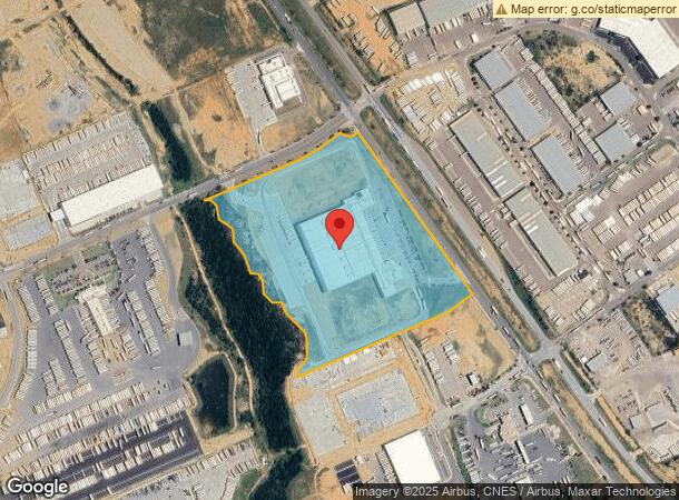
Property Record
201 Vidal Cantu Rd, Laredo, TX 78045

NEARBY LISTINGS FOR SALE OR LEASE
Property Detail
201 Vidal Cantu Rd
Laredo, TX
Pinnacle Industry Center Fm 1472
578661
PINNACLE INDUSTRY CENTER FM 1472, BLOCK 2, LOT 1, PHASE 1
Commercialnec
Webb
A
Texas
48479C1020C
1
2023
30 AC
2024
Texas South Area
0017111033
Other Market Areas
240,880 SF
DEMOGRAPHICS near 201 Vidal Cantu Rd
1 Mile
3 Mile
5 Mile
2024 Total Population
101
4,882
20,568
2029 Population
103
5,006
20,776
Pop Growth 2024-2029
+ 1.98%
+ 2.54%
+ 1.01%
Average Age
31
29
32
2024 Total Households
28
1,293
5,639
HH Growth 2024-2029
+ 3.57%
+ 2.55%
+ 1.03%
Median Household Inc
$69,999
$68,365
$66,351
Avg Household Size
3.40
3.70
3.60
2024 Avg HH Vehicles
2.00
2.00
2.00
Median Home Value
$199,999
$190,450
$165,748
Median Year Built
2002
2008
2003
Nearby Places
- Restaurants
- Banks
- Shops
- Fitness
- Groceries
PUBLIC TRANSPORTATION
AIRPORT
Laredo International
DRIVE
WALK
Distance
Laredo International
21 min
14.3 mi
Freight Ports
Port of Corpus Christi
DRIVE
WALK
Distance
Port of Corpus Christi
177 min
153.2 mi
Nearby Properties
Address
Land Use
TOTAL SIZE
Lot Size
Zoning
Address
Land Use
TOTAL SIZE
Lot Size
Zoning
292,914 SF
32.60 AC
Address
Land Use
TOTAL SIZE
Lot Size
Zoning
410,108 SF
33.18 AC
Address
Land Use
TOTAL SIZE
Lot Size
Zoning
48,288 SF
100.18 AC
Address
Land Use
TOTAL SIZE
Lot Size
Zoning
420,000 SF
25.82 AC
Address
Land Use
TOTAL SIZE
Lot Size
Zoning
98,998 SF
10.31 AC
B3
Address
Land Use
TOTAL SIZE
Lot Size
Zoning
359,790 SF
24.65 AC
Address
Land Use
TOTAL SIZE
Lot Size
Zoning
44,474 SF
50 AC
Address
Land Use
TOTAL SIZE
Lot Size
Zoning
141,974 SF
16.67 AC
M1
Address
Land Use
TOTAL SIZE
Lot Size
Zoning
263,842 SF
22.20 AC
Address
Land Use
TOTAL SIZE
Lot Size
Zoning
100,710 SF
9.58 AC
Address
Land Use
TOTAL SIZE
Lot Size
Zoning
11,599 SF
40 AC
M1
Address
Land Use
TOTAL SIZE
Lot Size
Zoning
46,123 SF
6.99 AC
Address
Land Use
TOTAL SIZE
Lot Size
Zoning
66,232 SF
47.65 AC
Address
Land Use
TOTAL SIZE
Lot Size
Zoning
128,935 SF
6.50 AC
M1
Address
Land Use
TOTAL SIZE
Lot Size
Zoning
61,156 SF
22.52 AC
M1
Address
Land Use
TOTAL SIZE
Lot Size
Zoning
84,764 SF
23.63 AC
Address
Land Use
TOTAL SIZE
Lot Size
Zoning
103,806 SF
10 AC
Address
Land Use
TOTAL SIZE
Lot Size
Zoning
4,235 SF
24.36 AC
B3
Address
Land Use
TOTAL SIZE
Lot Size
Zoning
37,332 SF
13.76 AC
M1
Address
Land Use
TOTAL SIZE
Lot Size
Zoning
22,252 SF
14 AC
Address
Land Use
TOTAL SIZE
Lot Size
Zoning
33,122 SF
10.88 AC
Address
Land Use
TOTAL SIZE
Lot Size
Zoning
93,992 SF
4.32 AC
Address
Land Use
TOTAL SIZE
Lot Size
Zoning
95,206 SF
5.91 AC
Address
Land Use
TOTAL SIZE
Lot Size
Zoning
29.11 AC
Address
Land Use
TOTAL SIZE
Lot Size
Zoning
60,070 SF
4.66 AC
Address
Land Use
TOTAL SIZE
Lot Size
Zoning
28.88 AC
Address
Land Use
TOTAL SIZE
Lot Size
Zoning
86,842 SF
5.90 AC
M1
Address
Land Use
TOTAL SIZE
Lot Size
Zoning
78,232 SF
6.39 AC
Address
Land Use
TOTAL SIZE
Lot Size
Zoning
95,800 SF
5.51 AC
M1
The World's #1 Commercial Real Estate Marketplace
Connect with us
© 2025 CoStar Group
The information above has been obtained from sources believed reliable. While we do not doubt its accuracy we have not verified it and make no guarantee, warranty or representation about it. It is your responsibility to independently confirm its accuracy and completeness. Any projections, opinions, assumptions, or estimates used are for example only and do not represent the current or future performance of the property. The value of this transaction to you depends on tax and other factors which should be evaluated by your tax, financial, and legal advisors. You and your advisors should conduct a careful, independent investigation of the property to determine to your satisfaction the suitability of the property for your needs.