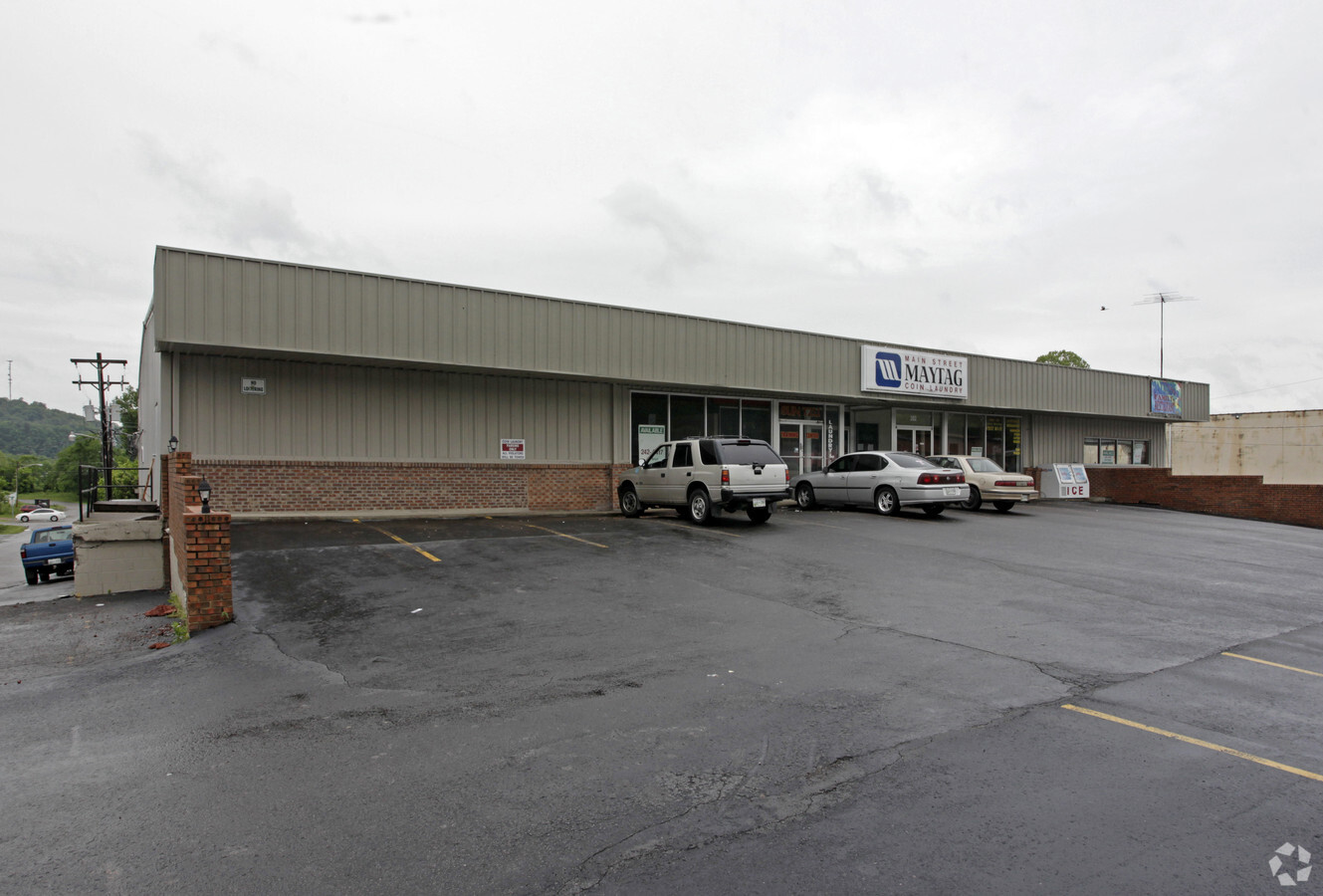
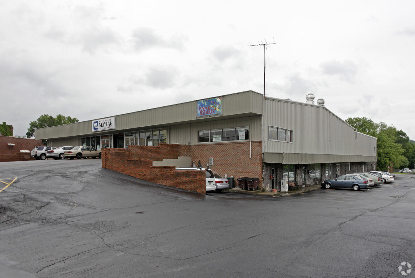
Property Record
202 N Main St, Ashland City, TN 37015
NEARBY LISTINGS FOR SALE OR LEASE
Property Detail
202 N Main St
Nashville-Davidson--Murfreesboro--Franklin, TN
Tn Of Ashland Plat 69-316
055C-J-013.00
SUB PLAT FOR INDUSTRIAL 5-A EASEMENT UT 2 PG 28
Storebuilding
Cheatham
X
Tennessee
47021C0165E
5-a
2024
0.32 AC
2024
Cheatham County
070104
Nashville
29,725 SF
DEMOGRAPHICS near 202 N Main St
1 Mile
3 Mile
5 Mile
2024 Total Population
3,045
6,210
12,249
2029 Population
3,211
6,559
12,937
Pop Growth 2024-2029
+ 5.45%
+ 5.62%
+ 5.62%
Average Age
41
41
41
2024 Total Households
1,230
2,503
4,826
HH Growth 2024-2029
+ 5.45%
+ 5.59%
+ 5.57%
Median Household Inc
$62,260
$62,521
$63,254
Avg Household Size
2.40
2.40
2.50
2024 Avg HH Vehicles
2.00
2.00
2.00
Median Home Value
$234,503
$225,841
$219,094
Median Year Built
1993
1992
1991
Nearby Places
- Restaurants
- Banks
- Shops
- Fitness
- Groceries
PUBLIC TRANSPORTATION
AIRPORT
Nashville International
DRIVE
WALK
Distance
Nashville International
45 min
30.1 mi
Freight Ports
Port of Mobile
DRIVE
WALK
Distance
Port of Mobile
513 min
466.7 mi
SALE & LEASE HISTORY
LISTING DATE
SALE/LEASE

Sep 25, 2016
For Lease
Nearby Properties
Address
Land Use
TOTAL SIZE
Lot Size
Zoning
Address
Land Use
TOTAL SIZE
Lot Size
Zoning
54,804 SF
77 AC
Address
Land Use
TOTAL SIZE
Lot Size
Zoning
3,014 SF
33.80 AC
Address
Land Use
TOTAL SIZE
Lot Size
Zoning
42,824 SF
1.73 AC
Address
Land Use
TOTAL SIZE
Lot Size
Zoning
Address
Land Use
TOTAL SIZE
Lot Size
Zoning
64,604 SF
21.73 AC
Address
Land Use
TOTAL SIZE
Lot Size
Zoning
156,844 SF
18.25 AC
Address
Land Use
TOTAL SIZE
Lot Size
Zoning
8,268 SF
7 AC
Address
Land Use
TOTAL SIZE
Lot Size
Zoning
66,843 SF
2.37 AC
Address
Land Use
TOTAL SIZE
Lot Size
Zoning
32,878 SF
4.60 AC
Address
Land Use
TOTAL SIZE
Lot Size
Zoning
Address
Land Use
TOTAL SIZE
Lot Size
Zoning
Address
Land Use
TOTAL SIZE
Lot Size
Zoning
44,623 SF
7.40 AC
Address
Land Use
TOTAL SIZE
Lot Size
Zoning
33,516 SF
1.43 AC
Address
Land Use
TOTAL SIZE
Lot Size
Zoning
Address
Land Use
TOTAL SIZE
Lot Size
Zoning
28,727 SF
4.95 AC
Address
Land Use
TOTAL SIZE
Lot Size
Zoning
Address
Land Use
TOTAL SIZE
Lot Size
Zoning
23,885 SF
6.02 AC
433
Address
Land Use
TOTAL SIZE
Lot Size
Zoning
46,835 SF
6.85 AC
Address
Land Use
TOTAL SIZE
Lot Size
Zoning
20,292 SF
3.50 AC
Address
Land Use
TOTAL SIZE
Lot Size
Zoning
7,004 SF
5.15 AC
Address
Land Use
TOTAL SIZE
Lot Size
Zoning
Address
Land Use
TOTAL SIZE
Lot Size
Zoning
6,900 SF
0.44 AC
Address
Land Use
TOTAL SIZE
Lot Size
Zoning
14,748 SF
1.82 AC
Address
Land Use
TOTAL SIZE
Lot Size
Zoning
12,575 SF
Address
Land Use
TOTAL SIZE
Lot Size
Zoning
34,792 SF
5.33 AC
Address
Land Use
TOTAL SIZE
Lot Size
Zoning
13,347 SF
1.50 AC
Address
Land Use
TOTAL SIZE
Lot Size
Zoning
7,827 SF
0.93 AC
Address
Land Use
TOTAL SIZE
Lot Size
Zoning
25,825 SF
Address
Land Use
TOTAL SIZE
Lot Size
Zoning
53.80 AC
Address
Land Use
TOTAL SIZE
Lot Size
Zoning
924 SF
4.90 AC
The World's #1 Commercial Real Estate Marketplace
Connect with us
© 2025 CoStar Group
The information above has been obtained from sources believed reliable. While we do not doubt its accuracy we have not verified it and make no guarantee, warranty or representation about it. It is your responsibility to independently confirm its accuracy and completeness. Any projections, opinions, assumptions, or estimates used are for example only and do not represent the current or future performance of the property. The value of this transaction to you depends on tax and other factors which should be evaluated by your tax, financial, and legal advisors. You and your advisors should conduct a careful, independent investigation of the property to determine to your satisfaction the suitability of the property for your needs.