Property Record
202 Route 131, Springfield, VT 05156
NEARBY LISTINGS FOR SALE OR LEASE
-
-
View all Springfield listings for sale on LoopNet.com
Property Detail
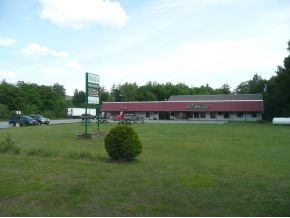
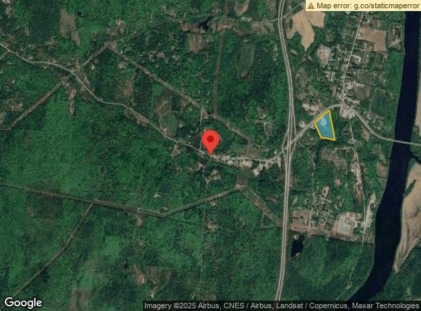
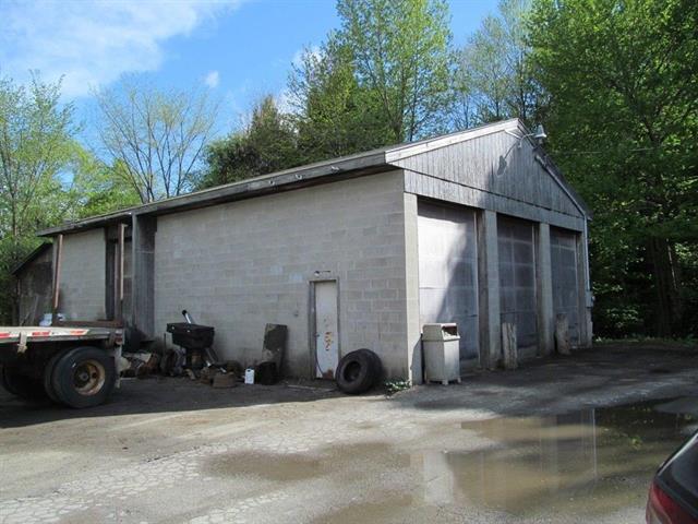
202 Route 131
705-224-11123
LAND & BUILDINGS - STORE REST. ETC
Commercialnec
Windsor
X
Vermont
50027C0643E
8.70 AC
2023
Vermont South Area
2023
Other Market Areas
966100
Claremont-Lebanon, NH-VT
3,908 SF
DEMOGRAPHICS near 202 Route 131
1 Mile
3 Mile
5 Mile
2024 Total Population
313
2,738
17,056
2029 Population
308
2,805
17,849
Pop Growth 2024-2029
(1.60%)
+ 2.45%
+ 4.65%
Average Age
48
46
43
2024 Total Households
142
1,199
7,323
HH Growth 2024-2029
(1.41%)
+ 2.09%
+ 4.36%
Median Household Inc
$69,499
$54,575
$49,195
Avg Household Size
2.20
2.20
2.20
2024 Avg HH Vehicles
2.00
2.00
2.00
Median Home Value
$183,333
$178,133
$169,696
Median Year Built
1970
1967
1962
Nearby Places
- Restaurants
- Banks
- Shops
- Fitness
- Groceries
PUBLIC TRANSPORTATION
COMMUTER RAIL
Claremont Amtrak (Vermonter - Amtrak)
DRIVE
WALK
Distance
Claremont Amtrak (Vermonter - Amtrak)
8 min
4.8 mi
Windsor-Mt. Ascutney Amtrak (Vermonter - Amtrak)
DRIVE
WALK
Distance
Windsor-Mt. Ascutney Amtrak (Vermonter - Amtrak)
9 min
6.4 mi
Freight Ports
Albany, NY Port
DRIVE
WALK
Distance
Albany, NY Port
168 min
111.0 mi
SALE & LEASE HISTORY
LISTING DATE
SALE/LEASE

Aug 21, 2019
For Sale
Nearby Properties
Address
Land Use
TOTAL SIZE
Lot Size
Zoning
Address
Land Use
TOTAL SIZE
Lot Size
Zoning
3,304 SF
58 AC
I2
Address
Land Use
TOTAL SIZE
Lot Size
Zoning
24,206 SF
12.47 AC
LD
Address
Land Use
TOTAL SIZE
Lot Size
Zoning
5,841 SF
224.10 AC
AR
Address
Land Use
TOTAL SIZE
Lot Size
Zoning
Address
Land Use
TOTAL SIZE
Lot Size
Zoning
3,400 SF
4.70 AC
Address
Land Use
TOTAL SIZE
Lot Size
Zoning
598.33 AC
Address
Land Use
TOTAL SIZE
Lot Size
Zoning
23,511 SF
2 AC
LD
Address
Land Use
TOTAL SIZE
Lot Size
Zoning
3,174 SF
669 AC
AR
Address
Land Use
TOTAL SIZE
Lot Size
Zoning
Address
Land Use
TOTAL SIZE
Lot Size
Zoning
5,006 SF
6.70 AC
B2
Address
Land Use
TOTAL SIZE
Lot Size
Zoning
2,880 SF
43 AC
RR2
Address
Land Use
TOTAL SIZE
Lot Size
Zoning
Address
Land Use
TOTAL SIZE
Lot Size
Zoning
3,075 SF
5.90 AC
R1
Address
Land Use
TOTAL SIZE
Lot Size
Zoning
97.90 AC
Address
Land Use
TOTAL SIZE
Lot Size
Zoning
3,236 SF
11.64 AC
B2
Address
Land Use
TOTAL SIZE
Lot Size
Zoning
2,892 SF
2.10 AC
R1
Address
Land Use
TOTAL SIZE
Lot Size
Zoning
489.90 AC
Address
Land Use
TOTAL SIZE
Lot Size
Zoning
1,000 SF
13.27 AC
I
Address
Land Use
TOTAL SIZE
Lot Size
Zoning
7,161 SF
1.72 AC
R1
Address
Land Use
TOTAL SIZE
Lot Size
Zoning
168.50 AC
Address
Land Use
TOTAL SIZE
Lot Size
Zoning
5,725 SF
1.01 AC
Address
Land Use
TOTAL SIZE
Lot Size
Zoning
6,831 SF
1 AC
R1
Address
Land Use
TOTAL SIZE
Lot Size
Zoning
Address
Land Use
TOTAL SIZE
Lot Size
Zoning
1,848 SF
4.46 AC
R1
Address
Land Use
TOTAL SIZE
Lot Size
Zoning
2,712 SF
21.15 AC
AR
Address
Land Use
TOTAL SIZE
Lot Size
Zoning
2,070 SF
15.93 AC
AR
Address
Land Use
TOTAL SIZE
Lot Size
Zoning
Address
Land Use
TOTAL SIZE
Lot Size
Zoning
2,082 SF
58.60 AC
The World's #1 Commercial Real Estate Marketplace
Connect with us
© 2025 CoStar Group
The information above has been obtained from sources believed reliable. While we do not doubt its accuracy we have not verified it and make no guarantee, warranty or representation about it. It is your responsibility to independently confirm its accuracy and completeness. Any projections, opinions, assumptions, or estimates used are for example only and do not represent the current or future performance of the property. The value of this transaction to you depends on tax and other factors which should be evaluated by your tax, financial, and legal advisors. You and your advisors should conduct a careful, independent investigation of the property to determine to your satisfaction the suitability of the property for your needs.