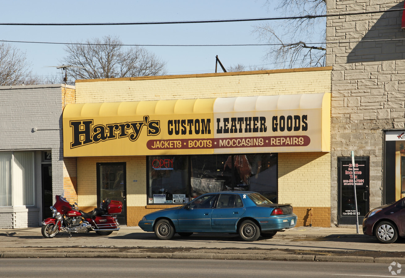
Property Record
2020 N Telegraph Rd, Dearborn, MI 48128


Current Lease Availabilities
NEARBY LISTINGS FOR SALE OR LEASE
Property Detail
2020 N Telegraph Rd
Detroit-Warren-Dearborn, MI
Telegraph Ford Sub
82-09-161-01-008
LOT 67 AND N 1/2 OF LOT 68 TELEGRAPH FORD SUB
Storebuilding
Wayne
X
Michigan
26163C0234E
67-68
2024
0.07 AC
2024
Dearborn
574600
Detroit
2,940 SF
DEMOGRAPHICS near 2020 N Telegraph Rd
1 Mile
3 Mile
5 Mile
2024 Total Population
17,401
124,674
323,237
2029 Population
16,667
120,461
312,797
Pop Growth 2024-2029
(4.22%)
(3.38%)
(3.23%)
Average Age
38
38
38
2024 Total Households
5,989
46,465
121,766
HH Growth 2024-2029
(4.27%)
(3.38%)
(3.26%)
Median Household Inc
$82,311
$60,667
$55,283
Avg Household Size
2.80
2.60
2.60
2024 Avg HH Vehicles
2.00
2.00
2.00
Median Home Value
$211,198
$172,342
$147,156
Median Year Built
1953
1955
1955
Nearby Places
- Restaurants
- Banks
- Shops
- Fitness
- Groceries
PUBLIC TRANSPORTATION
COMMUTER RAIL
Dearborn (Wolverine - Amtrak)
DRIVE
WALK
Distance
Dearborn (Wolverine - Amtrak)
9 min
4.1 mi
AIRPORT
Detroit Metro Wayne County
DRIVE
WALK
Distance
Detroit Metro Wayne County
23 min
12.6 mi
Windsor International
DRIVE
WALK
Distance
Windsor International
43 min
23.0 mi
Freight Ports
Port of Toledo
DRIVE
WALK
Distance
Port of Toledo
75 min
55.8 mi
Nearby Properties
Address
Land Use
TOTAL SIZE
Lot Size
Zoning
Address
Land Use
TOTAL SIZE
Lot Size
Zoning
303,893 SF
349 AC
IC
Address
Land Use
TOTAL SIZE
Lot Size
Zoning
73.85 AC
IB
Address
Land Use
TOTAL SIZE
Lot Size
Zoning
675,440 SF
66.32 AC
IB
Address
Land Use
TOTAL SIZE
Lot Size
Zoning
1,209,711 SF
69.44 AC
IB
Address
Land Use
TOTAL SIZE
Lot Size
Zoning
581,293 SF
51.81 AC
IB
Address
Land Use
TOTAL SIZE
Lot Size
Zoning
371,614 SF
18.68 AC
RD
Address
Land Use
TOTAL SIZE
Lot Size
Zoning
854,358 SF
12.49 AC
BC
Address
Land Use
TOTAL SIZE
Lot Size
Zoning
349,045 SF
40.28 AC
IB
Address
Land Use
TOTAL SIZE
Lot Size
Zoning
317,040 SF
12.03 AC
BC
Address
Land Use
TOTAL SIZE
Lot Size
Zoning
335,133 SF
22.08 AC
Address
Land Use
TOTAL SIZE
Lot Size
Zoning
Address
Land Use
TOTAL SIZE
Lot Size
Zoning
228,519 SF
6.16 AC
BC
Address
Land Use
TOTAL SIZE
Lot Size
Zoning
521,519 SF
30 AC
BC
Address
Land Use
TOTAL SIZE
Lot Size
Zoning
Address
Land Use
TOTAL SIZE
Lot Size
Zoning
126,712 SF
4.52 AC
BC
Address
Land Use
TOTAL SIZE
Lot Size
Zoning
810,000 SF
23.15 AC
BC
Address
Land Use
TOTAL SIZE
Lot Size
Zoning
330,819 SF
11.54 AC
IA
Address
Land Use
TOTAL SIZE
Lot Size
Zoning
240,425 SF
6.39 AC
IB
Address
Land Use
TOTAL SIZE
Lot Size
Zoning
463,642 SF
22.82 AC
Address
Land Use
TOTAL SIZE
Lot Size
Zoning
159,059 SF
11.34 AC
BC
Address
Land Use
TOTAL SIZE
Lot Size
Zoning
250,277 SF
4.12 AC
RE
Address
Land Use
TOTAL SIZE
Lot Size
Zoning
84,333 SF
1.15 AC
BC
Address
Land Use
TOTAL SIZE
Lot Size
Zoning
560,265 SF
10.87 AC
BC
Address
Land Use
TOTAL SIZE
Lot Size
Zoning
86.77 AC
BC
Address
Land Use
TOTAL SIZE
Lot Size
Zoning
207,081 SF
8.80 AC
B5
Address
Land Use
TOTAL SIZE
Lot Size
Zoning
107,680 SF
7.46 AC
BC
Address
Land Use
TOTAL SIZE
Lot Size
Zoning
127,391 SF
1.79 AC
BC
Address
Land Use
TOTAL SIZE
Lot Size
Zoning
544,536 SF
17.30 AC
IB
Address
Land Use
TOTAL SIZE
Lot Size
Zoning
113,515 SF
12.90 AC
BB
Address
Land Use
TOTAL SIZE
Lot Size
Zoning
179,412 SF
2.17 AC
The World's #1 Commercial Real Estate Marketplace
Connect with us
© 2025 CoStar Group
The information above has been obtained from sources believed reliable. While we do not doubt its accuracy we have not verified it and make no guarantee, warranty or representation about it. It is your responsibility to independently confirm its accuracy and completeness. Any projections, opinions, assumptions, or estimates used are for example only and do not represent the current or future performance of the property. The value of this transaction to you depends on tax and other factors which should be evaluated by your tax, financial, and legal advisors. You and your advisors should conduct a careful, independent investigation of the property to determine to your satisfaction the suitability of the property for your needs.