Property Record
2020 Queen St, North Fort Myers, FL 33917


NEARBY LISTINGS FOR SALE OR LEASE
-
-
No Photo
-
View all North Fort Myers listings for sale on LoopNet.com
Property Detail
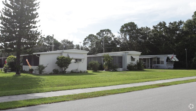
2020 Queen St
Cape Coral-Fort Myers, FL
North Fort Myers
35-43-24-00-00007.0010
N 1/2 OF SW 1/4 OF SW 1/4 OF NE 1/4 + 3380 SQ FT DESC OR 1305 PG 569 AKA FOX RENTAL PARK
Orphanage
Lee
AE
Florida
12071C0259G
1
2024
5.12 AC
2025
North Ft Myers
020501
Southwest Florida
1,848 SF
DEMOGRAPHICS near 2020 Queen St
1 Mile
3 Mile
5 Mile
2024 Total Population
6,661
42,978
126,178
2029 Population
7,840
51,155
149,629
Pop Growth 2024-2029
+ 17.70%
+ 19.03%
+ 18.59%
Average Age
54
51
45
2024 Total Households
3,362
20,338
52,328
HH Growth 2024-2029
+ 17.07%
+ 18.47%
+ 18.25%
Median Household Inc
$33,664
$44,420
$49,945
Avg Household Size
1.90
2.00
2.30
2024 Avg HH Vehicles
1.00
1.00
2.00
Median Home Value
$70,960
$131,064
$182,624
Median Year Built
1975
1984
1985
Nearby Places
Map Layers
Map Styles
 Street
 Aerial
- Restaurants
- Banks
- Shops
- Fitness
- Groceries
PUBLIC TRANSPORTATION
AIRPORT
Southwest Florida International
DRIVE
WALK
Distance
Southwest Florida International
30 min
17.4 mi
Punta Gorda
DRIVE
WALK
Distance
Punta Gorda
30 min
20.2 mi
Freight Ports
Port Manatee
DRIVE
WALK
Distance
Port Manatee
110 min
91.9 mi
Nearby Properties
Address
Land Use
TOTAL SIZE
Lot Size
Zoning
Address
Land Use
TOTAL SIZE
Lot Size
Zoning
214,515 SF
30.60 AC
I-1
Address
Land Use
TOTAL SIZE
Lot Size
Zoning
485,271 SF
20.05 AC
CORR
Address
Land Use
TOTAL SIZE
Lot Size
Zoning
347,871 SF
29.40 AC
RML
Address
Land Use
TOTAL SIZE
Lot Size
Zoning
13.60 AC
CC
Address
Land Use
TOTAL SIZE
Lot Size
Zoning
333,938 SF
35.80 AC
C-1
Address
Land Use
TOTAL SIZE
Lot Size
Zoning
138,476 SF
4.11 AC
CORR
Address
Land Use
TOTAL SIZE
Lot Size
Zoning
451,348 SF
21.43 AC
CPD
Address
Land Use
TOTAL SIZE
Lot Size
Zoning
209,881 SF
63.03 AC
AG-2
Address
Land Use
TOTAL SIZE
Lot Size
Zoning
1,666 SF
35.55 AC
AG-2
Address
Land Use
TOTAL SIZE
Lot Size
Zoning
73,644 SF
34.16 AC
AG-2
Address
Land Use
TOTAL SIZE
Lot Size
Zoning
82,478 SF
15.46 AC
CORR
Address
Land Use
TOTAL SIZE
Lot Size
Zoning
212,616 SF
6.61 AC
CORR/CPO
Address
Land Use
TOTAL SIZE
Lot Size
Zoning
128,355 SF
19.24 AC
C-1
Address
Land Use
TOTAL SIZE
Lot Size
Zoning
112,356 SF
18.99 AC
AG-2
Address
Land Use
TOTAL SIZE
Lot Size
Zoning
109,404 SF
14.22 AC
AG-2
Address
Land Use
TOTAL SIZE
Lot Size
Zoning
51,478 SF
68.97 AC
C-2
Address
Land Use
TOTAL SIZE
Lot Size
Zoning
107,321 SF
7.80 AC
C-1A
Address
Land Use
TOTAL SIZE
Lot Size
Zoning
101,343 SF
8.06 AC
IL
Address
Land Use
TOTAL SIZE
Lot Size
Zoning
141,571 SF
4.57 AC
C-1A
Address
Land Use
TOTAL SIZE
Lot Size
Zoning
222,159 SF
25.12 AC
CP-D
Address
Land Use
TOTAL SIZE
Lot Size
Zoning
81,160 SF
9.40 AC
CPD
Address
Land Use
TOTAL SIZE
Lot Size
Zoning
72,683 SF
9.82 AC
CPD
Address
Land Use
TOTAL SIZE
Lot Size
Zoning
99,939 SF
3.39 AC
C-1A
Address
Land Use
TOTAL SIZE
Lot Size
Zoning
48,780 SF
14.99 AC
Address
Land Use
TOTAL SIZE
Lot Size
Zoning
53,781 SF
6.84 AC
CPO
Address
Land Use
TOTAL SIZE
Lot Size
Zoning
85,915 SF
9.33 AC
CC
Address
Land Use
TOTAL SIZE
Lot Size
Zoning
59,736 SF
14.91 AC
C-2
Address
Land Use
TOTAL SIZE
Lot Size
Zoning
67,403 SF
11.78 AC
CPD
Address
Land Use
TOTAL SIZE
Lot Size
Zoning
145,734 SF
13.20 AC
C-1A
Address
Land Use
TOTAL SIZE
Lot Size
Zoning
90 AC
C-2
The World's #1 Commercial Real Estate Marketplace
Connect with us
© 2026 CoStar Group
The information above has been obtained from sources believed reliable. While we do not doubt its accuracy we have not verified it and make no guarantee, warranty or representation about it. It is your responsibility to independently confirm its accuracy and completeness. Any projections, opinions, assumptions, or estimates used are for example only and do not represent the current or future performance of the property. The value of this transaction to you depends on tax and other factors which should be evaluated by your tax, financial, and legal advisors. You and your advisors should conduct a careful, independent investigation of the property to determine to your satisfaction the suitability of the property for your needs.