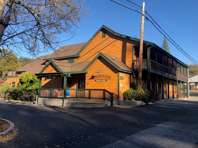
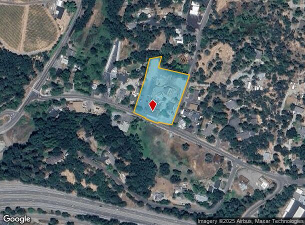
Property Record
2021 Smith Flat Rd, Placerville, CA 95667

NEARBY LISTINGS FOR SALE OR LEASE
Property Detail
2021 Smith Flat Rd
048-240-014-000
SEC 10 10 11
Officebuilding
El Dorado
X
California
06017C0757E
1.81 AC
2024
El Dorado
2024
Sacramento
031100
Sacramento--Roseville--Arden-Arcade, CA
7,552 SF
DEMOGRAPHICS near 2021 Smith Flat Rd
1 Mile
3 Mile
5 Mile
2024 Total Population
1,190
12,027
26,280
2029 Population
1,214
12,187
26,530
Pop Growth 2024-2029
+ 2.02%
+ 1.33%
+ 0.95%
Average Age
47
46
46
2024 Total Households
525
5,112
10,984
HH Growth 2024-2029
+ 1.90%
+ 1.35%
+ 0.97%
Median Household Inc
$74,642
$78,063
$77,598
Avg Household Size
2.20
2.30
2.30
2024 Avg HH Vehicles
2.00
2.00
2.00
Median Home Value
$506,579
$490,745
$482,159
Median Year Built
1972
1972
1977
Nearby Places
- Restaurants
- Banks
- Shops
- Fitness
- Groceries
SALE & LEASE HISTORY
LISTING DATE
SALE/LEASE

Nov 10, 2019
For Sale
Nearby Properties
Address
Land Use
TOTAL SIZE
Lot Size
Zoning
Address
Land Use
TOTAL SIZE
Lot Size
Zoning
201,296 SF
13 AC
Address
Land Use
TOTAL SIZE
Lot Size
Zoning
4,688 SF
12.28 AC
R106
Address
Land Use
TOTAL SIZE
Lot Size
Zoning
3,072 SF
3.83 AC
Address
Land Use
TOTAL SIZE
Lot Size
Zoning
24,750 SF
8.60 AC
Address
Land Use
TOTAL SIZE
Lot Size
Zoning
74,718 SF
2.08 AC
CG
Address
Land Use
TOTAL SIZE
Lot Size
Zoning
25,050 SF
2.08 AC
RE
Address
Land Use
TOTAL SIZE
Lot Size
Zoning
48,440 SF
5.11 AC
Address
Land Use
TOTAL SIZE
Lot Size
Zoning
5,764 SF
4.38 AC
PD
Address
Land Use
TOTAL SIZE
Lot Size
Zoning
28,830 SF
3.04 AC
R106
Address
Land Use
TOTAL SIZE
Lot Size
Zoning
261.24 AC
A
Address
Land Use
TOTAL SIZE
Lot Size
Zoning
2,215 SF
0.29 AC
Address
Land Use
TOTAL SIZE
Lot Size
Zoning
26,417 SF
0.17 AC
C
Address
Land Use
TOTAL SIZE
Lot Size
Zoning
28,566 SF
2.14 AC
C
Address
Land Use
TOTAL SIZE
Lot Size
Zoning
22,058 SF
2.40 AC
R2
Address
Land Use
TOTAL SIZE
Lot Size
Zoning
14,256 SF
0.25 AC
C
Address
Land Use
TOTAL SIZE
Lot Size
Zoning
36,504 SF
14.90 AC
RE
Address
Land Use
TOTAL SIZE
Lot Size
Zoning
18,125 SF
0.80 AC
C
Address
Land Use
TOTAL SIZE
Lot Size
Zoning
14,850 SF
1.51 AC
R2
Address
Land Use
TOTAL SIZE
Lot Size
Zoning
42,698 SF
0.87 AC
CG
Address
Land Use
TOTAL SIZE
Lot Size
Zoning
3,547 SF
2.23 AC
PD
Address
Land Use
TOTAL SIZE
Lot Size
Zoning
9,722 SF
0.77 AC
C
Address
Land Use
TOTAL SIZE
Lot Size
Zoning
35,937 SF
0.83 AC
CG
Address
Land Use
TOTAL SIZE
Lot Size
Zoning
18,626 SF
2.38 AC
C
Address
Land Use
TOTAL SIZE
Lot Size
Zoning
18,315 SF
2.47 AC
C
Address
Land Use
TOTAL SIZE
Lot Size
Zoning
2,559 SF
25.29 AC
AE
Address
Land Use
TOTAL SIZE
Lot Size
Zoning
10,521 SF
0.54 AC
CG
Address
Land Use
TOTAL SIZE
Lot Size
Zoning
1,150 SF
31.11 AC
A
Address
Land Use
TOTAL SIZE
Lot Size
Zoning
5.89 AC
The World's #1 Commercial Real Estate Marketplace
Connect with us
© 2025 CoStar Group
The information above has been obtained from sources believed reliable. While we do not doubt its accuracy we have not verified it and make no guarantee, warranty or representation about it. It is your responsibility to independently confirm its accuracy and completeness. Any projections, opinions, assumptions, or estimates used are for example only and do not represent the current or future performance of the property. The value of this transaction to you depends on tax and other factors which should be evaluated by your tax, financial, and legal advisors. You and your advisors should conduct a careful, independent investigation of the property to determine to your satisfaction the suitability of the property for your needs.