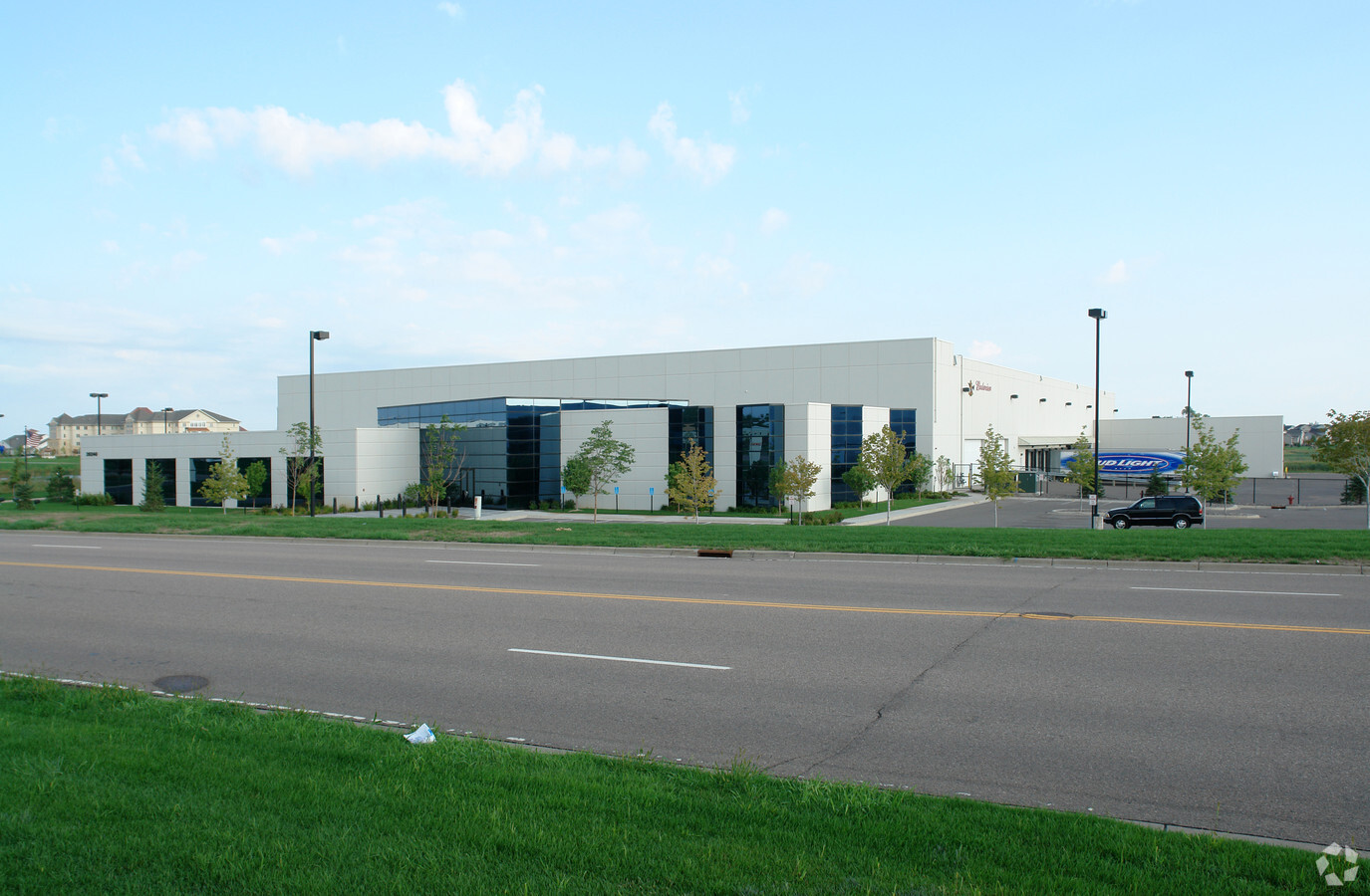
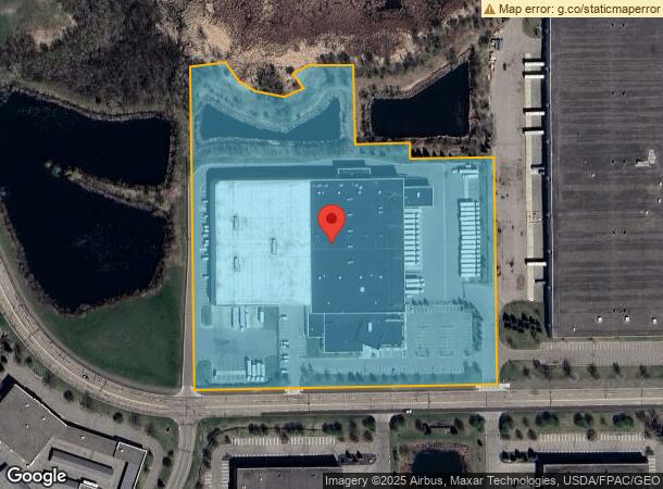
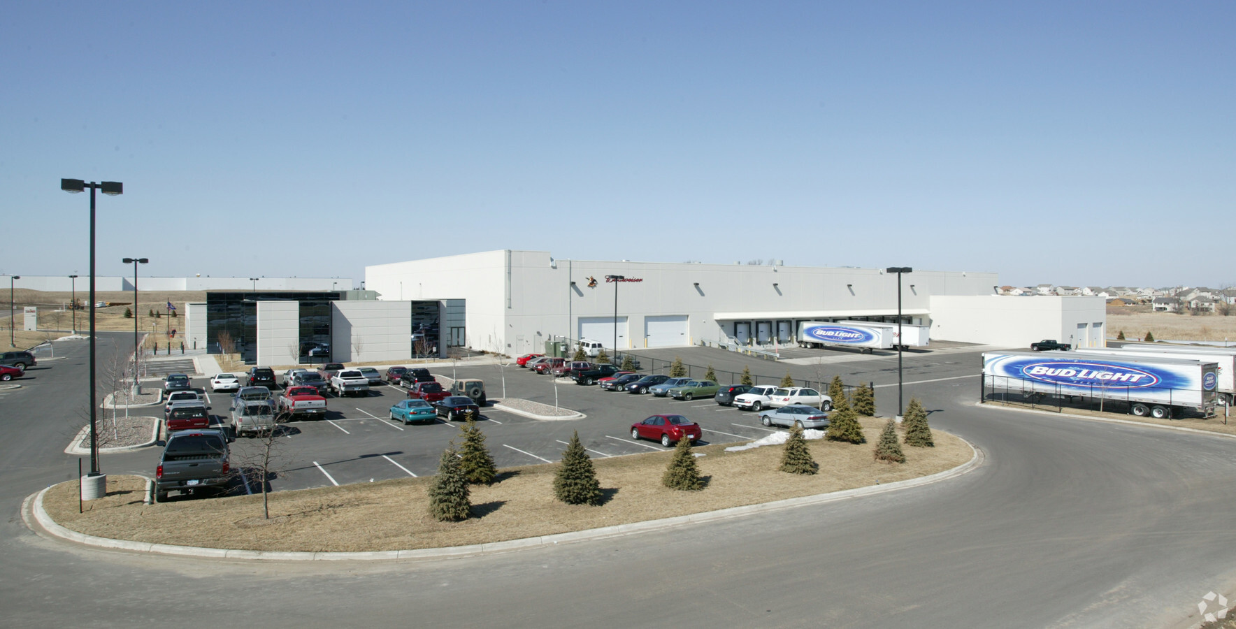
Property Record
20240 S Diamond Lake Rd, Rogers, MN 55374
NEARBY LISTINGS FOR SALE OR LEASE
Property Detail
20240 S Diamond Lake Rd
Minneapolis-St. Paul-Bloomington, MN-WI
Rogers Industrial Park 15Th
13-120-23-34-0004
LOT 001 BLOCK 001 A ROGERS INDUSTRIAL PARK 15TH IRREGULAR
Industrialgeneral
Hennepin
X
Minnesota
27053C0033F
1
2024
12.39 AC
2023
Northwest
0269092083
Minneapolis/St Paul
DEMOGRAPHICS near 20240 S Diamond Lake Rd
1 Mile
3 Mile
5 Mile
2024 Total Population
2,998
16,937
42,227
2029 Population
3,021
17,292
44,306
Pop Growth 2024-2029
+ 0.77%
+ 2.10%
+ 4.92%
Average Age
38
37
38
2024 Total Households
1,034
5,647
14,794
HH Growth 2024-2029
+ 0.58%
+ 1.75%
+ 4.95%
Median Household Inc
$139,673
$130,583
$117,102
Avg Household Size
2.80
3.00
2.80
2024 Avg HH Vehicles
2.00
2.00
2.00
Median Home Value
$398,683
$387,101
$373,209
Median Year Built
2004
2002
2003
Nearby Places
- Restaurants
- Banks
- Shops
- Fitness
- Groceries
PUBLIC TRANSPORTATION
COMMUTER RAIL
Elk River Station (Northstar Corridor - Northstar Commuter Rail)
DRIVE
WALK
Distance
Elk River Station (Northstar Corridor - Northstar Commuter Rail)
14 min
8.7 mi
AIRPORT
Minneapolis-St Paul International/Wold-Chamberlain
DRIVE
WALK
Distance
Minneapolis-St Paul International/Wold-Chamberlain
51 min
37.2 mi
Freight Ports
Port Milwaukee
DRIVE
WALK
Distance
Port Milwaukee
403 min
362.4 mi
Nearby Properties
Address
Land Use
TOTAL SIZE
Lot Size
Zoning
Address
Land Use
TOTAL SIZE
Lot Size
Zoning
30.13 AC
Address
Land Use
TOTAL SIZE
Lot Size
Zoning
Address
Land Use
TOTAL SIZE
Lot Size
Zoning
22.24 AC
Address
Land Use
TOTAL SIZE
Lot Size
Zoning
8.10 AC
Address
Land Use
TOTAL SIZE
Lot Size
Zoning
3.32 AC
Address
Land Use
TOTAL SIZE
Lot Size
Zoning
62.34 AC
Address
Land Use
TOTAL SIZE
Lot Size
Zoning
24.34 AC
Address
Land Use
TOTAL SIZE
Lot Size
Zoning
21.02 AC
Address
Land Use
TOTAL SIZE
Lot Size
Zoning
16.17 AC
Address
Land Use
TOTAL SIZE
Lot Size
Zoning
15.20 AC
Address
Land Use
TOTAL SIZE
Lot Size
Zoning
17.13 AC
Address
Land Use
TOTAL SIZE
Lot Size
Zoning
15.15 AC
Address
Land Use
TOTAL SIZE
Lot Size
Zoning
19.03 AC
Address
Land Use
TOTAL SIZE
Lot Size
Zoning
16.57 AC
Address
Land Use
TOTAL SIZE
Lot Size
Zoning
12.98 AC
Address
Land Use
TOTAL SIZE
Lot Size
Zoning
13.21 AC
Address
Land Use
TOTAL SIZE
Lot Size
Zoning
14.07 AC
Address
Land Use
TOTAL SIZE
Lot Size
Zoning
11.44 AC
Address
Land Use
TOTAL SIZE
Lot Size
Zoning
Address
Land Use
TOTAL SIZE
Lot Size
Zoning
Address
Land Use
TOTAL SIZE
Lot Size
Zoning
11.74 AC
Address
Land Use
TOTAL SIZE
Lot Size
Zoning
Address
Land Use
TOTAL SIZE
Lot Size
Zoning
41.53 AC
Address
Land Use
TOTAL SIZE
Lot Size
Zoning
Address
Land Use
TOTAL SIZE
Lot Size
Zoning
11.33 AC
Address
Land Use
TOTAL SIZE
Lot Size
Zoning
Address
Land Use
TOTAL SIZE
Lot Size
Zoning
Address
Land Use
TOTAL SIZE
Lot Size
Zoning
Address
Land Use
TOTAL SIZE
Lot Size
Zoning
The World's #1 Commercial Real Estate Marketplace
Connect with us
© 2025 CoStar Group
The information above has been obtained from sources believed reliable. While we do not doubt its accuracy we have not verified it and make no guarantee, warranty or representation about it. It is your responsibility to independently confirm its accuracy and completeness. Any projections, opinions, assumptions, or estimates used are for example only and do not represent the current or future performance of the property. The value of this transaction to you depends on tax and other factors which should be evaluated by your tax, financial, and legal advisors. You and your advisors should conduct a careful, independent investigation of the property to determine to your satisfaction the suitability of the property for your needs.