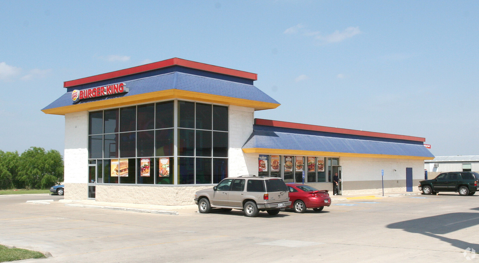
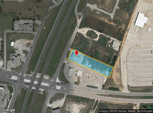
Property Record
20290 Interstate 37 S, Elmendorf, TX 78112
NEARBY LISTINGS FOR SALE OR LEASE
Property Detail
20290 Interstate 37 S
San Antonio-New Braunfels, TX
Southmost No. 2 Subd
04136-200-0020
CB 4136B BLK LOT 2 (SOUTHMOST NO. 2 SUBD) REFER TO: 81800-200-0020 SURVEY-CR # 12010
Restaurantdrivein
Bexar
X
Texas
48029C0735G
2
2023
2.16 AC
2023
South
152202
San Antonio
3,672 SF
DEMOGRAPHICS near 20290 Interstate 37 S
1 Mile
3 Mile
5 Mile
2024 Total Population
901
7,840
21,156
2029 Population
964
8,426
23,028
Pop Growth 2024-2029
+ 6.99%
+ 7.47%
+ 8.85%
Average Age
35
35
36
2024 Total Households
282
2,339
6,392
HH Growth 2024-2029
+ 7.09%
+ 7.57%
+ 9.00%
Median Household Inc
$62,308
$45,707
$49,147
Avg Household Size
3.10
3.30
3.20
2024 Avg HH Vehicles
2.00
2.00
2.00
Median Home Value
$144,382
$134,074
$150,170
Median Year Built
1999
1998
1998
Nearby Places
- Restaurants
- Banks
- Shops
- Fitness
- Groceries
PUBLIC TRANSPORTATION
AIRPORT
San Antonio International
DRIVE
WALK
Distance
San Antonio International
28 min
24.1 mi
Freight Ports
Port of Corpus Christi
DRIVE
WALK
Distance
Port of Corpus Christi
129 min
126.7 mi
Nearby Properties
Address
Land Use
TOTAL SIZE
Lot Size
Zoning
Address
Land Use
TOTAL SIZE
Lot Size
Zoning
226,474 SF
108.81 AC
Address
Land Use
TOTAL SIZE
Lot Size
Zoning
211,505 SF
21.04 AC
Address
Land Use
TOTAL SIZE
Lot Size
Zoning
2,470.32 AC
Address
Land Use
TOTAL SIZE
Lot Size
Zoning
47,314 SF
4.53 AC
Address
Land Use
TOTAL SIZE
Lot Size
Zoning
485.17 AC
Address
Land Use
TOTAL SIZE
Lot Size
Zoning
43,005 SF
2.48 AC
Address
Land Use
TOTAL SIZE
Lot Size
Zoning
1,056 SF
304.42 AC
Address
Land Use
TOTAL SIZE
Lot Size
Zoning
1,890 SF
361.85 AC
Address
Land Use
TOTAL SIZE
Lot Size
Zoning
16,710 SF
4 AC
Address
Land Use
TOTAL SIZE
Lot Size
Zoning
17,500 SF
6.77 AC
Address
Land Use
TOTAL SIZE
Lot Size
Zoning
9,673,474 SF
8.35 AC
Address
Land Use
TOTAL SIZE
Lot Size
Zoning
19,623 SF
21.04 AC
Address
Land Use
TOTAL SIZE
Lot Size
Zoning
29,105 SF
2.16 AC
Address
Land Use
TOTAL SIZE
Lot Size
Zoning
346,206 SF
2.99 AC
Address
Land Use
TOTAL SIZE
Lot Size
Zoning
21,562 SF
6.88 AC
Address
Land Use
TOTAL SIZE
Lot Size
Zoning
420 SF
150 AC
Address
Land Use
TOTAL SIZE
Lot Size
Zoning
3,183 SF
2.23 AC
Address
Land Use
TOTAL SIZE
Lot Size
Zoning
56,200 SF
2.90 AC
Address
Land Use
TOTAL SIZE
Lot Size
Zoning
185.13 AC
Address
Land Use
TOTAL SIZE
Lot Size
Zoning
784 SF
20.19 AC
Address
Land Use
TOTAL SIZE
Lot Size
Zoning
72.02 AC
Address
Land Use
TOTAL SIZE
Lot Size
Zoning
2,770 SF
27.53 AC
Address
Land Use
TOTAL SIZE
Lot Size
Zoning
4,544 SF
2.93 AC
Address
Land Use
TOTAL SIZE
Lot Size
Zoning
222.49 AC
Address
Land Use
TOTAL SIZE
Lot Size
Zoning
Address
Land Use
TOTAL SIZE
Lot Size
Zoning
9,920 SF
3.26 AC
Address
Land Use
TOTAL SIZE
Lot Size
Zoning
10,452 SF
3.41 AC
Address
Land Use
TOTAL SIZE
Lot Size
Zoning
14,496 SF
7.10 AC
Address
Land Use
TOTAL SIZE
Lot Size
Zoning
7,320 SF
1.27 AC
The World's #1 Commercial Real Estate Marketplace
Connect with us
© 2025 CoStar Group
The information above has been obtained from sources believed reliable. While we do not doubt its accuracy we have not verified it and make no guarantee, warranty or representation about it. It is your responsibility to independently confirm its accuracy and completeness. Any projections, opinions, assumptions, or estimates used are for example only and do not represent the current or future performance of the property. The value of this transaction to you depends on tax and other factors which should be evaluated by your tax, financial, and legal advisors. You and your advisors should conduct a careful, independent investigation of the property to determine to your satisfaction the suitability of the property for your needs.