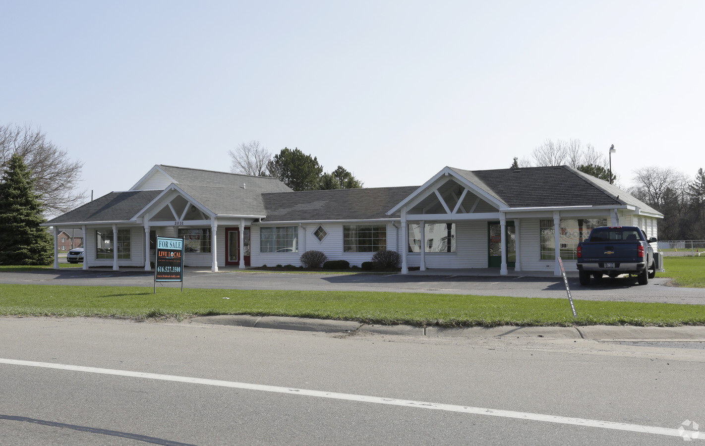
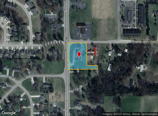
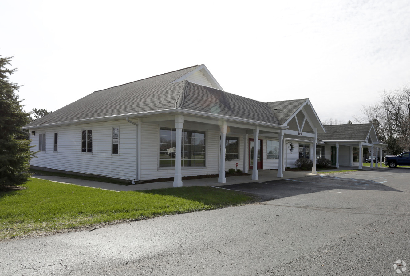
Property Record
2039 S State Rd, Ionia, MI 48846
Current Lease Availabilities
NEARBY LISTINGS FOR SALE OR LEASE
Property Detail
2039 S State Rd
060-031-000-060-01
PART OF THE NW1/4 OF SECTION 31, T7N-R6W, IONIA TOWNSHIP, IONIA COUNTY, MICHIGAN, DESCRIBED AS: BEGINNING AT THE NORTHWEST
Commercialnec
Ionia
X
Michigan
26067C0179D
1.39 AC
2023
Ionia County
2024
West Michigan
031900
Ionia, MI
3,220 SF
DEMOGRAPHICS near 2039 S State Rd
1 Mile
3 Mile
5 Mile
2024 Total Population
2,223
17,587
21,215
2029 Population
2,275
17,889
21,595
Pop Growth 2024-2029
+ 2.34%
+ 1.72%
+ 1.79%
Average Age
41
40
40
2024 Total Households
841
4,392
5,762
HH Growth 2024-2029
+ 2.26%
+ 2.53%
+ 2.43%
Median Household Inc
$62,570
$56,935
$57,863
Avg Household Size
2.60
2.50
2.50
2024 Avg HH Vehicles
2.00
2.00
2.00
Median Home Value
$149,558
$142,608
$146,164
Median Year Built
1980
1959
1965
Nearby Places
- Restaurants
- Banks
- Shops
- Fitness
- Groceries
PUBLIC TRANSPORTATION
AIRPORT
Gerald R. Ford International
DRIVE
WALK
Distance
Gerald R. Ford International
35 min
32.6 mi
Capital Region International
DRIVE
WALK
Distance
Capital Region International
36 min
33.4 mi
Freight Ports
Port of Baltimore
DRIVE
WALK
Distance
Port of Baltimore
1 min
509.5 mi
Nearby Properties
Address
Land Use
TOTAL SIZE
Lot Size
Zoning
Address
Land Use
TOTAL SIZE
Lot Size
Zoning
209,286 SF
23.37 AC
Address
Land Use
TOTAL SIZE
Lot Size
Zoning
178,310 SF
21.07 AC
Address
Land Use
TOTAL SIZE
Lot Size
Zoning
Address
Land Use
TOTAL SIZE
Lot Size
Zoning
8,960 SF
6.11 AC
Address
Land Use
TOTAL SIZE
Lot Size
Zoning
96,695 SF
11.92 AC
I-1
Address
Land Use
TOTAL SIZE
Lot Size
Zoning
111,316 SF
14.62 AC
Address
Land Use
TOTAL SIZE
Lot Size
Zoning
1,408 SF
136 AC
Address
Land Use
TOTAL SIZE
Lot Size
Zoning
131,333 SF
14.07 AC
Address
Land Use
TOTAL SIZE
Lot Size
Zoning
127,496 SF
10.70 AC
I-1
Address
Land Use
TOTAL SIZE
Lot Size
Zoning
94,800 SF
13.63 AC
Address
Land Use
TOTAL SIZE
Lot Size
Zoning
29,270 SF
3.09 AC
I-1
Address
Land Use
TOTAL SIZE
Lot Size
Zoning
70.10 AC
Address
Land Use
TOTAL SIZE
Lot Size
Zoning
31,585 SF
4.20 AC
RM-1
Address
Land Use
TOTAL SIZE
Lot Size
Zoning
1,920 SF
68.57 AC
Address
Land Use
TOTAL SIZE
Lot Size
Zoning
16.30 AC
RM-1
Address
Land Use
TOTAL SIZE
Lot Size
Zoning
31,242 SF
0.25 AC
B-2
Address
Land Use
TOTAL SIZE
Lot Size
Zoning
23,904 SF
0.31 AC
B-2
Address
Land Use
TOTAL SIZE
Lot Size
Zoning
628.74 AC
Address
Land Use
TOTAL SIZE
Lot Size
Zoning
4.31 AC
RM-1
Address
Land Use
TOTAL SIZE
Lot Size
Zoning
2,396 SF
72.30 AC
Address
Land Use
TOTAL SIZE
Lot Size
Zoning
78.62 AC
Address
Land Use
TOTAL SIZE
Lot Size
Zoning
24,672 SF
4.46 AC
Address
Land Use
TOTAL SIZE
Lot Size
Zoning
13,440 SF
5.50 AC
B-3
Address
Land Use
TOTAL SIZE
Lot Size
Zoning
1,885 SF
1.17 AC
Address
Land Use
TOTAL SIZE
Lot Size
Zoning
7,200 SF
2.72 AC
Address
Land Use
TOTAL SIZE
Lot Size
Zoning
1.45 AC
Address
Land Use
TOTAL SIZE
Lot Size
Zoning
32,565 SF
5.61 AC
Address
Land Use
TOTAL SIZE
Lot Size
Zoning
11,701 SF
2.13 AC
B-3
Address
Land Use
TOTAL SIZE
Lot Size
Zoning
33,556 SF
2 AC
Address
Land Use
TOTAL SIZE
Lot Size
Zoning
14,224 SF
5.12 AC
The World's #1 Commercial Real Estate Marketplace
Connect with us
© 2025 CoStar Group
The information above has been obtained from sources believed reliable. While we do not doubt its accuracy we have not verified it and make no guarantee, warranty or representation about it. It is your responsibility to independently confirm its accuracy and completeness. Any projections, opinions, assumptions, or estimates used are for example only and do not represent the current or future performance of the property. The value of this transaction to you depends on tax and other factors which should be evaluated by your tax, financial, and legal advisors. You and your advisors should conduct a careful, independent investigation of the property to determine to your satisfaction the suitability of the property for your needs.