Property Record
20310 Temescal Canyon Rd, Corona, CA 92881


NEARBY LISTINGS FOR SALE OR LEASE
-
-
View all Corona listings for sale on LoopNet.com
Property Detail
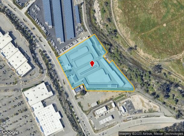
20310 Temescal Canyon Rd
Inland Empire (California)
Parcel Map No. 23271
Riverside-San Bernardino-Ontario, CA
6.56 ACRES M/L IN POR PARS 7 & 8 PM 170/095 PM 23271
279-530-048
Riverside
Warehouse
California
2023
7,8
2023
6.56 AC
041909
Corona/Eastvale
131,470 SF
DEMOGRAPHICS near 20310 Temescal Canyon Rd
1 Mile
3 Mile
5 Mile
2024 Total Population
3,120
37,727
135,343
2029 Population
3,299
39,684
142,204
Pop Growth 2024-2029
+ 5.74%
+ 5.19%
+ 5.07%
Average Age
37
37
38
2024 Total Households
1,049
11,051
39,491
HH Growth 2024-2029
+ 5.34%
+ 4.70%
+ 4.64%
Median Household Inc
$111,171
$129,136
$106,837
Avg Household Size
2.90
3.30
3.30
2024 Avg HH Vehicles
2.00
3.00
2.00
Median Home Value
$637,500
$718,125
$648,813
Median Year Built
1995
1997
1992
Nearby Places
- Restaurants
- Banks
- Shops
- Fitness
- Groceries
PUBLIC TRANSPORTATION
COMMUTER RAIL
North Main Corona (91 Line - Southern California Regional Rail Authority (Metrolink), Inland Empire-Orange County Line - Southern California Regional Rail Authority (Metrolink))
DRIVE
WALK
Distance
North Main Corona (91 Line - Southern California Regional Rail Authority (Metrolink), Inland Empire-Orange County Line - Southern California Regional Rail Authority (Metrolink))
10 min
5.5 mi
Riverside-La Sierra (91 Line - Southern California Regional Rail Authority (Metrolink), Inland Empire-Orange County Line - Southern California Regional Rail Authority (Metrolink))
DRIVE
WALK
Distance
Riverside-La Sierra (91 Line - Southern California Regional Rail Authority (Metrolink), Inland Empire-Orange County Line - Southern California Regional Rail Authority (Metrolink))
14 min
9.5 mi
AIRPORT
Ontario International
DRIVE
WALK
Distance
Ontario International
28 min
20.4 mi
John Wayne/Orange County
DRIVE
WALK
Distance
John Wayne/Orange County
43 min
34.0 mi
Freight Ports
Port of Long Beach
DRIVE
WALK
Distance
Port of Long Beach
64 min
48.0 mi
Nearby Properties
Address
Land Use
TOTAL SIZE
Lot Size
Zoning
Address
Land Use
TOTAL SIZE
Lot Size
Zoning
164,712 SF
10 AC
R3
Address
Land Use
TOTAL SIZE
Lot Size
Zoning
173,676 SF
10.96 AC
R3
Address
Land Use
TOTAL SIZE
Lot Size
Zoning
18.76 AC
Address
Land Use
TOTAL SIZE
Lot Size
Zoning
39,646 SF
13.13 AC
Address
Land Use
TOTAL SIZE
Lot Size
Zoning
8.80 AC
R3
Address
Land Use
TOTAL SIZE
Lot Size
Zoning
248,799 SF
12.06 AC
Address
Land Use
TOTAL SIZE
Lot Size
Zoning
186,190 SF
9.79 AC
Address
Land Use
TOTAL SIZE
Lot Size
Zoning
205,235 SF
10.30 AC
Address
Land Use
TOTAL SIZE
Lot Size
Zoning
151,672 SF
0.69 AC
Address
Land Use
TOTAL SIZE
Lot Size
Zoning
138,800 SF
10 AC
M4
Address
Land Use
TOTAL SIZE
Lot Size
Zoning
150,404 SF
8.02 AC
Address
Land Use
TOTAL SIZE
Lot Size
Zoning
364,162 SF
10 AC
M4
Address
Land Use
TOTAL SIZE
Lot Size
Zoning
159,921 SF
5.29 AC
EC
Address
Land Use
TOTAL SIZE
Lot Size
Zoning
115,545 SF
5.97 AC
Address
Land Use
TOTAL SIZE
Lot Size
Zoning
96,943 SF
12.76 AC
SP
Address
Land Use
TOTAL SIZE
Lot Size
Zoning
164,888 SF
9.88 AC
Address
Land Use
TOTAL SIZE
Lot Size
Zoning
104,740 SF
4.88 AC
Address
Land Use
TOTAL SIZE
Lot Size
Zoning
246,225 SF
26.09 AC
Address
Land Use
TOTAL SIZE
Lot Size
Zoning
153,541 SF
0.99 AC
Address
Land Use
TOTAL SIZE
Lot Size
Zoning
139,800 SF
9.21 AC
IP
Address
Land Use
TOTAL SIZE
Lot Size
Zoning
66,031 SF
3.78 AC
Address
Land Use
TOTAL SIZE
Lot Size
Zoning
64,224 SF
10.70 AC
Address
Land Use
TOTAL SIZE
Lot Size
Zoning
53,894 SF
4.76 AC
Address
Land Use
TOTAL SIZE
Lot Size
Zoning
5.23 AC
Address
Land Use
TOTAL SIZE
Lot Size
Zoning
57,248 SF
9.87 AC
Address
Land Use
TOTAL SIZE
Lot Size
Zoning
89,682 SF
4.65 AC
Address
Land Use
TOTAL SIZE
Lot Size
Zoning
90,765 SF
7.69 AC
Address
Land Use
TOTAL SIZE
Lot Size
Zoning
64,247 SF
2.88 AC
The World's #1 Commercial Real Estate Marketplace
Connect with us
© 2025 CoStar Group
The information above has been obtained from sources believed reliable. While we do not doubt its accuracy we have not verified it and make no guarantee, warranty or representation about it. It is your responsibility to independently confirm its accuracy and completeness. Any projections, opinions, assumptions, or estimates used are for example only and do not represent the current or future performance of the property. The value of this transaction to you depends on tax and other factors which should be evaluated by your tax, financial, and legal advisors. You and your advisors should conduct a careful, independent investigation of the property to determine to your satisfaction the suitability of the property for your needs.