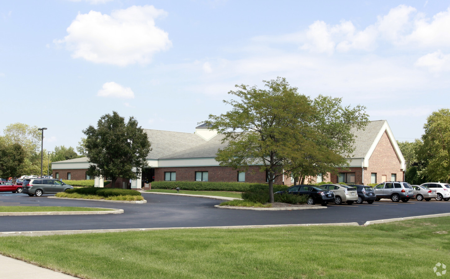
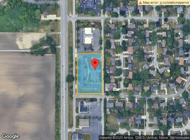
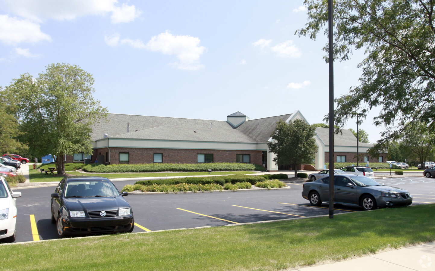
Property Record
2050 N Main St, Crown Point, IN 46307
NEARBY LISTINGS FOR SALE OR LEASE
Property Detail
2050 N Main St
Chicago-Naperville-Elgin, IL-IN-WI
Wirtz Crown Heights Unit A
45-12-32-251-003.000-029
WIRTZ CROWN HEIGHTS UNIT A SEC 3 LOT 3
Taxexempt
Lake
X
Indiana
18089C0253E
3
2023
2.01 AC
2024
Indiana
042506
Chicago
15,270 SF
DEMOGRAPHICS near 2050 N Main St
1 Mile
3 Mile
5 Mile
2024 Total Population
6,264
45,335
100,264
2029 Population
6,272
45,291
100,487
Pop Growth 2024-2029
+ 0.13%
(0.10%)
+ 0.22%
Average Age
43
42
41
2024 Total Households
2,663
18,540
38,661
HH Growth 2024-2029
+ 0.19%
(0.09%)
+ 0.19%
Median Household Inc
$83,598
$71,883
$81,034
Avg Household Size
2.20
2.30
2.50
2024 Avg HH Vehicles
2.00
2.00
2.00
Median Home Value
$230,510
$222,309
$246,922
Median Year Built
1991
1985
1987
Nearby Places
- Restaurants
- Banks
- Shops
- Fitness
- Groceries
Nearby Properties
Address
Land Use
TOTAL SIZE
Lot Size
Zoning
Address
Land Use
TOTAL SIZE
Lot Size
Zoning
598,983 SF
88 AC
Address
Land Use
TOTAL SIZE
Lot Size
Zoning
129,204 SF
16.57 AC
Address
Land Use
TOTAL SIZE
Lot Size
Zoning
536,896 SF
20.08 AC
Address
Land Use
TOTAL SIZE
Lot Size
Zoning
377,878 SF
21.58 AC
Address
Land Use
TOTAL SIZE
Lot Size
Zoning
184,544 SF
16.76 AC
Address
Land Use
TOTAL SIZE
Lot Size
Zoning
365,748 SF
17.44 AC
R33
Address
Land Use
TOTAL SIZE
Lot Size
Zoning
324,724 SF
17.30 AC
Address
Land Use
TOTAL SIZE
Lot Size
Zoning
289,840 SF
15.31 AC
Address
Land Use
TOTAL SIZE
Lot Size
Zoning
111,453 SF
15.21 AC
Address
Land Use
TOTAL SIZE
Lot Size
Zoning
291,060 SF
37.07 AC
Address
Land Use
TOTAL SIZE
Lot Size
Zoning
263,968 SF
27.86 AC
Address
Land Use
TOTAL SIZE
Lot Size
Zoning
1,002,000 SF
60.96 AC
Address
Land Use
TOTAL SIZE
Lot Size
Zoning
236,904 SF
11.30 AC
R33
Address
Land Use
TOTAL SIZE
Lot Size
Zoning
116,352 SF
9 AC
Address
Land Use
TOTAL SIZE
Lot Size
Zoning
276,540 SF
21.16 AC
Address
Land Use
TOTAL SIZE
Lot Size
Zoning
428,008 SF
54.72 AC
Address
Land Use
TOTAL SIZE
Lot Size
Zoning
116,352 SF
8.08 AC
Address
Land Use
TOTAL SIZE
Lot Size
Zoning
143,060 SF
33.82 AC
Address
Land Use
TOTAL SIZE
Lot Size
Zoning
108,193 SF
2.42 AC
Address
Land Use
TOTAL SIZE
Lot Size
Zoning
329,040 SF
30.18 AC
Address
Land Use
TOTAL SIZE
Lot Size
Zoning
40,890 SF
11.27 AC
Address
Land Use
TOTAL SIZE
Lot Size
Zoning
304,429 SF
84.07 AC
Address
Land Use
TOTAL SIZE
Lot Size
Zoning
237,291 SF
33.51 AC
R33
Address
Land Use
TOTAL SIZE
Lot Size
Zoning
87,264 SF
7.74 AC
Address
Land Use
TOTAL SIZE
Lot Size
Zoning
61,318 SF
15.79 AC
R33
Address
Land Use
TOTAL SIZE
Lot Size
Zoning
92,823 SF
8.56 AC
Address
Land Use
TOTAL SIZE
Lot Size
Zoning
94,527 SF
6.10 AC
R33
Address
Land Use
TOTAL SIZE
Lot Size
Zoning
59,824 SF
5.29 AC
R33
Address
Land Use
TOTAL SIZE
Lot Size
Zoning
71,786 SF
9.20 AC
R33
Address
Land Use
TOTAL SIZE
Lot Size
Zoning
125,172 SF
5.57 AC
R33
The World's #1 Commercial Real Estate Marketplace
Connect with us
© 2025 CoStar Group
The information above has been obtained from sources believed reliable. While we do not doubt its accuracy we have not verified it and make no guarantee, warranty or representation about it. It is your responsibility to independently confirm its accuracy and completeness. Any projections, opinions, assumptions, or estimates used are for example only and do not represent the current or future performance of the property. The value of this transaction to you depends on tax and other factors which should be evaluated by your tax, financial, and legal advisors. You and your advisors should conduct a careful, independent investigation of the property to determine to your satisfaction the suitability of the property for your needs.