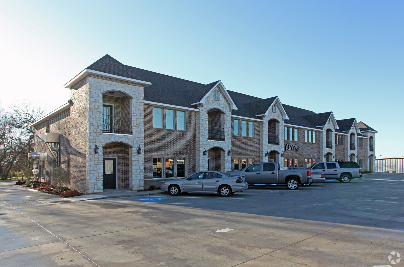
Property Record
206 S State Highway 342, Red Oak, TX 75154
NEARBY LISTINGS FOR SALE OR LEASE
Property Detail
206 S State Highway 342
Dallas-Fort Worth-Arlington, TX
Douthit Addition
179914
LOT 1 BLK A DOUTHIT ADDITION 0.7982 AC
Commercialnec
Ellis
X
Texas
48139C0070G
1
2023
0.80 AC
2023
Southwest Outlying
060207
Dallas/Ft Worth
15,488 SF
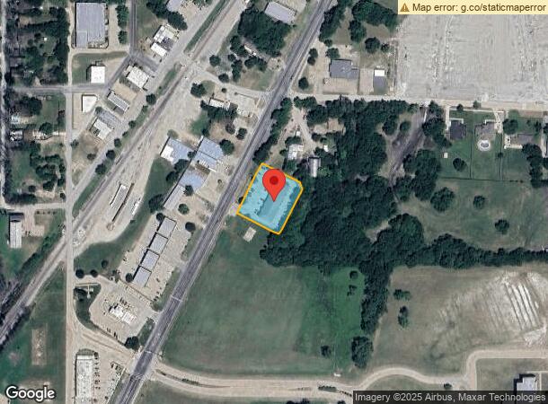
DEMOGRAPHICS near 206 S State Highway 342
1 Mile
3 Mile
5 Mile
2024 Total Population
6,853
27,295
66,458
2029 Population
8,595
34,446
79,145
Pop Growth 2024-2029
+ 25.42%
+ 26.20%
+ 19.09%
Average Age
36
38
37
2024 Total Households
2,333
9,174
22,077
HH Growth 2024-2029
+ 25.76%
+ 26.53%
+ 19.45%
Median Household Inc
$92,417
$99,385
$94,355
Avg Household Size
2.90
2.90
3.00
2024 Avg HH Vehicles
2.00
2.00
2.00
Median Home Value
$256,870
$261,585
$260,546
Median Year Built
2001
1998
1999
Nearby Places
- Restaurants
- Banks
- Shops
- Fitness
- Groceries
PUBLIC TRANSPORTATION
AIRPORT
Dallas Love Field
DRIVE
WALK
Distance
Dallas Love Field
38 min
26.2 mi
Dallas-Fort Worth International
DRIVE
WALK
Distance
Dallas-Fort Worth International
51 min
39.8 mi
Freight Ports
Port of Shreveport
DRIVE
WALK
Distance
Port of Shreveport
224 min
205.1 mi
SALE & LEASE HISTORY
LISTING DATE
SALE/LEASE

Sep 25, 2016
For Lease
Sep 24, 2016
For Sale
Nov 07, 2016
For Sale
Mar 22, 2017
For Sale
Jul 18, 2017
For Lease
Apr 16, 2021
For Lease
Nearby Properties
Address
Land Use
TOTAL SIZE
Lot Size
Zoning
Address
Land Use
TOTAL SIZE
Lot Size
Zoning
269,178 SF
33.28 AC
Address
Land Use
TOTAL SIZE
Lot Size
Zoning
364,339 SF
105.96 AC
Address
Land Use
TOTAL SIZE
Lot Size
Zoning
332,510 SF
18.45 AC
Address
Land Use
TOTAL SIZE
Lot Size
Zoning
269,178 SF
19.04 AC
Address
Land Use
TOTAL SIZE
Lot Size
Zoning
305,214 SF
19.27 AC
Address
Land Use
TOTAL SIZE
Lot Size
Zoning
261,597 SF
14.85 AC
Address
Land Use
TOTAL SIZE
Lot Size
Zoning
281,216 SF
75.37 AC
Address
Land Use
TOTAL SIZE
Lot Size
Zoning
258,147 SF
12.40 AC
Address
Land Use
TOTAL SIZE
Lot Size
Zoning
269,178 SF
19.18 AC
Address
Land Use
TOTAL SIZE
Lot Size
Zoning
316,312 SF
17.09 AC
Address
Land Use
TOTAL SIZE
Lot Size
Zoning
119,625 SF
8 AC
Address
Land Use
TOTAL SIZE
Lot Size
Zoning
41,390 SF
90.38 AC
Address
Land Use
TOTAL SIZE
Lot Size
Zoning
102,356 SF
4.81 AC
Address
Land Use
TOTAL SIZE
Lot Size
Zoning
117,564 SF
25.59 AC
Address
Land Use
TOTAL SIZE
Lot Size
Zoning
110,065 SF
8.29 AC
Address
Land Use
TOTAL SIZE
Lot Size
Zoning
39,446 SF
15.96 AC
Address
Land Use
TOTAL SIZE
Lot Size
Zoning
156,680 SF
24.03 AC
Address
Land Use
TOTAL SIZE
Lot Size
Zoning
86,425 SF
5.04 AC
Address
Land Use
TOTAL SIZE
Lot Size
Zoning
43,164 SF
21.84 AC
Address
Land Use
TOTAL SIZE
Lot Size
Zoning
179,025 SF
38.96 AC
Address
Land Use
TOTAL SIZE
Lot Size
Zoning
20,695 SF
2.10 AC
Address
Land Use
TOTAL SIZE
Lot Size
Zoning
51,744 SF
2.02 AC
Address
Land Use
TOTAL SIZE
Lot Size
Zoning
49,015 SF
30.05 AC
Address
Land Use
TOTAL SIZE
Lot Size
Zoning
68,464 SF
16 AC
Address
Land Use
TOTAL SIZE
Lot Size
Zoning
87,074 SF
17.71 AC
Address
Land Use
TOTAL SIZE
Lot Size
Zoning
852,500 SF
90.61 AC
Address
Land Use
TOTAL SIZE
Lot Size
Zoning
71,450 SF
37.50 AC
Address
Land Use
TOTAL SIZE
Lot Size
Zoning
4,108 SF
300.81 AC
Address
Land Use
TOTAL SIZE
Lot Size
Zoning
21,550 SF
2.25 AC
Address
Land Use
TOTAL SIZE
Lot Size
Zoning
26,547 SF
3.52 AC
The World's #1 Commercial Real Estate Marketplace
Connect with us
© 2025 CoStar Group
The information above has been obtained from sources believed reliable. While we do not doubt its accuracy we have not verified it and make no guarantee, warranty or representation about it. It is your responsibility to independently confirm its accuracy and completeness. Any projections, opinions, assumptions, or estimates used are for example only and do not represent the current or future performance of the property. The value of this transaction to you depends on tax and other factors which should be evaluated by your tax, financial, and legal advisors. You and your advisors should conduct a careful, independent investigation of the property to determine to your satisfaction the suitability of the property for your needs.