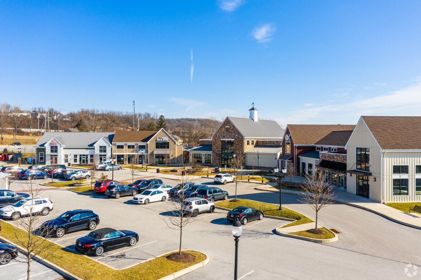
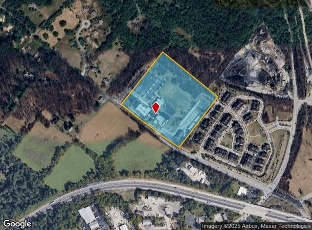
Property Record
2060 Charlestown Rd, Malvern, PA 19355

NEARBY LISTINGS FOR SALE OR LEASE
Property Detail
2060 Charlestown Rd
35-004-0050.000E
12.3 AC & SCHOOL
Utilities
Chester
X
Pennsylvania
42029C0105G
12.30 AC
2024
Exton/Whitelands
2024
Philadelphia
302000
Philadelphia-Camden-Wilmington, PA-NJ-DE-MD
69,305 SF
DEMOGRAPHICS near 2060 Charlestown Rd
1 Mile
3 Mile
5 Mile
2024 Total Population
4,014
24,435
94,679
2029 Population
4,234
25,771
98,955
Pop Growth 2024-2029
+ 5.48%
+ 5.47%
+ 4.52%
Average Age
37
41
42
2024 Total Households
1,471
9,161
37,539
HH Growth 2024-2029
+ 5.57%
+ 5.62%
+ 4.62%
Median Household Inc
$143,679
$140,667
$120,414
Avg Household Size
2.70
2.60
2.40
2024 Avg HH Vehicles
2.00
2.00
2.00
Median Home Value
$729,711
$610,397
$469,728
Median Year Built
2010
1987
1979
Nearby Places
- Restaurants
- Banks
- Shops
- Fitness
- Groceries
PUBLIC TRANSPORTATION
COMMUTER RAIL
Malvern (R5 - Southeastern Pennsylvania Transportation Authority Regional Rail (SEPTA Regional Rail))
DRIVE
WALK
Distance
Malvern (R5 - Southeastern Pennsylvania Transportation Authority Regional Rail (SEPTA Regional Rail))
8 min
4.0 mi
Paoli (R5 - Southeastern Pennsylvania Transportation Authority Regional Rail (SEPTA Regional Rail))
DRIVE
WALK
Distance
Paoli (R5 - Southeastern Pennsylvania Transportation Authority Regional Rail (SEPTA Regional Rail))
10 min
5.1 mi
AIRPORT
Philadelphia International
DRIVE
WALK
Distance
Philadelphia International
49 min
27.2 mi
Freight Ports
South Jersey Port
DRIVE
WALK
Distance
South Jersey Port
45 min
30.5 mi
Nearby Properties
Address
Land Use
TOTAL SIZE
Lot Size
Zoning
Address
Land Use
TOTAL SIZE
Lot Size
Zoning
691,182 SF
84.22 AC
GI
Address
Land Use
TOTAL SIZE
Lot Size
Zoning
273,175 SF
20.46 AC
PO1
Address
Land Use
TOTAL SIZE
Lot Size
Zoning
461,014 SF
70.50 AC
R1
Address
Land Use
TOTAL SIZE
Lot Size
Zoning
1,173,683 SF
56.30 AC
LI
Address
Land Use
TOTAL SIZE
Lot Size
Zoning
615,910 SF
24.84 AC
C1
Address
Land Use
TOTAL SIZE
Lot Size
Zoning
447,886 SF
13.17 AC
C1
Address
Land Use
TOTAL SIZE
Lot Size
Zoning
921,976 SF
111 AC
PO1
Address
Land Use
TOTAL SIZE
Lot Size
Zoning
268,392 SF
13.72 AC
RIC
Address
Land Use
TOTAL SIZE
Lot Size
Zoning
412,888 SF
44.75 AC
LI
Address
Land Use
TOTAL SIZE
Lot Size
Zoning
377,378 SF
33.20 AC
LI
Address
Land Use
TOTAL SIZE
Lot Size
Zoning
395,031 SF
17.96 AC
PIP
Address
Land Use
TOTAL SIZE
Lot Size
Zoning
338,507 SF
2.08 AC
R2
Address
Land Use
TOTAL SIZE
Lot Size
Zoning
214,675 SF
22.50 AC
PO2
Address
Land Use
TOTAL SIZE
Lot Size
Zoning
124,849 SF
22.09 AC
RIC
Address
Land Use
TOTAL SIZE
Lot Size
Zoning
152,792 SF
43.32 AC
FR
Address
Land Use
TOTAL SIZE
Lot Size
Zoning
223,303 SF
15.80 AC
LI
Address
Land Use
TOTAL SIZE
Lot Size
Zoning
129,207 SF
13.24 AC
R2
Address
Land Use
TOTAL SIZE
Lot Size
Zoning
264,792 SF
23.50 AC
C3
Address
Land Use
TOTAL SIZE
Lot Size
Zoning
196,076 SF
14.04 AC
LI
Address
Land Use
TOTAL SIZE
Lot Size
Zoning
291,349 SF
17.90 AC
LI
Address
Land Use
TOTAL SIZE
Lot Size
Zoning
144,024 SF
10 AC
RIC
Address
Land Use
TOTAL SIZE
Lot Size
Zoning
200,275 SF
45.83 AC
LI
Address
Land Use
TOTAL SIZE
Lot Size
Zoning
141,810 SF
20 AC
LI
Address
Land Use
TOTAL SIZE
Lot Size
Zoning
184,309 SF
24.70 AC
C1
Address
Land Use
TOTAL SIZE
Lot Size
Zoning
105,802 SF
10.90 AC
LI
Address
Land Use
TOTAL SIZE
Lot Size
Zoning
186,770 SF
24.30 AC
AR
Address
Land Use
TOTAL SIZE
Lot Size
Zoning
125,700 SF
11.50 AC
R2
Address
Land Use
TOTAL SIZE
Lot Size
Zoning
171,184 SF
18.30 AC
PIP
Address
Land Use
TOTAL SIZE
Lot Size
Zoning
192,780 SF
21.90 AC
PO1
Address
Land Use
TOTAL SIZE
Lot Size
Zoning
108,852 SF
19.80 AC
C
The World's #1 Commercial Real Estate Marketplace
Connect with us
© 2025 CoStar Group
The information above has been obtained from sources believed reliable. While we do not doubt its accuracy we have not verified it and make no guarantee, warranty or representation about it. It is your responsibility to independently confirm its accuracy and completeness. Any projections, opinions, assumptions, or estimates used are for example only and do not represent the current or future performance of the property. The value of this transaction to you depends on tax and other factors which should be evaluated by your tax, financial, and legal advisors. You and your advisors should conduct a careful, independent investigation of the property to determine to your satisfaction the suitability of the property for your needs.