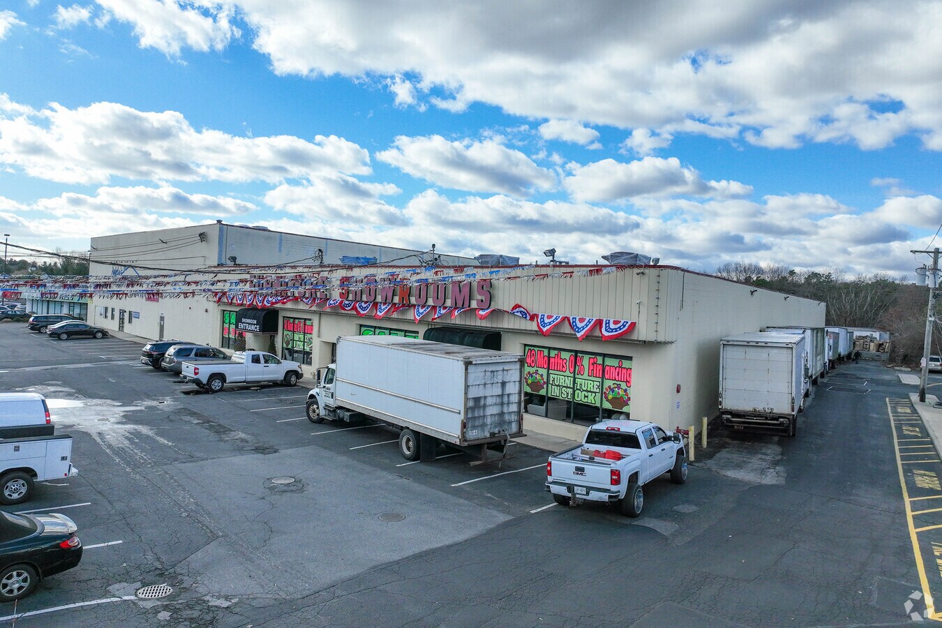
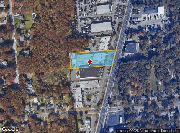
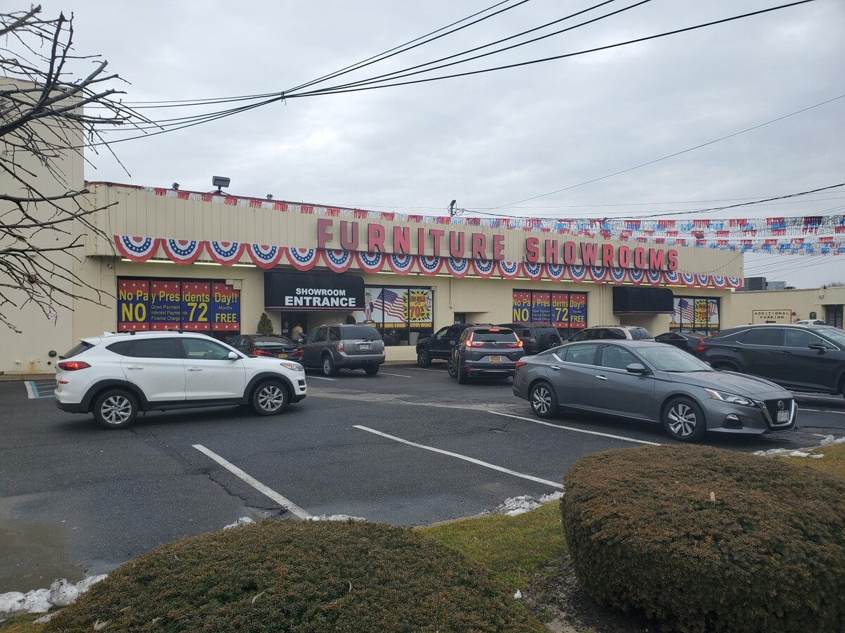
Property Record
2066 Route 112, Medford, NY 11763
This Property Is For Sale
NEARBY LISTINGS FOR SALE OR LEASE
Property Detail
2066 Route 112
Nassau County-Suffolk County, NY
Schwencke O L
0200-808-00-02-00-018-000
O L SCHWENCKE 28 345 160X423 ALL 12
Warehouse
Suffolk
X
New York
36103C0695H
18
2023
1.55 AC
2023
Central Suffolk
159107
Long Island (New York)
DEMOGRAPHICS near 2066 Route 112
1 Mile
3 Mile
5 Mile
2024 Total Population
6,737
73,009
189,781
2029 Population
6,610
72,136
187,316
Pop Growth 2024-2029
(1.89%)
(1.20%)
(1.30%)
Average Age
41
41
41
2024 Total Households
1,974
25,052
66,338
HH Growth 2024-2029
(2.28%)
(1.49%)
(1.50%)
Median Household Inc
$110,584
$106,096
$104,773
Avg Household Size
3.10
2.80
2.70
2024 Avg HH Vehicles
2.00
2.00
2.00
Median Home Value
$409,137
$413,291
$427,145
Median Year Built
1974
1974
1974
Nearby Places
- Restaurants
- Banks
- Shops
- Fitness
- Groceries
PUBLIC TRANSPORTATION
COMMUTER RAIL
Medford Station (Greenport Branch - Long Island Rail Road)
DRIVE
WALK
Distance
Medford Station (Greenport Branch - Long Island Rail Road)
1 min
11 min
0.6 mi
Patchogue Station (Montauk Branch - Long Island Rail Road)
DRIVE
WALK
Distance
Patchogue Station (Montauk Branch - Long Island Rail Road)
11 min
4.0 mi
AIRPORT
Long Island MacArthur
DRIVE
WALK
Distance
Long Island MacArthur
15 min
7.9 mi
Freight Ports
NY - Red Hook Container Terminal
DRIVE
WALK
Distance
NY - Red Hook Container Terminal
1 min
53.2 mi
Nearby Properties
Address
Land Use
TOTAL SIZE
Lot Size
Zoning
Address
Land Use
TOTAL SIZE
Lot Size
Zoning
42.37 AC
Address
Land Use
TOTAL SIZE
Lot Size
Zoning
19.70 AC
AA
Address
Land Use
TOTAL SIZE
Lot Size
Zoning
3,278 SF
0.51 AC
VILLA
Address
Land Use
TOTAL SIZE
Lot Size
Zoning
3,942 SF
0.45 AC
VILLA
Address
Land Use
TOTAL SIZE
Lot Size
Zoning
8.10 AC
GSC
Address
Land Use
TOTAL SIZE
Lot Size
Zoning
6,486 SF
0.55 AC
VILLA
Address
Land Use
TOTAL SIZE
Lot Size
Zoning
3,960 SF
0.72 AC
R40
Address
Land Use
TOTAL SIZE
Lot Size
Zoning
8.60 AC
IND1
Address
Land Use
TOTAL SIZE
Lot Size
Zoning
28.97 AC
Address
Land Use
TOTAL SIZE
Lot Size
Zoning
26.20 AC
Address
Land Use
TOTAL SIZE
Lot Size
Zoning
0.80 AC
CR80
Address
Land Use
TOTAL SIZE
Lot Size
Zoning
4.48 AC
IND1
Address
Land Use
TOTAL SIZE
Lot Size
Zoning
0.98 AC
CR80
Address
Land Use
TOTAL SIZE
Lot Size
Zoning
28.20 AC
AA278
Address
Land Use
TOTAL SIZE
Lot Size
Zoning
Address
Land Use
TOTAL SIZE
Lot Size
Zoning
36 AC
AA
Address
Land Use
TOTAL SIZE
Lot Size
Zoning
24.50 AC
AA
Address
Land Use
TOTAL SIZE
Lot Size
Zoning
Address
Land Use
TOTAL SIZE
Lot Size
Zoning
20.30 AC
B278
Address
Land Use
TOTAL SIZE
Lot Size
Zoning
1,828 SF
0.18 AC
VILLA
Address
Land Use
TOTAL SIZE
Lot Size
Zoning
19.20 AC
AA278
Address
Land Use
TOTAL SIZE
Lot Size
Zoning
12.47 AC
Address
Land Use
TOTAL SIZE
Lot Size
Zoning
3 AC
BUS1
Address
Land Use
TOTAL SIZE
Lot Size
Zoning
38.42 AC
Address
Land Use
TOTAL SIZE
Lot Size
Zoning
16.99 AC
B278
Address
Land Use
TOTAL SIZE
Lot Size
Zoning
21.19 AC
Address
Land Use
TOTAL SIZE
Lot Size
Zoning
30.94 AC
Address
Land Use
TOTAL SIZE
Lot Size
Zoning
Address
Land Use
TOTAL SIZE
Lot Size
Zoning
12.09 AC
Address
Land Use
TOTAL SIZE
Lot Size
Zoning
The World's #1 Commercial Real Estate Marketplace
Connect with us
© 2025 CoStar Group
The information above has been obtained from sources believed reliable. While we do not doubt its accuracy we have not verified it and make no guarantee, warranty or representation about it. It is your responsibility to independently confirm its accuracy and completeness. Any projections, opinions, assumptions, or estimates used are for example only and do not represent the current or future performance of the property. The value of this transaction to you depends on tax and other factors which should be evaluated by your tax, financial, and legal advisors. You and your advisors should conduct a careful, independent investigation of the property to determine to your satisfaction the suitability of the property for your needs.