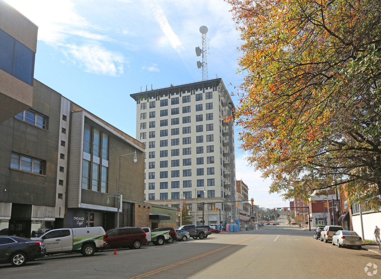
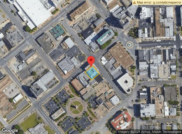
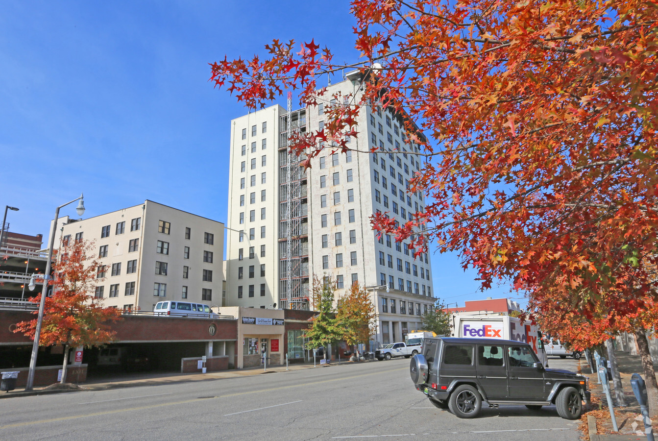
Property Record
207 Montgomery St, Montgomery, AL 36104
NEARBY LISTINGS FOR SALE OR LEASE
Property Detail
207 Montgomery St
11-01-12-4-404-027.001
City Of Montgomery
Gardenaptcourtapt5plusunits
BEG AT THE SW COR OF LEE ST & MONTGOMERY ST TH SELY 113.9 TH SWLY 111.7 TH NWLY 113.9 TH NELY 111.7 TO POB 1101124404027001
X
Montgomery
01101C0093J
Alabama
2024
0.29 AC
2024
Downtown Montgomery
000100
Montgomery
120,509 SF
Montgomery, AL
DEMOGRAPHICS near 207 Montgomery St
1 Mile
3 Mile
5 Mile
2024 Total Population
6,337
52,892
104,532
2029 Population
6,506
53,302
103,863
Pop Growth 2024-2029
+ 2.67%
+ 0.78%
(0.64%)
Average Age
37
38
39
2024 Total Households
2,475
21,218
42,219
HH Growth 2024-2029
+ 4.48%
+ 1.07%
(0.56%)
Median Household Inc
$35,317
$32,875
$39,258
Avg Household Size
1.70
2.20
2.30
2024 Avg HH Vehicles
1.00
1.00
2.00
Median Home Value
$88,280
$88,081
$112,502
Median Year Built
1972
1957
1965
Nearby Places
- Restaurants
- Banks
- Shops
- Fitness
- Groceries
PUBLIC TRANSPORTATION
AIRPORT
Montgomery Regional (Dannelly Field)
DRIVE
WALK
Distance
Montgomery Regional (Dannelly Field)
12 min
9.1 mi
Freight Ports
Port of Mobile
DRIVE
WALK
Distance
Port of Mobile
183 min
168.2 mi
SALE & LEASE HISTORY
LISTING DATE
SALE/LEASE

Sep 25, 2016
For Lease
Nearby Properties
Address
Land Use
TOTAL SIZE
Lot Size
Zoning
Address
Land Use
TOTAL SIZE
Lot Size
Zoning
800,140 SF
2.27 AC
T5
Address
Land Use
TOTAL SIZE
Lot Size
Zoning
392,741 SF
2.98 AC
T5
Address
Land Use
TOTAL SIZE
Lot Size
Zoning
150,842 SF
5.40 AC
T5
Address
Land Use
TOTAL SIZE
Lot Size
Zoning
193,643 SF
1.61 AC
T5
Address
Land Use
TOTAL SIZE
Lot Size
Zoning
40,829 SF
50.49 AC
SD
Address
Land Use
TOTAL SIZE
Lot Size
Zoning
10,844 SF
1.63 AC
Address
Land Use
TOTAL SIZE
Lot Size
Zoning
285,162 SF
M-1
Address
Land Use
TOTAL SIZE
Lot Size
Zoning
107,355 SF
4.12 AC
T5
Address
Land Use
TOTAL SIZE
Lot Size
Zoning
216,654 SF
26.49 AC
B-2
Address
Land Use
TOTAL SIZE
Lot Size
Zoning
93,981 SF
1.90 AC
T5
Address
Land Use
TOTAL SIZE
Lot Size
Zoning
13,273 SF
2.05 AC
T5
Address
Land Use
TOTAL SIZE
Lot Size
Zoning
8,519 SF
15.60 AC
B-2
Address
Land Use
TOTAL SIZE
Lot Size
Zoning
91,378 SF
2.46 AC
SD-M
Address
Land Use
TOTAL SIZE
Lot Size
Zoning
117,175 SF
1.49 AC
T5
Address
Land Use
TOTAL SIZE
Lot Size
Zoning
113,449 SF
0.80 AC
T5
Address
Land Use
TOTAL SIZE
Lot Size
Zoning
77,905 SF
0.83 AC
T5
Address
Land Use
TOTAL SIZE
Lot Size
Zoning
38,226 SF
5.77 AC
T5
Address
Land Use
TOTAL SIZE
Lot Size
Zoning
58,930 SF
2.24 AC
T5
Address
Land Use
TOTAL SIZE
Lot Size
Zoning
22,183 SF
8.38 AC
T5
Address
Land Use
TOTAL SIZE
Lot Size
Zoning
116,707 SF
0.28 AC
T5
Address
Land Use
TOTAL SIZE
Lot Size
Zoning
1,721 SF
12.02 AC
R-60-M
Address
Land Use
TOTAL SIZE
Lot Size
Zoning
81,736 SF
0.63 AC
T5
Address
Land Use
TOTAL SIZE
Lot Size
Zoning
3,401 SF
3.21 AC
T5
Address
Land Use
TOTAL SIZE
Lot Size
Zoning
61,137 SF
59 AC
INST
Address
Land Use
TOTAL SIZE
Lot Size
Zoning
128,328 SF
2.27 AC
T5
Address
Land Use
TOTAL SIZE
Lot Size
Zoning
30,386 SF
10.12 AC
B-2
Address
Land Use
TOTAL SIZE
Lot Size
Zoning
144,788 SF
0.33 AC
T5
Address
Land Use
TOTAL SIZE
Lot Size
Zoning
1,904 SF
13 AC
R-75-S
Address
Land Use
TOTAL SIZE
Lot Size
Zoning
65,060 SF
2.16 AC
T4-R
The World's #1 Commercial Real Estate Marketplace
Connect with us
© 2025 CoStar Group
The information above has been obtained from sources believed reliable. While we do not doubt its accuracy we have not verified it and make no guarantee, warranty or representation about it. It is your responsibility to independently confirm its accuracy and completeness. Any projections, opinions, assumptions, or estimates used are for example only and do not represent the current or future performance of the property. The value of this transaction to you depends on tax and other factors which should be evaluated by your tax, financial, and legal advisors. You and your advisors should conduct a careful, independent investigation of the property to determine to your satisfaction the suitability of the property for your needs.