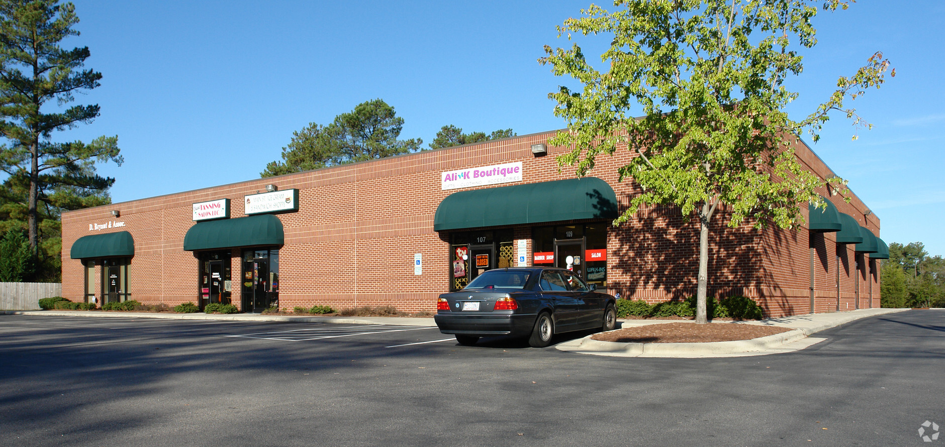
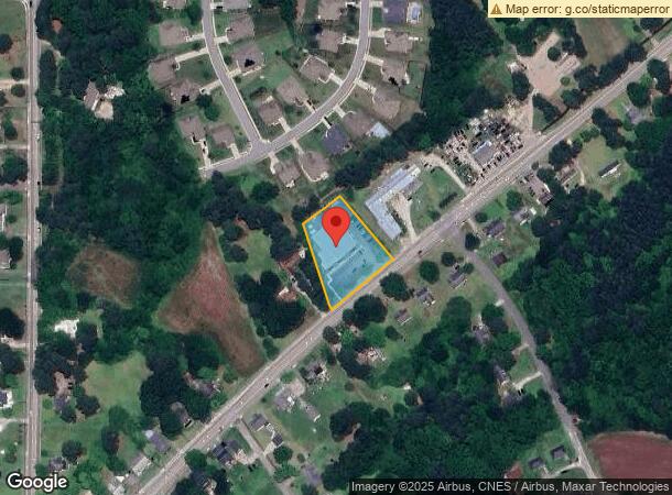
Property Record
207 N Main St, Rolesville, NC 27571
NEARBY LISTINGS FOR SALE OR LEASE
Property Detail
207 N Main St
1769.17-12-4496-000
Jolene W Edwards & Joe Willard
Commercialnec
PROP JOLENE EDWARDS & JOE EDDINS 97-2005
X
Wake
3720176900J
North Carolina
2024
1.02 AC
2024
Route 1
054221
Raleigh/Durham
10,627 SF
Raleigh, NC
DEMOGRAPHICS near 207 N Main St
1 Mile
3 Mile
5 Mile
2024 Total Population
4,122
24,348
74,362
2029 Population
4,556
26,674
81,689
Pop Growth 2024-2029
+ 10.53%
+ 9.55%
+ 9.85%
Average Age
39
38
39
2024 Total Households
1,353
8,031
26,243
HH Growth 2024-2029
+ 10.57%
+ 9.55%
+ 9.90%
Median Household Inc
$142,329
$122,312
$107,538
Avg Household Size
3.00
3.00
2.80
2024 Avg HH Vehicles
2.00
2.00
2.00
Median Home Value
$442,966
$410,237
$369,293
Median Year Built
2010
2010
2006
Nearby Places
- Restaurants
- Banks
- Shops
- Fitness
- Groceries
PUBLIC TRANSPORTATION
AIRPORT
Raleigh-Durham International
DRIVE
WALK
Distance
Raleigh-Durham International
34 min
24.3 mi
Freight Ports
Virginia Port Authority - Richmond
DRIVE
WALK
Distance
Virginia Port Authority - Richmond
170 min
139.1 mi
SALE & LEASE HISTORY
LISTING DATE
SALE/LEASE

Sep 03, 2020
For Lease
Nov 05, 2018
For Sale
Feb 04, 2020
For Sale
Dec 04, 2019
For Lease
Nearby Properties
Address
Land Use
TOTAL SIZE
Lot Size
Zoning
Address
Land Use
TOTAL SIZE
Lot Size
Zoning
340,702 SF
121.26 AC
RM-CZ
Address
Land Use
TOTAL SIZE
Lot Size
Zoning
283,870 SF
11.39 AC
RMX
Address
Land Use
TOTAL SIZE
Lot Size
Zoning
196,091 SF
37.21 AC
RL
Address
Land Use
TOTAL SIZE
Lot Size
Zoning
100,625 SF
16.39 AC
RL
Address
Land Use
TOTAL SIZE
Lot Size
Zoning
227,653 SF
10.86 AC
TC
Address
Land Use
TOTAL SIZE
Lot Size
Zoning
88,053 SF
12.16 AC
GR10
Address
Land Use
TOTAL SIZE
Lot Size
Zoning
74,000 SF
20 AC
R-30
Address
Land Use
TOTAL SIZE
Lot Size
Zoning
53,707 SF
17.07 AC
RL
Address
Land Use
TOTAL SIZE
Lot Size
Zoning
45,723 SF
8.96 AC
GC
Address
Land Use
TOTAL SIZE
Lot Size
Zoning
66,801 SF
11.01 AC
RL
Address
Land Use
TOTAL SIZE
Lot Size
Zoning
36,295 SF
5.71 AC
GC
Address
Land Use
TOTAL SIZE
Lot Size
Zoning
46,203 SF
4.68 AC
GC-CZ
Address
Land Use
TOTAL SIZE
Lot Size
Zoning
18,962 SF
52.06 AC
RL
Address
Land Use
TOTAL SIZE
Lot Size
Zoning
14,652 SF
1.74 AC
GC
Address
Land Use
TOTAL SIZE
Lot Size
Zoning
65,078 SF
5.74 AC
R&PUD
Address
Land Use
TOTAL SIZE
Lot Size
Zoning
28,670 SF
8.28 AC
GC-CZ
Address
Land Use
TOTAL SIZE
Lot Size
Zoning
20,220 SF
1.62 AC
GC
Address
Land Use
TOTAL SIZE
Lot Size
Zoning
32.96 AC
TC
Address
Land Use
TOTAL SIZE
Lot Size
Zoning
21,000 SF
3.21 AC
CO-SUD
Address
Land Use
TOTAL SIZE
Lot Size
Zoning
21,245 SF
0.45 AC
RL
Address
Land Use
TOTAL SIZE
Lot Size
Zoning
24.27 AC
GC-CZ
Address
Land Use
TOTAL SIZE
Lot Size
Zoning
81,031 SF
6.13 AC
R&PUD
Address
Land Use
TOTAL SIZE
Lot Size
Zoning
21.03 AC
GC-CZ
Address
Land Use
TOTAL SIZE
Lot Size
Zoning
7,748 SF
4.54 AC
GC-CZ
Address
Land Use
TOTAL SIZE
Lot Size
Zoning
39.94 AC
HB
Address
Land Use
TOTAL SIZE
Lot Size
Zoning
172.03 AC
RL
Address
Land Use
TOTAL SIZE
Lot Size
Zoning
19,500 SF
1.98 AC
R&PUD
Address
Land Use
TOTAL SIZE
Lot Size
Zoning
30,600 SF
4 AC
GC-CZ
Address
Land Use
TOTAL SIZE
Lot Size
Zoning
14.05 AC
GC-CZ
Address
Land Use
TOTAL SIZE
Lot Size
Zoning
12,518 SF
84.15 AC
RL
The World's #1 Commercial Real Estate Marketplace
Connect with us
© 2025 CoStar Group
The information above has been obtained from sources believed reliable. While we do not doubt its accuracy we have not verified it and make no guarantee, warranty or representation about it. It is your responsibility to independently confirm its accuracy and completeness. Any projections, opinions, assumptions, or estimates used are for example only and do not represent the current or future performance of the property. The value of this transaction to you depends on tax and other factors which should be evaluated by your tax, financial, and legal advisors. You and your advisors should conduct a careful, independent investigation of the property to determine to your satisfaction the suitability of the property for your needs.