Property Record
2070 Sam Rittenberg Blvd, Charleston, SC 29407

NEARBY LISTINGS FOR SALE OR LEASE
Property Detail
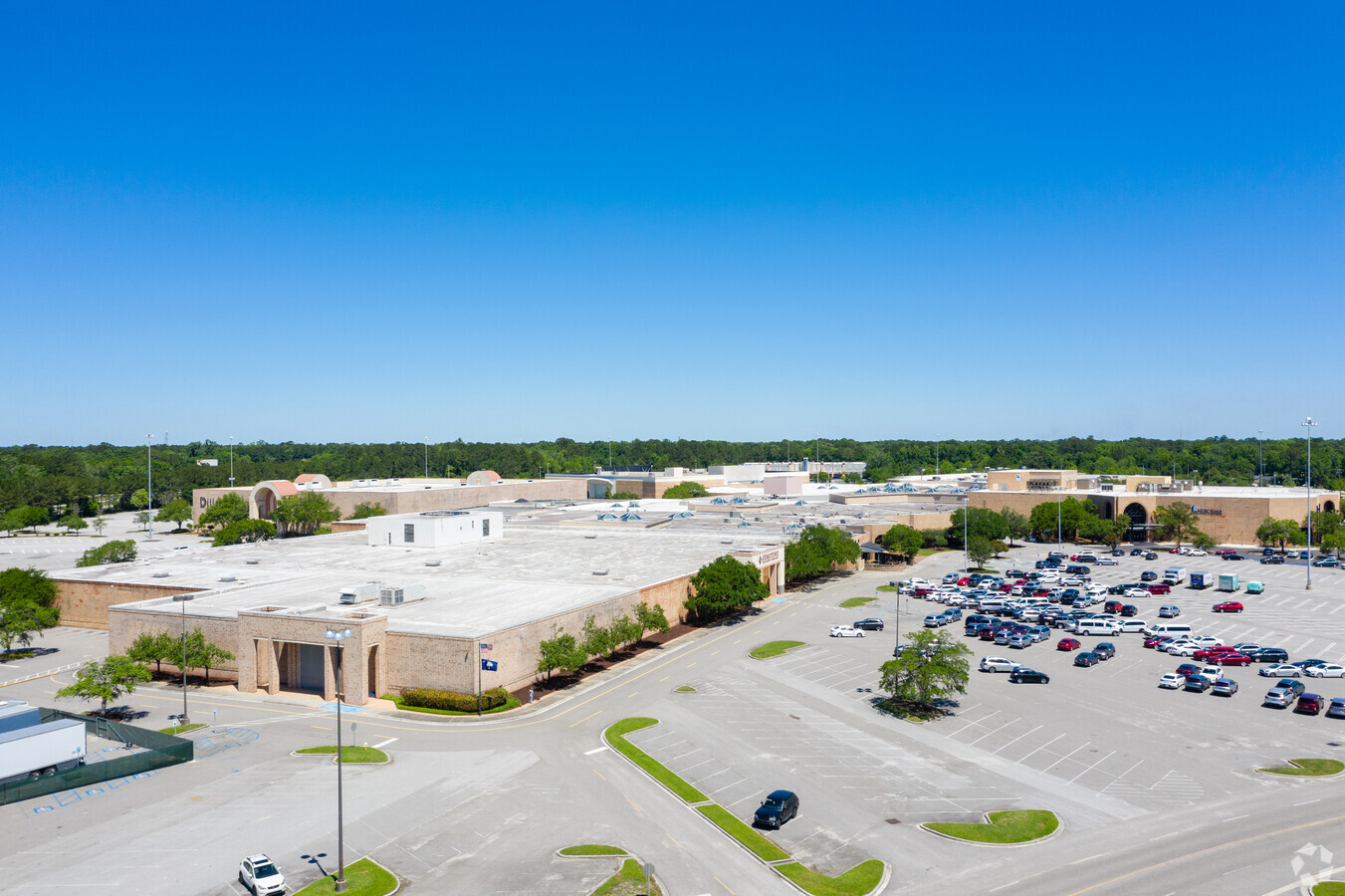
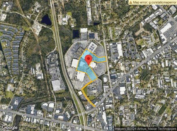
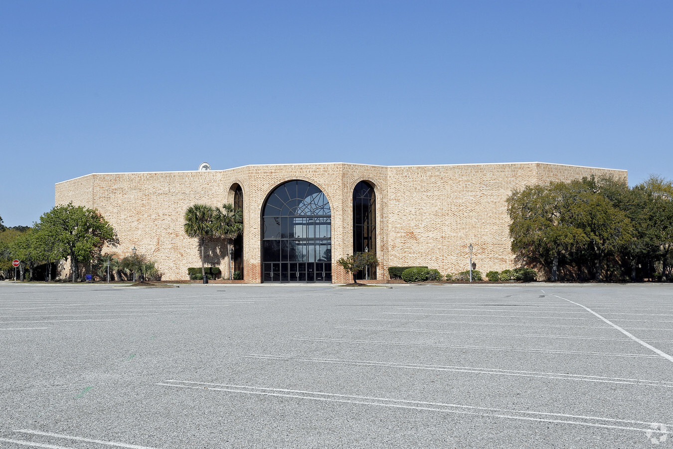
2070 Sam Rittenberg Blvd
351-09-00-015
Citadel Mall
Storebuilding
LEGAL DESCRIPTION SUBDIVISION NAME -CITADEL MALL DESCRIPTION -PART PARCEL A DEVELOPER PARCEL SITE NAME -CITADEL MALL (AKA 207
AE
Charleston
45019C0491K
South Carolina
2023
19.61 AC
2023
West Ashley
002701
Charleston/N Charleston
296,981 SF
Charleston-North Charleston, SC
DEMOGRAPHICS near 2070 Sam Rittenberg Blvd
1 Mile
3 Mile
5 Mile
2024 Total Population
7,167
52,401
132,837
2029 Population
7,613
55,774
141,835
Pop Growth 2024-2029
+ 6.22%
+ 6.44%
+ 6.77%
Average Age
40
40
40
2024 Total Households
3,611
24,308
58,047
HH Growth 2024-2029
+ 6.15%
+ 6.26%
+ 6.63%
Median Household Inc
$64,437
$67,898
$70,858
Avg Household Size
1.90
2.10
2.20
2024 Avg HH Vehicles
1.00
2.00
2.00
Median Home Value
$262,736
$327,784
$342,914
Median Year Built
1980
1979
1983
Nearby Places
- Restaurants
- Banks
- Shops
- Fitness
- Groceries
PUBLIC TRANSPORTATION
COMMUTER RAIL
Charleston Amtrak Station (Palmetto - Amtrak, Silver Meteor - Amtrak)
Drive
Walk
Distance
Charleston Amtrak Station (Palmetto - Amtrak, Silver Meteor - Amtrak)
13 min
7.7 mi
AIRPORT
Charleston AFB/International
Drive
Walk
Distance
Charleston AFB/International
17 min
10.3 mi
Freight Ports
Columbus Street Terminal
Drive
Walk
Distance
Columbus Street Terminal
14 min
6.8 mi
SALE & LEASE HISTORY
LISTING DATE
SALE/LEASE

May 30, 2017
For Lease
Aug 16, 2017
For Lease
Nearby Properties
Address
Land Use
TOTAL SIZE
Lot Size
Zoning
Address
Land Use
TOTAL SIZE
Lot Size
Zoning
36,587 SF
17.75 AC
Address
Land Use
TOTAL SIZE
Lot Size
Zoning
6,036 SF
8.79 AC
Address
Land Use
TOTAL SIZE
Lot Size
Zoning
5.54 AC
Address
Land Use
TOTAL SIZE
Lot Size
Zoning
16,917 SF
2.40 AC
Address
Land Use
TOTAL SIZE
Lot Size
Zoning
50,356 SF
5.19 AC
Address
Land Use
TOTAL SIZE
Lot Size
Zoning
6,531 SF
3.11 AC
Address
Land Use
TOTAL SIZE
Lot Size
Zoning
3,520 SF
7.70 AC
Address
Land Use
TOTAL SIZE
Lot Size
Zoning
26,010 SF
4.32 AC
Address
Land Use
TOTAL SIZE
Lot Size
Zoning
7.09 AC
Address
Land Use
TOTAL SIZE
Lot Size
Zoning
34,609 SF
3.57 AC
Address
Land Use
TOTAL SIZE
Lot Size
Zoning
25,749 SF
2.49 AC
Address
Land Use
TOTAL SIZE
Lot Size
Zoning
Address
Land Use
TOTAL SIZE
Lot Size
Zoning
5,421 SF
22.92 AC
Address
Land Use
TOTAL SIZE
Lot Size
Zoning
Address
Land Use
TOTAL SIZE
Lot Size
Zoning
75,984 SF
2.15 AC
Address
Land Use
TOTAL SIZE
Lot Size
Zoning
11,300 SF
25.42 AC
Address
Land Use
TOTAL SIZE
Lot Size
Zoning
9,778 SF
11.90 AC
Address
Land Use
TOTAL SIZE
Lot Size
Zoning
11,840 SF
9.66 AC
Address
Land Use
TOTAL SIZE
Lot Size
Zoning
33,756 SF
2.52 AC
Address
Land Use
TOTAL SIZE
Lot Size
Zoning
4,060 SF
27.84 AC
Address
Land Use
TOTAL SIZE
Lot Size
Zoning
4,228 SF
23.65 AC
Address
Land Use
TOTAL SIZE
Lot Size
Zoning
Address
Land Use
TOTAL SIZE
Lot Size
Zoning
105,816 SF
16.34 AC
Address
Land Use
TOTAL SIZE
Lot Size
Zoning
7,722 SF
20.48 AC
Address
Land Use
TOTAL SIZE
Lot Size
Zoning
14.07 AC
Address
Land Use
TOTAL SIZE
Lot Size
Zoning
35.14 AC
Address
Land Use
TOTAL SIZE
Lot Size
Zoning
7,316 SF
12.09 AC
Address
Land Use
TOTAL SIZE
Lot Size
Zoning
7,237 SF
1.17 AC
Address
Land Use
TOTAL SIZE
Lot Size
Zoning
Address
Land Use
TOTAL SIZE
Lot Size
Zoning
1.11 AC
Start a new search to find other properties for sale or lease
Connect with us
© 2024 CoStar Group
The information above has been obtained from sources believed reliable. While we do not doubt its accuracy we have not verified it and make no guarantee, warranty or representation about it. It is your responsibility to independently confirm its accuracy and completeness. Any projections, opinions, assumptions, or estimates used are for example only and do not represent the current or future performance of the property. The value of this transaction to you depends on tax and other factors which should be evaluated by your tax, financial, and legal advisors. You and your advisors should conduct a careful, independent investigation of the property to determine to your satisfaction the suitability of the property for your needs.