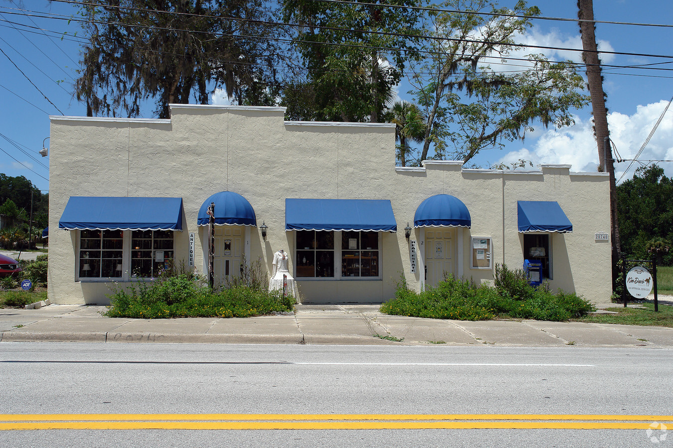
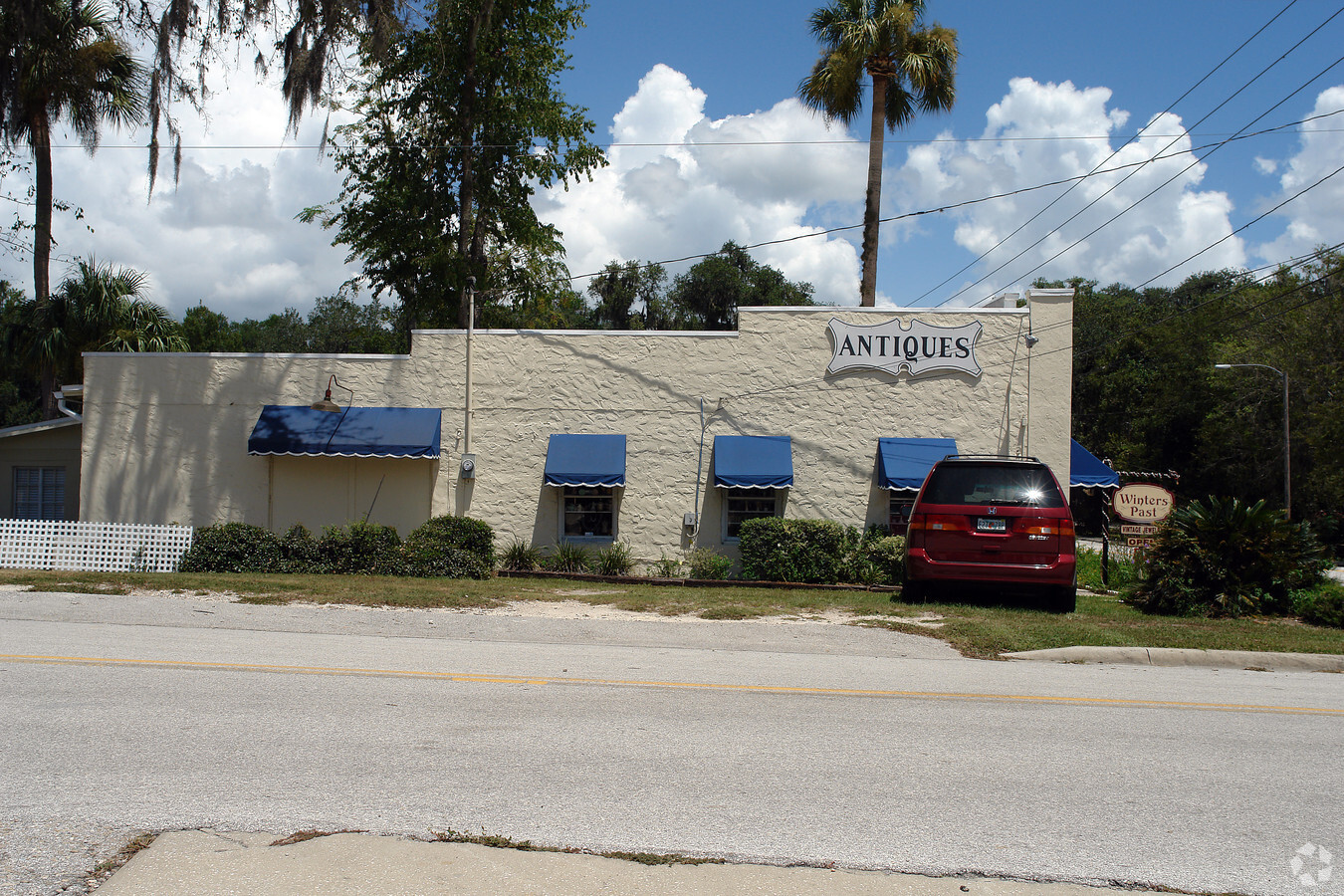
Property Record
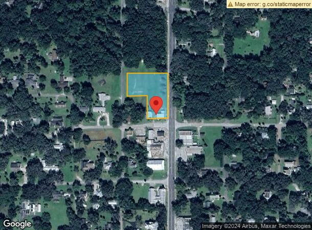
20740 9Th St All Units St, Mc Intosh, FL 32664
NEARBY LISTINGS FOR SALE OR LEASE
Property Detail
20740 9Th St All Units St
Ocala, FL
Mackintosh
02470-000-00
SEC 17 TWP 12 RGE 21 PLAT BOOK A PAGE 032 MACKINTOSH BLK 26 LOTS 1.2.4 EX RD
Storebuilding
Marion
X
Florida
12083C0130D
1
2023
1.39 AC
2023
Outlying Marion County
000100
Ocala
3,826 SF
DEMOGRAPHICS near 20740 9Th St All Units St
1 Mile
3 Mile
5 Mile
2024 Total Population
158
1,667
4,315
2029 Population
173
1,794
4,692
Pop Growth 2024-2029
+ 9.49%
+ 7.62%
+ 8.74%
Average Age
46
47
47
2024 Total Households
68
730
1,869
HH Growth 2024-2029
+ 8.82%
+ 7.40%
+ 8.56%
Median Household Inc
$59,999
$48,073
$56,359
Avg Household Size
2.30
2.30
2.30
2024 Avg HH Vehicles
2.00
2.00
2.00
Median Home Value
$264,285
$254,278
$275,841
Median Year Built
1977
1980
1981
Nearby Places
- Restaurants
- Banks
- Shops
- Fitness
- Groceries
PUBLIC TRANSPORTATION
AIRPORT
Gainesville Regional
DRIVE
WALK
Distance
Gainesville Regional
35 min
22.1 mi
Freight Ports
Jacksonville Port
DRIVE
WALK
Distance
Jacksonville Port
121 min
91.9 mi
SALE & LEASE HISTORY
LISTING DATE
SALE/LEASE

Jan 04, 2018
For Lease
Nearby Properties
Address
Land Use
TOTAL SIZE
Lot Size
Zoning
Address
Land Use
TOTAL SIZE
Lot Size
Zoning
32,919 SF
115.49 AC
PRV
Address
Land Use
TOTAL SIZE
Lot Size
Zoning
140.91 AC
PUD
Address
Land Use
TOTAL SIZE
Lot Size
Zoning
11,063 SF
417.23 AC
A1
Address
Land Use
TOTAL SIZE
Lot Size
Zoning
62,288 SF
49.98 AC
B4
Address
Land Use
TOTAL SIZE
Lot Size
Zoning
9,739 SF
50.98 AC
A1
Address
Land Use
TOTAL SIZE
Lot Size
Zoning
9,603 SF
6.30 AC
GU
Address
Land Use
TOTAL SIZE
Lot Size
Zoning
21,766 SF
10.01 AC
B2
Address
Land Use
TOTAL SIZE
Lot Size
Zoning
4,777 SF
19.70 AC
A1
Address
Land Use
TOTAL SIZE
Lot Size
Zoning
9,230 SF
1.24 AC
B4
Address
Land Use
TOTAL SIZE
Lot Size
Zoning
6,468 SF
159.54 AC
A1
Address
Land Use
TOTAL SIZE
Lot Size
Zoning
83.57 AC
A1
Address
Land Use
TOTAL SIZE
Lot Size
Zoning
21,655 SF
33.01 AC
A1
Address
Land Use
TOTAL SIZE
Lot Size
Zoning
20,720 SF
3.14 AC
B5
Address
Land Use
TOTAL SIZE
Lot Size
Zoning
9,927 SF
3.42 AC
B4
Address
Land Use
TOTAL SIZE
Lot Size
Zoning
4,420 SF
1.68 AC
B2
Address
Land Use
TOTAL SIZE
Lot Size
Zoning
6,766 SF
12.33 AC
A
Address
Land Use
TOTAL SIZE
Lot Size
Zoning
5,349 SF
0.75 AC
A
Address
Land Use
TOTAL SIZE
Lot Size
Zoning
5,000 SF
0.34 AC
R1
Address
Land Use
TOTAL SIZE
Lot Size
Zoning
6,349 SF
0.90 AC
GU
Address
Land Use
TOTAL SIZE
Lot Size
Zoning
16,475 SF
8 AC
M1
Address
Land Use
TOTAL SIZE
Lot Size
Zoning
4,716 SF
160.39 AC
A
Address
Land Use
TOTAL SIZE
Lot Size
Zoning
2,580 SF
0.95 AC
B4
Address
Land Use
TOTAL SIZE
Lot Size
Zoning
4,668 SF
2.27 AC
B4
Address
Land Use
TOTAL SIZE
Lot Size
Zoning
2,056 SF
2.07 AC
GU
Address
Land Use
TOTAL SIZE
Lot Size
Zoning
7,428 SF
1.21 AC
B4
Address
Land Use
TOTAL SIZE
Lot Size
Zoning
3,337 SF
10 AC
A
Address
Land Use
TOTAL SIZE
Lot Size
Zoning
5,000 SF
7.46 AC
B4
Address
Land Use
TOTAL SIZE
Lot Size
Zoning
5,596 SF
0.64 AC
R1
Address
Land Use
TOTAL SIZE
Lot Size
Zoning
3,452 SF
0.83 AC
A
Address
Land Use
TOTAL SIZE
Lot Size
Zoning
6,756 SF
3.01 AC
A1
The World's #1 Commercial Real Estate Marketplace
Connect with us
© 2025 CoStar Group
The information above has been obtained from sources believed reliable. While we do not doubt its accuracy we have not verified it and make no guarantee, warranty or representation about it. It is your responsibility to independently confirm its accuracy and completeness. Any projections, opinions, assumptions, or estimates used are for example only and do not represent the current or future performance of the property. The value of this transaction to you depends on tax and other factors which should be evaluated by your tax, financial, and legal advisors. You and your advisors should conduct a careful, independent investigation of the property to determine to your satisfaction the suitability of the property for your needs.