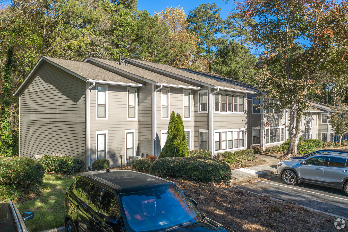
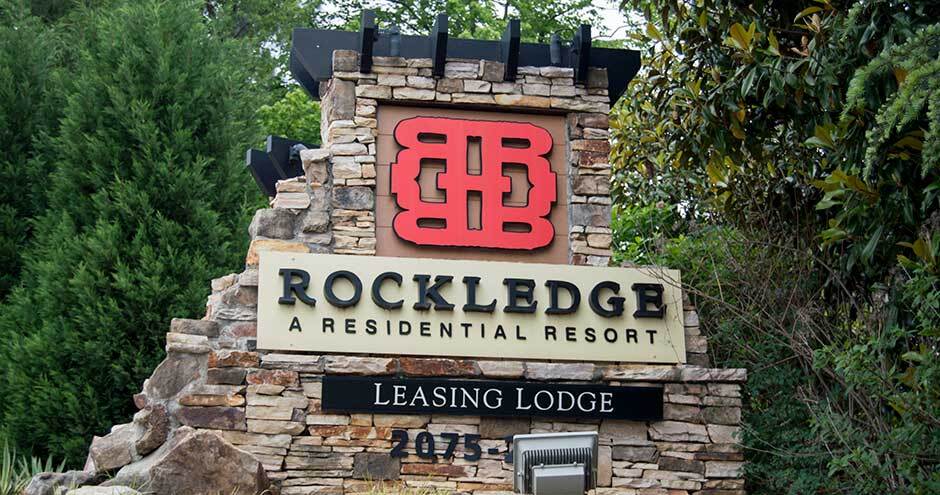
Property Record
2075 Powers Ferry Rd Se, Marietta, GA 30067
NEARBY LISTINGS FOR SALE OR LEASE
-
-
View all Marietta listings for sale on LoopNet.com
Property Detail
2075 Powers Ferry Rd Se
Apartment
Cobb
AE
Georgia
13121C0139F
32.12 AC
2024
Cumberland
2024
Atlanta
030405
Atlanta-Sandy Springs-Roswell, GA
341,885 SF
17-1033-0-004-0
DEMOGRAPHICS near 2075 Powers Ferry Rd Se
1 Mile
3 Mile
5 Mile
2024 Total Population
10,601
81,382
218,480
2029 Population
10,616
82,884
223,301
Pop Growth 2024-2029
+ 0.14%
+ 1.85%
+ 2.21%
Average Age
37
37
38
2024 Total Households
5,928
40,056
97,702
HH Growth 2024-2029
(0.19%)
+ 1.76%
+ 2.24%
Median Household Inc
$88,756
$83,368
$90,927
Avg Household Size
1.80
2.00
2.20
2024 Avg HH Vehicles
1.00
2.00
2.00
Median Home Value
$343,844
$433,811
$492,882
Median Year Built
1992
1986
1985
Nearby Places
- Restaurants
- Banks
- Shops
- Fitness
- Groceries
PUBLIC TRANSPORTATION
AIRPORT
Hartsfield - Jackson Atlanta International
DRIVE
WALK
Distance
Hartsfield - Jackson Atlanta International
34 min
22.1 mi
Freight Ports
Georgia Ports - Savannah
DRIVE
WALK
Distance
Georgia Ports - Savannah
296 min
261.4 mi
Nearby Properties
Address
Land Use
TOTAL SIZE
Lot Size
Zoning
Address
Land Use
TOTAL SIZE
Lot Size
Zoning
41,500 SF
15.61 AC
RRC
Address
Land Use
TOTAL SIZE
Lot Size
Zoning
1,221,836 SF
12.32 AC
GC
Address
Land Use
TOTAL SIZE
Lot Size
Zoning
649,754 SF
20.73 AC
PSC/CRC
Address
Land Use
TOTAL SIZE
Lot Size
Zoning
1,116,209 SF
5.05 AC
OHR
Address
Land Use
TOTAL SIZE
Lot Size
Zoning
1,779,364 SF
8.66 AC
OHR
Address
Land Use
TOTAL SIZE
Lot Size
Zoning
583,570 SF
4.56 AC
PVC/OI
Address
Land Use
TOTAL SIZE
Lot Size
Zoning
560,836 SF
60.28 AC
RM-8
Address
Land Use
TOTAL SIZE
Lot Size
Zoning
968,384 SF
4.93 AC
GC
Address
Land Use
TOTAL SIZE
Lot Size
Zoning
2.81 AC
RRC
Address
Land Use
TOTAL SIZE
Lot Size
Zoning
379,000 SF
29.86 AC
RM-12
Address
Land Use
TOTAL SIZE
Lot Size
Zoning
610,147 SF
45.74 AC
RRC
Address
Land Use
TOTAL SIZE
Lot Size
Zoning
914,424 SF
56.61 AC
OI
Address
Land Use
TOTAL SIZE
Lot Size
Zoning
612,660 SF
46.67 AC
RM-16
Address
Land Use
TOTAL SIZE
Lot Size
Zoning
789,925 SF
3.77 AC
GC
Address
Land Use
TOTAL SIZE
Lot Size
Zoning
5.36 AC
RRC
Address
Land Use
TOTAL SIZE
Lot Size
Zoning
483,147 SF
29.70 AC
RM-16
Address
Land Use
TOTAL SIZE
Lot Size
Zoning
468,079 SF
31.79 AC
RMR
Address
Land Use
TOTAL SIZE
Lot Size
Zoning
9,242 SF
2.92 AC
GC
Address
Land Use
TOTAL SIZE
Lot Size
Zoning
416,113 SF
28.12 AC
RM-12
Address
Land Use
TOTAL SIZE
Lot Size
Zoning
417,453 SF
21.94 AC
RMR
Address
Land Use
TOTAL SIZE
Lot Size
Zoning
643,086 SF
40.63 AC
RM-12
Address
Land Use
TOTAL SIZE
Lot Size
Zoning
482,016 SF
50.92 AC
RM-8
Address
Land Use
TOTAL SIZE
Lot Size
Zoning
387,822 SF
36.47 AC
RM-12
Address
Land Use
TOTAL SIZE
Lot Size
Zoning
403,545 SF
6.33 AC
RRC
Address
Land Use
TOTAL SIZE
Lot Size
Zoning
883,054 SF
3 AC
GC
Address
Land Use
TOTAL SIZE
Lot Size
Zoning
325,339 SF
8.52 AC
RRC
Address
Land Use
TOTAL SIZE
Lot Size
Zoning
300,404 SF
22.23 AC
RM-16
Address
Land Use
TOTAL SIZE
Lot Size
Zoning
2,131 SF
3.57 AC
UVC/WS
Address
Land Use
TOTAL SIZE
Lot Size
Zoning
553,125 SF
42.07 AC
PRD MF
Address
Land Use
TOTAL SIZE
Lot Size
Zoning
364,064 SF
21.16 AC
RM-12
The World's #1 Commercial Real Estate Marketplace
Connect with us
© 2025 CoStar Group
The information above has been obtained from sources believed reliable. While we do not doubt its accuracy we have not verified it and make no guarantee, warranty or representation about it. It is your responsibility to independently confirm its accuracy and completeness. Any projections, opinions, assumptions, or estimates used are for example only and do not represent the current or future performance of the property. The value of this transaction to you depends on tax and other factors which should be evaluated by your tax, financial, and legal advisors. You and your advisors should conduct a careful, independent investigation of the property to determine to your satisfaction the suitability of the property for your needs.