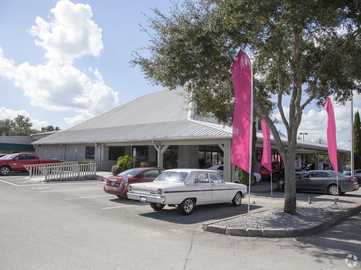
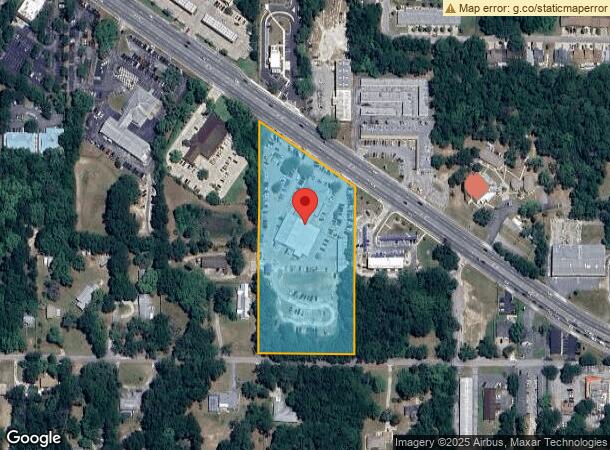
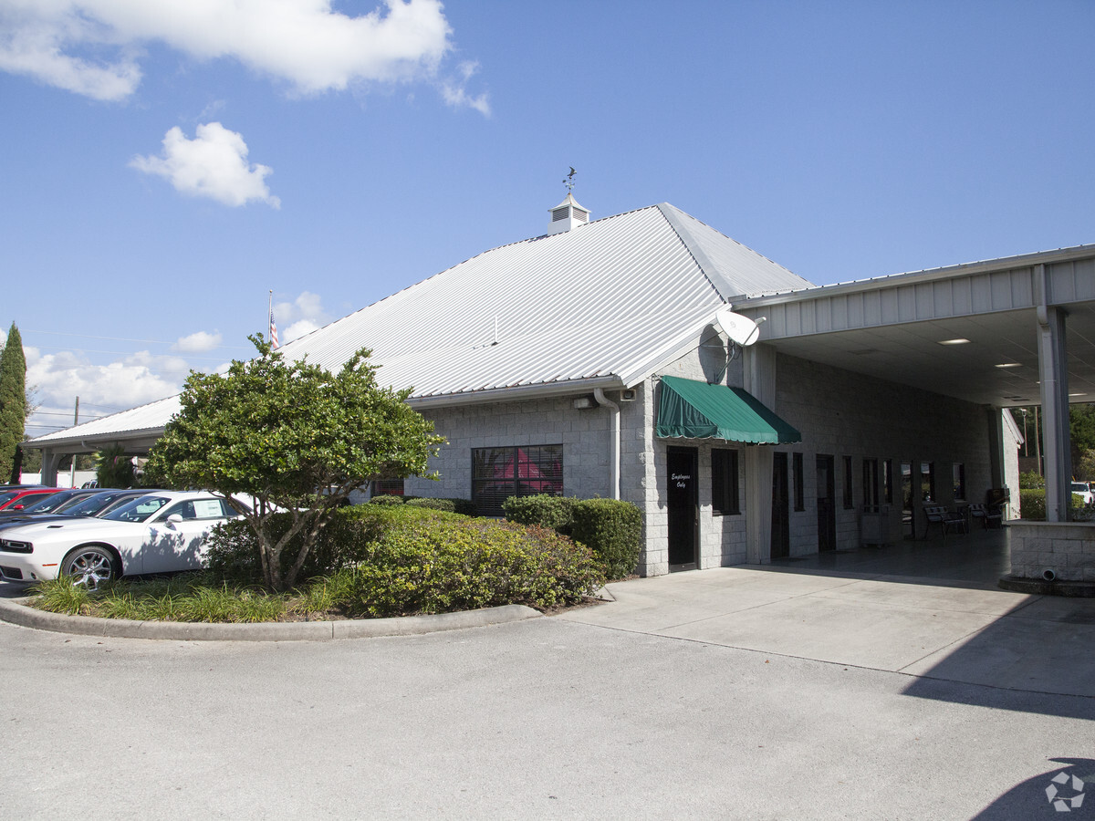
Property Record
2077 Highway 44 W, Inverness, FL 34453
NEARBY LISTINGS FOR SALE OR LEASE
Property Detail
2077 Highway 44 W
Homosassa Springs, FL
Fletchers Heights Unit 2
19E-19S-13-0020-00000-0360
FLETCHER HTS PB 1 PG 41 PT OF LOT 36 & LOT 61 S OF R/W OF SR 44 SEC 13-19-19 FURTHER DESC AS FOL: (PARCEL 1) A PART OF LOT 61; COM AT THE SW COR OF SD LOT 61 TH N 264.79 FT AL THE W BNDRY OF SD LOT 61 TH S 89D 28M 10S E 329.35 FT TO THE E BNDRY OF SD
Vehiclerentalsvehiclesales
Citrus
AE
Florida
12017C0353D
36,61
2023
5.16 AC
2024
Florida Central North Area
451400
Other Market Areas
21,674 SF
DEMOGRAPHICS near 2077 Highway 44 W
1 Mile
3 Mile
5 Mile
2024 Total Population
2,530
18,667
34,129
2029 Population
2,914
21,163
38,646
Pop Growth 2024-2029
+ 15.18%
+ 13.37%
+ 13.24%
Average Age
49
47
49
2024 Total Households
1,160
8,272
15,282
HH Growth 2024-2029
+ 15.52%
+ 13.20%
+ 13.03%
Median Household Inc
$44,820
$38,595
$42,316
Avg Household Size
2.10
2.10
2.20
2024 Avg HH Vehicles
1.00
2.00
2.00
Median Home Value
$204,545
$157,763
$175,591
Median Year Built
1991
1985
1985
Nearby Places
- Restaurants
- Banks
- Shops
- Fitness
- Groceries
Nearby Properties
Address
Land Use
TOTAL SIZE
Lot Size
Zoning
Address
Land Use
TOTAL SIZE
Lot Size
Zoning
1,248 SF
14,169.46 AC
CON
Address
Land Use
TOTAL SIZE
Lot Size
Zoning
7,138,137 SF
12.68 AC
PSP
Address
Land Use
TOTAL SIZE
Lot Size
Zoning
151,398 SF
51.27 AC
PSP
Address
Land Use
TOTAL SIZE
Lot Size
Zoning
3,088,386 SF
35.29 AC
GNC
Address
Land Use
TOTAL SIZE
Lot Size
Zoning
40,730 SF
35.79 AC
PSP
Address
Land Use
TOTAL SIZE
Lot Size
Zoning
103,592 SF
1.12 AC
CBD
Address
Land Use
TOTAL SIZE
Lot Size
Zoning
316,654 SF
16.13 AC
GNC
Address
Land Use
TOTAL SIZE
Lot Size
Zoning
151,168 SF
16.38 AC
PSP
Address
Land Use
TOTAL SIZE
Lot Size
Zoning
36,756 SF
22.06 AC
PSP
Address
Land Use
TOTAL SIZE
Lot Size
Zoning
139,076 SF
6.12 AC
C
Address
Land Use
TOTAL SIZE
Lot Size
Zoning
89,638 SF
21.78 AC
PSP
Address
Land Use
TOTAL SIZE
Lot Size
Zoning
273,301 SF
20.99 AC
GNC
Address
Land Use
TOTAL SIZE
Lot Size
Zoning
106,366 SF
45.53 AC
PSP
Address
Land Use
TOTAL SIZE
Lot Size
Zoning
83,966 SF
29.08 AC
PSP
Address
Land Use
TOTAL SIZE
Lot Size
Zoning
2,251,312 SF
13.80 AC
C
Address
Land Use
TOTAL SIZE
Lot Size
Zoning
53,746 SF
13.98 AC
PSP
Address
Land Use
TOTAL SIZE
Lot Size
Zoning
155,103 SF
3.90 AC
PSP
Address
Land Use
TOTAL SIZE
Lot Size
Zoning
146,480 SF
2.27 AC
CBD
Address
Land Use
TOTAL SIZE
Lot Size
Zoning
61,778 SF
1.54 AC
CBD
Address
Land Use
TOTAL SIZE
Lot Size
Zoning
162,123 SF
10.82 AC
C
Address
Land Use
TOTAL SIZE
Lot Size
Zoning
157,116 SF
4.37 AC
PSP
Address
Land Use
TOTAL SIZE
Lot Size
Zoning
44,260 SF
3.92 AC
RO
Address
Land Use
TOTAL SIZE
Lot Size
Zoning
91,826 SF
19.74 AC
RO
Address
Land Use
TOTAL SIZE
Lot Size
Zoning
106,908 SF
19.69 AC
LDRMH
Address
Land Use
TOTAL SIZE
Lot Size
Zoning
26,391 SF
5.06 AC
LD
Address
Land Use
TOTAL SIZE
Lot Size
Zoning
68,720 SF
1.01 AC
CBD
Address
Land Use
TOTAL SIZE
Lot Size
Zoning
37,800 SF
5.15 AC
PSP
Address
Land Use
TOTAL SIZE
Lot Size
Zoning
271,131 SF
6.34 AC
GNC
Address
Land Use
TOTAL SIZE
Lot Size
Zoning
16,448 SF
1.61 AC
CBD
Address
Land Use
TOTAL SIZE
Lot Size
Zoning
31,322 SF
7.35 AC
ULD
The World's #1 Commercial Real Estate Marketplace
Connect with us
© 2025 CoStar Group
The information above has been obtained from sources believed reliable. While we do not doubt its accuracy we have not verified it and make no guarantee, warranty or representation about it. It is your responsibility to independently confirm its accuracy and completeness. Any projections, opinions, assumptions, or estimates used are for example only and do not represent the current or future performance of the property. The value of this transaction to you depends on tax and other factors which should be evaluated by your tax, financial, and legal advisors. You and your advisors should conduct a careful, independent investigation of the property to determine to your satisfaction the suitability of the property for your needs.