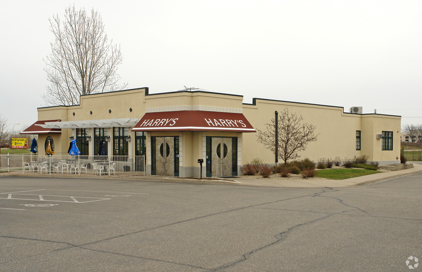
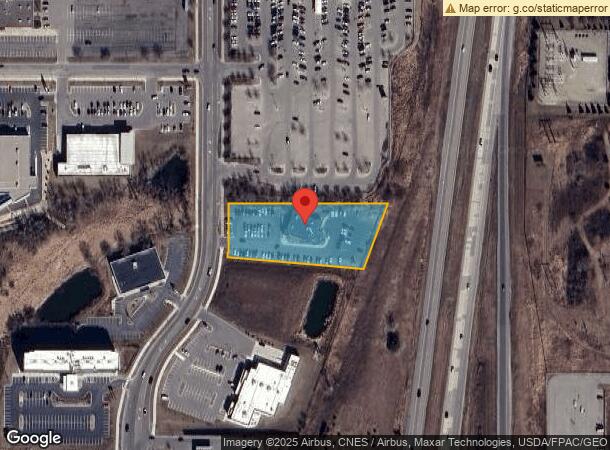
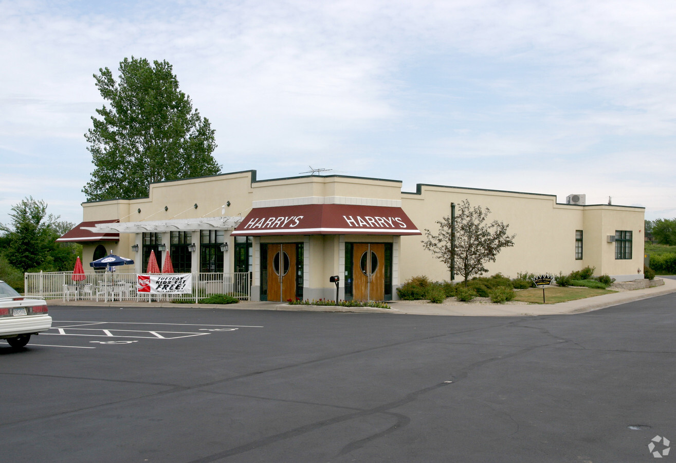
Property Record
20790 Keokuk Ave, Lakeville, MN 55044
NEARBY LISTINGS FOR SALE OR LEASE
Property Detail
20790 Keokuk Ave
Minneapolis-St. Paul-Bloomington, MN-WI
Lakeville Commerce Center
22-44340-01-032
LAKEVILLE COMMERCE CENTER 3 1 PT OF LOT 3 BLK 1 LYING N OF LINE COM NW COR S ON W LINE 103.84 FT THENCE SLY ON W LINE ON TANG CUR 48.55 FT TO BEG OF LINE S 84D 57M 20S E 381.97 FT TO PT ON ELY LINE 196.76 FT SLY OF NE COR & THERE TERM
Commercialnec
Dakota
X
Minnesota
27037C0193E
3
2024
1.61 AC
2023
Burnsville
060835
Minneapolis/St Paul
6,292 SF
DEMOGRAPHICS near 20790 Keokuk Ave
1 Mile
3 Mile
5 Mile
2024 Total Population
2,127
22,993
56,440
2029 Population
2,160
23,703
58,491
Pop Growth 2024-2029
+ 1.55%
+ 3.09%
+ 3.63%
Average Age
37
38
38
2024 Total Households
692
7,923
19,268
HH Growth 2024-2029
+ 1.59%
+ 3.19%
+ 3.73%
Median Household Inc
$152,896
$123,871
$124,565
Avg Household Size
3.10
2.90
2.90
2024 Avg HH Vehicles
2.00
2.00
2.00
Median Home Value
$445,701
$429,624
$425,051
Median Year Built
2000
1999
1998
Nearby Places
- Restaurants
- Banks
- Shops
- Fitness
- Groceries
PUBLIC TRANSPORTATION
AIRPORT
Minneapolis-St Paul International/Wold-Chamberlain
DRIVE
WALK
Distance
Minneapolis-St Paul International/Wold-Chamberlain
28 min
21.0 mi
Freight Ports
Port Milwaukee
DRIVE
WALK
Distance
Port Milwaukee
386 min
346.2 mi
Nearby Properties
Address
Land Use
TOTAL SIZE
Lot Size
Zoning
Address
Land Use
TOTAL SIZE
Lot Size
Zoning
749,550 SF
71.74 AC
Address
Land Use
TOTAL SIZE
Lot Size
Zoning
179,859 SF
43.48 AC
Address
Land Use
TOTAL SIZE
Lot Size
Zoning
282,100 SF
18.86 AC
Address
Land Use
TOTAL SIZE
Lot Size
Zoning
183,049 SF
15.23 AC
Address
Land Use
TOTAL SIZE
Lot Size
Zoning
187,993 SF
21.88 AC
Address
Land Use
TOTAL SIZE
Lot Size
Zoning
121,600 SF
27.55 AC
Address
Land Use
TOTAL SIZE
Lot Size
Zoning
93,883 SF
4.17 AC
Address
Land Use
TOTAL SIZE
Lot Size
Zoning
53,022 SF
11.89 AC
Address
Land Use
TOTAL SIZE
Lot Size
Zoning
151,109 SF
14.54 AC
Address
Land Use
TOTAL SIZE
Lot Size
Zoning
56,950 SF
27.71 AC
Address
Land Use
TOTAL SIZE
Lot Size
Zoning
130,180 SF
9.01 AC
Address
Land Use
TOTAL SIZE
Lot Size
Zoning
78,220 SF
5.96 AC
Address
Land Use
TOTAL SIZE
Lot Size
Zoning
158,698 SF
8.59 AC
Address
Land Use
TOTAL SIZE
Lot Size
Zoning
109,440 SF
8.92 AC
Address
Land Use
TOTAL SIZE
Lot Size
Zoning
87,832 SF
3.02 AC
Address
Land Use
TOTAL SIZE
Lot Size
Zoning
118,065 SF
7.63 AC
Address
Land Use
TOTAL SIZE
Lot Size
Zoning
102,664 SF
3.82 AC
Address
Land Use
TOTAL SIZE
Lot Size
Zoning
49,460 SF
14.65 AC
Address
Land Use
TOTAL SIZE
Lot Size
Zoning
84,582 SF
14.20 AC
Address
Land Use
TOTAL SIZE
Lot Size
Zoning
54,378 SF
6.48 AC
Address
Land Use
TOTAL SIZE
Lot Size
Zoning
75,411 SF
1.12 AC
Address
Land Use
TOTAL SIZE
Lot Size
Zoning
87,670 SF
1.84 AC
Address
Land Use
TOTAL SIZE
Lot Size
Zoning
100,536 SF
6.68 AC
Address
Land Use
TOTAL SIZE
Lot Size
Zoning
90,937 SF
18.55 AC
Address
Land Use
TOTAL SIZE
Lot Size
Zoning
82,747 SF
11.66 AC
Address
Land Use
TOTAL SIZE
Lot Size
Zoning
107,464 SF
8.74 AC
Address
Land Use
TOTAL SIZE
Lot Size
Zoning
75,703 SF
23.62 AC
The World's #1 Commercial Real Estate Marketplace
Connect with us
© 2025 CoStar Group
The information above has been obtained from sources believed reliable. While we do not doubt its accuracy we have not verified it and make no guarantee, warranty or representation about it. It is your responsibility to independently confirm its accuracy and completeness. Any projections, opinions, assumptions, or estimates used are for example only and do not represent the current or future performance of the property. The value of this transaction to you depends on tax and other factors which should be evaluated by your tax, financial, and legal advisors. You and your advisors should conduct a careful, independent investigation of the property to determine to your satisfaction the suitability of the property for your needs.