Property Record
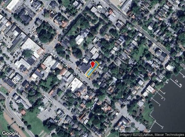
208 High St, Chestertown, MD 21620
NEARBY LISTINGS FOR SALE OR LEASE
Property Detail
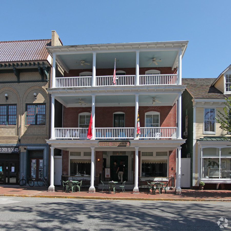
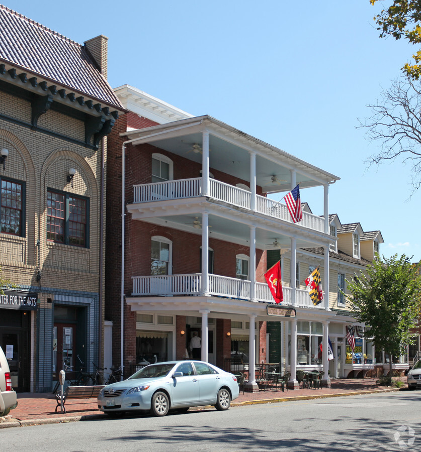
208 High St
04-005384
Imperial Hotel Prop
Hotel
LOT 6,446 SQ FT 208 HIGH ST CHESTERTOWN
X
Kent
24035C0055D
Maryland
2024
6
2024
0.15 AC
9503004034
Kent County
8,190 SF
Baltimore
DEMOGRAPHICS near 208 High St
1 Mile
3 Mile
5 Mile
2024 Total Population
4,360
9,021
10,611
2029 Population
4,407
9,196
10,841
Pop Growth 2024-2029
+ 1.08%
+ 1.94%
+ 2.17%
Average Age
42
43
44
2024 Total Households
1,701
3,570
4,223
HH Growth 2024-2029
+ 1.12%
+ 1.88%
+ 2.08%
Median Household Inc
$41,704
$53,534
$58,926
Avg Household Size
1.90
2.20
2.20
2024 Avg HH Vehicles
1.00
2.00
2.00
Median Home Value
$295,081
$284,432
$287,941
Median Year Built
1980
1980
1980
Nearby Places
- Restaurants
- Banks
- Shops
- Fitness
- Groceries
Nearby Properties
Address
Land Use
TOTAL SIZE
Lot Size
Zoning
Address
Land Use
TOTAL SIZE
Lot Size
Zoning
33,748 SF
87 AC
R-3
Address
Land Use
TOTAL SIZE
Lot Size
Zoning
26,006 SF
61.15 AC
R-2
Address
Land Use
TOTAL SIZE
Lot Size
Zoning
57,976 SF
4.83 AC
RB
Address
Land Use
TOTAL SIZE
Lot Size
Zoning
86,584 SF
6.48 AC
RB
Address
Land Use
TOTAL SIZE
Lot Size
Zoning
21,824 SF
8.13 AC
R-3
Address
Land Use
TOTAL SIZE
Lot Size
Zoning
19,950 SF
15.07 AC
Address
Land Use
TOTAL SIZE
Lot Size
Zoning
31,200 SF
4.81 AC
Address
Land Use
TOTAL SIZE
Lot Size
Zoning
100,000 SF
12.19 AC
Address
Land Use
TOTAL SIZE
Lot Size
Zoning
153,343 SF
13.06 AC
C-1
Address
Land Use
TOTAL SIZE
Lot Size
Zoning
11.05 AC
R-3
Address
Land Use
TOTAL SIZE
Lot Size
Zoning
53,811 SF
11.25 AC
C-1
Address
Land Use
TOTAL SIZE
Lot Size
Zoning
64,534 SF
22.80 AC
C-1
Address
Land Use
TOTAL SIZE
Lot Size
Zoning
10,621 SF
11.71 AC
CC &I
Address
Land Use
TOTAL SIZE
Lot Size
Zoning
41,046 SF
5.11 AC
R-3
Address
Land Use
TOTAL SIZE
Lot Size
Zoning
44,074 SF
18.53 AC
Address
Land Use
TOTAL SIZE
Lot Size
Zoning
29,000 SF
4.47 AC
R-3
Address
Land Use
TOTAL SIZE
Lot Size
Zoning
20,897 SF
2.88 AC
R3/R4
Address
Land Use
TOTAL SIZE
Lot Size
Zoning
20,244 SF
13.38 AC
R-2
Address
Land Use
TOTAL SIZE
Lot Size
Zoning
8,109 SF
2.87 AC
CM
Address
Land Use
TOTAL SIZE
Lot Size
Zoning
27,673 SF
2.94 AC
R-3
Address
Land Use
TOTAL SIZE
Lot Size
Zoning
43,200 SF
5.99 AC
C-1
Address
Land Use
TOTAL SIZE
Lot Size
Zoning
9,884 SF
2.73 AC
HI-1
Address
Land Use
TOTAL SIZE
Lot Size
Zoning
46,431 SF
2.66 AC
C-1
Address
Land Use
TOTAL SIZE
Lot Size
Zoning
48,176 SF
6.35 AC
LI
Address
Land Use
TOTAL SIZE
Lot Size
Zoning
72,000 SF
8 AC
LI-2
Address
Land Use
TOTAL SIZE
Lot Size
Zoning
46,810 SF
6.40 AC
Address
Land Use
TOTAL SIZE
Lot Size
Zoning
66,271 SF
15 AC
Address
Land Use
TOTAL SIZE
Lot Size
Zoning
5,733 SF
3.93 AC
CC
Address
Land Use
TOTAL SIZE
Lot Size
Zoning
2,925 SF
1.77 AC
C-1
Address
Land Use
TOTAL SIZE
Lot Size
Zoning
32,767 SF
2.10 AC
C-1
The World's #1 Commercial Real Estate Marketplace
Connect with us
© 2025 CoStar Group
The information above has been obtained from sources believed reliable. While we do not doubt its accuracy we have not verified it and make no guarantee, warranty or representation about it. It is your responsibility to independently confirm its accuracy and completeness. Any projections, opinions, assumptions, or estimates used are for example only and do not represent the current or future performance of the property. The value of this transaction to you depends on tax and other factors which should be evaluated by your tax, financial, and legal advisors. You and your advisors should conduct a careful, independent investigation of the property to determine to your satisfaction the suitability of the property for your needs.