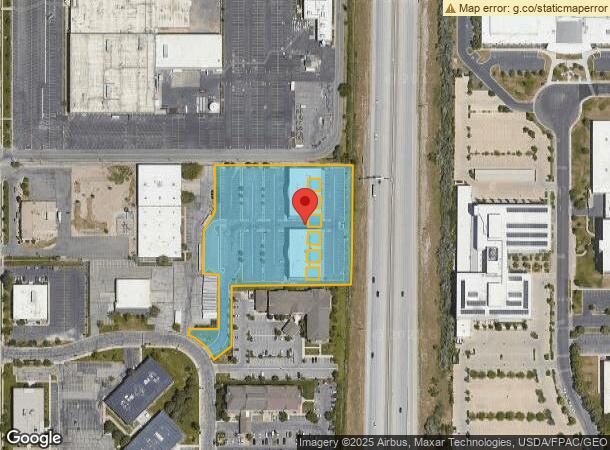
Property Record
208 N 2100 W, Salt Lake City, UT 84116
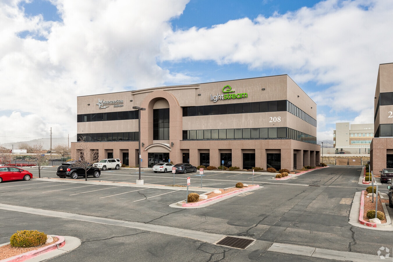
This Property Is For Sale
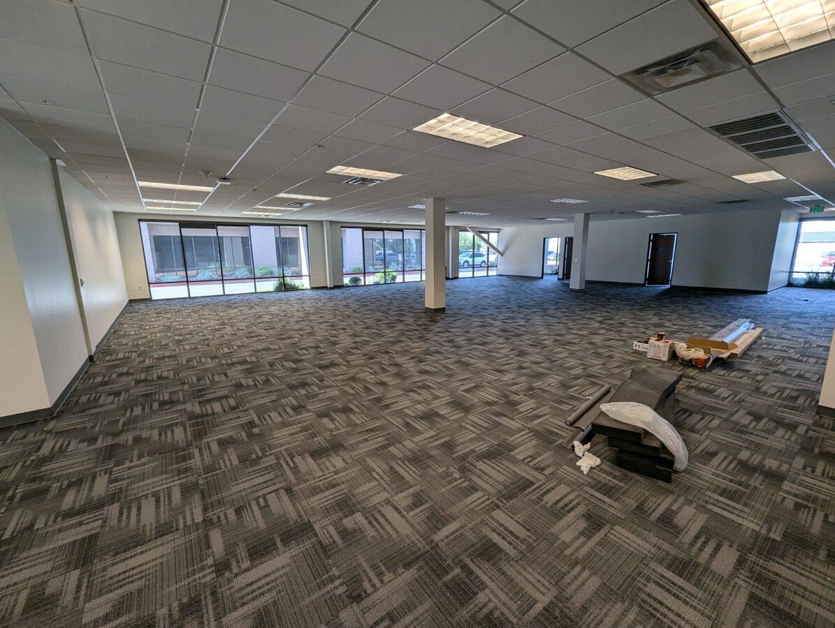
Current Lease Availabilities
NEARBY LISTINGS FOR SALE OR LEASE
Property Detail
208 N 2100 W
Salt Lake City, UT
North Temple Lodging Pl 1 Sub
08-33-479-007-0000
LOT 2, NORTH TEMPLE LODGING PL 1 SUB. BEING MORE PARTICULARYDESCRIBED AS; BEG AT NE COR LOT 1, NORTH TEMPLE LODGING PL 1SUB; W 352.84 FT; S 179.19 FT; S 530000] W 71.44 FT; NWLYALG A 147 FT RADIUS CURVE TO L 102.2 FT (CHD N 441252] W 100.15 FT); N 05
Officebuilding
Salt Lake
X
Utah
49011C0525E
2
0
3.70 AC
2023
Airport/International Ctr
980000
Salt Lake City
27,000 SF
DEMOGRAPHICS near 208 N 2100 W
1 Mile
3 Mile
5 Mile
2024 Total Population
10,295
68,719
158,351
2029 Population
10,610
70,011
161,886
Pop Growth 2024-2029
+ 3.06%
+ 1.88%
+ 2.23%
Average Age
34
35
36
2024 Total Households
3,778
25,977
67,869
HH Growth 2024-2029
+ 3.10%
+ 2.45%
+ 2.75%
Median Household Inc
$54,728
$57,666
$57,902
Avg Household Size
2.60
2.50
2.20
2024 Avg HH Vehicles
2.00
2.00
2.00
Median Home Value
$230,227
$324,060
$393,671
Median Year Built
1993
1979
1974
Nearby Places
- Restaurants
- Banks
- Shops
- Fitness
- Groceries
PUBLIC TRANSPORTATION
TRANSIT/SUBWAY
1940 W. North Temple Station (Green Line - Utah Transit Authority (UTA))
DRIVE
WALK
Distance
1940 W. North Temple Station (Green Line - Utah Transit Authority (UTA))
2 min
9 min
0.5 mi
COMMUTER RAIL
North Temple Station (FrontRunner - Utah Transit Authority (UTA))
DRIVE
WALK
Distance
North Temple Station (FrontRunner - Utah Transit Authority (UTA))
10 min
3.4 mi
Warm Springs Relief Point (FrontRunner - Utah Transit Authority (UTA))
DRIVE
WALK
Distance
Warm Springs Relief Point (FrontRunner - Utah Transit Authority (UTA))
11 min
4.5 mi
AIRPORT
Salt Lake City International
DRIVE
WALK
Distance
Salt Lake City International
8 min
3.5 mi
Freight Ports
Port of Stockton
DRIVE
WALK
Distance
Port of Stockton
710 min
693.9 mi
Nearby Properties
Address
Land Use
TOTAL SIZE
Lot Size
Zoning
Address
Land Use
TOTAL SIZE
Lot Size
Zoning
1,620,389 SF
37.63 AC
M-1
Address
Land Use
TOTAL SIZE
Lot Size
Zoning
1,450,542 SF
9.72 AC
D-4
Address
Land Use
TOTAL SIZE
Lot Size
Zoning
243,202 SF
18.71 AC
BP
Address
Land Use
TOTAL SIZE
Lot Size
Zoning
836,183 SF
5.89 AC
TSA-UC
Address
Land Use
TOTAL SIZE
Lot Size
Zoning
566,160 SF
4.14 AC
3000
Address
Land Use
TOTAL SIZE
Lot Size
Zoning
35,720 SF
0.55 AC
D-1
Address
Land Use
TOTAL SIZE
Lot Size
Zoning
737,755 SF
1.63 AC
D-1
Address
Land Use
TOTAL SIZE
Lot Size
Zoning
449,528 SF
1.64 AC
2000
Address
Land Use
TOTAL SIZE
Lot Size
Zoning
366,584 SF
1.95 AC
TSAUC
Address
Land Use
TOTAL SIZE
Lot Size
Zoning
187,682 SF
20.46 AC
M-2
Address
Land Use
TOTAL SIZE
Lot Size
Zoning
472,757 SF
3.20 AC
GMU
Address
Land Use
TOTAL SIZE
Lot Size
Zoning
1,330,057 SF
5.02 AC
D2
Address
Land Use
TOTAL SIZE
Lot Size
Zoning
210,623 SF
1.35 AC
TSAUCC
Address
Land Use
TOTAL SIZE
Lot Size
Zoning
824,320 SF
48.05 AC
IP-M-1
Address
Land Use
TOTAL SIZE
Lot Size
Zoning
140,173 SF
6.77 AC
D-4
Address
Land Use
TOTAL SIZE
Lot Size
Zoning
157,938 SF
12 AC
1205
Address
Land Use
TOTAL SIZE
Lot Size
Zoning
0.01 AC
D-4
Address
Land Use
TOTAL SIZE
Lot Size
Zoning
248,345 SF
50 AC
PL
Address
Land Use
TOTAL SIZE
Lot Size
Zoning
127,348 SF
4.55 AC
BP
Address
Land Use
TOTAL SIZE
Lot Size
Zoning
102,667 SF
12.03 AC
BP
Address
Land Use
TOTAL SIZE
Lot Size
Zoning
622,652 SF
2.08 AC
R-MU
Address
Land Use
TOTAL SIZE
Lot Size
Zoning
146,652 SF
16.63 AC
RMF-45
Address
Land Use
TOTAL SIZE
Lot Size
Zoning
612,038 SF
2.10 AC
CC
Address
Land Use
TOTAL SIZE
Lot Size
Zoning
236,302 SF
2.57 AC
GMU
Address
Land Use
TOTAL SIZE
Lot Size
Zoning
433,025 SF
1.75 AC
D-4
Address
Land Use
TOTAL SIZE
Lot Size
Zoning
77,693 SF
2.99 AC
TSA-MU
Address
Land Use
TOTAL SIZE
Lot Size
Zoning
472.94 AC
AIRPRT
Address
Land Use
TOTAL SIZE
Lot Size
Zoning
312,327 SF
1.99 AC
D-4
Address
Land Use
TOTAL SIZE
Lot Size
Zoning
398,351 SF
1.57 AC
D-1
Address
Land Use
TOTAL SIZE
Lot Size
Zoning
252,420 SF
15.26 AC
TSA-MU
The World's #1 Commercial Real Estate Marketplace
Connect with us
© 2025 CoStar Group
The information above has been obtained from sources believed reliable. While we do not doubt its accuracy we have not verified it and make no guarantee, warranty or representation about it. It is your responsibility to independently confirm its accuracy and completeness. Any projections, opinions, assumptions, or estimates used are for example only and do not represent the current or future performance of the property. The value of this transaction to you depends on tax and other factors which should be evaluated by your tax, financial, and legal advisors. You and your advisors should conduct a careful, independent investigation of the property to determine to your satisfaction the suitability of the property for your needs.