Property Record
2085 S Pacheco St, Santa Fe, NM 87505


NEARBY LISTINGS FOR SALE OR LEASE
Property Detail
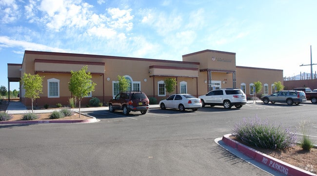
2085 S Pacheco St
910020370
Pacheco Plaza Office
Commercialnec
UNIT B PACHECO PLAZA OFFICET17N R 9E S35 CONDOS
X
Santa Fe
35049C0414E
New Mexico
2025
0.09 AC
2025
Southwest Santa Fe
001103
Other Market Areas
12,880 SF
Santa Fe, NM
DEMOGRAPHICS near 2085 S Pacheco St
1 Mile
3 Mile
5 Mile
2024 Total Population
10,045
55,893
92,594
2029 Population
10,340
57,350
95,203
Pop Growth 2024-2029
+ 2.94%
+ 2.61%
+ 2.82%
Average Age
46
49
47
2024 Total Households
5,191
27,972
42,895
HH Growth 2024-2029
+ 2.87%
+ 2.68%
+ 2.84%
Median Household Inc
$58,582
$66,790
$69,330
Avg Household Size
1.90
1.90
2.10
2024 Avg HH Vehicles
2.00
2.00
2.00
Median Home Value
$367,391
$390,397
$392,158
Median Year Built
1984
1979
1986
Nearby Places
Map Layers
Map Styles
 Street
 Aerial
- Restaurants
- Banks
- Shops
- Fitness
- Groceries
PUBLIC TRANSPORTATION
TRANSIT/SUBWAY
Zia Road (Rail Runner Express - New Mexico Rail Runner Express)
DRIVE
WALK
Distance
Zia Road (Rail Runner Express - New Mexico Rail Runner Express)
3 min
13 min
0.7 mi
COMMUTER RAIL
DRIVE
WALK
Distance
3 min
12 min
0.6 mi
Zia Road (Rail Runner Express - New Mexico Rail Runner Express)
DRIVE
WALK
Distance
Zia Road (Rail Runner Express - New Mexico Rail Runner Express)
3 min
14 min
0.7 mi
AIRPORT
Santa Fe Regional
DRIVE
WALK
Distance
Santa Fe Regional
18 min
12.4 mi
SALE & LEASE HISTORY
LISTING DATE
SALE/LEASE

Nov 02, 2020
For Lease
Nearby Properties
Address
Land Use
TOTAL SIZE
Lot Size
Zoning
Address
Land Use
TOTAL SIZE
Lot Size
Zoning
103.78 AC
Address
Land Use
TOTAL SIZE
Lot Size
Zoning
Address
Land Use
TOTAL SIZE
Lot Size
Zoning
Address
Land Use
TOTAL SIZE
Lot Size
Zoning
0.80 AC
Address
Land Use
TOTAL SIZE
Lot Size
Zoning
Address
Land Use
TOTAL SIZE
Lot Size
Zoning
17.18 AC
Address
Land Use
TOTAL SIZE
Lot Size
Zoning
21.49 AC
Address
Land Use
TOTAL SIZE
Lot Size
Zoning
130.13 AC
Address
Land Use
TOTAL SIZE
Lot Size
Zoning
40.65 AC
Address
Land Use
TOTAL SIZE
Lot Size
Zoning
7.32 AC
Address
Land Use
TOTAL SIZE
Lot Size
Zoning
Address
Land Use
TOTAL SIZE
Lot Size
Zoning
Address
Land Use
TOTAL SIZE
Lot Size
Zoning
Address
Land Use
TOTAL SIZE
Lot Size
Zoning
5.72 AC
Address
Land Use
TOTAL SIZE
Lot Size
Zoning
Address
Land Use
TOTAL SIZE
Lot Size
Zoning
Address
Land Use
TOTAL SIZE
Lot Size
Zoning
Address
Land Use
TOTAL SIZE
Lot Size
Zoning
26.30 AC
Address
Land Use
TOTAL SIZE
Lot Size
Zoning
4.40 AC
Address
Land Use
TOTAL SIZE
Lot Size
Zoning
Address
Land Use
TOTAL SIZE
Lot Size
Zoning
1.08 AC
Address
Land Use
TOTAL SIZE
Lot Size
Zoning
7.30 AC
Address
Land Use
TOTAL SIZE
Lot Size
Zoning
0.25 AC
Address
Land Use
TOTAL SIZE
Lot Size
Zoning
6,212 SF
5.13 AC
Address
Land Use
TOTAL SIZE
Lot Size
Zoning
18.25 AC
Address
Land Use
TOTAL SIZE
Lot Size
Zoning
Address
Land Use
TOTAL SIZE
Lot Size
Zoning
Address
Land Use
TOTAL SIZE
Lot Size
Zoning
8.02 AC
Address
Land Use
TOTAL SIZE
Lot Size
Zoning
19.93 AC
Address
Land Use
TOTAL SIZE
Lot Size
Zoning
11.98 AC
The World's #1 Commercial Real Estate Marketplace
Connect with us
© 2025 CoStar Group
The information above has been obtained from sources believed reliable. While we do not doubt its accuracy we have not verified it and make no guarantee, warranty or representation about it. It is your responsibility to independently confirm its accuracy and completeness. Any projections, opinions, assumptions, or estimates used are for example only and do not represent the current or future performance of the property. The value of this transaction to you depends on tax and other factors which should be evaluated by your tax, financial, and legal advisors. You and your advisors should conduct a careful, independent investigation of the property to determine to your satisfaction the suitability of the property for your needs.