Property Record
209 Santa Barbara Blvd, Cape Coral, FL 33991
This Property Is For Sale
NEARBY LISTINGS FOR SALE OR LEASE
Property Detail
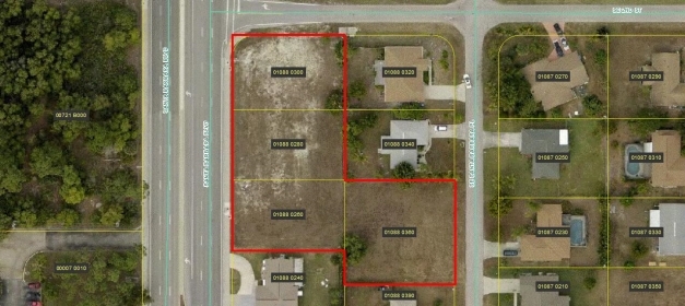
209 Santa Barbara Blvd
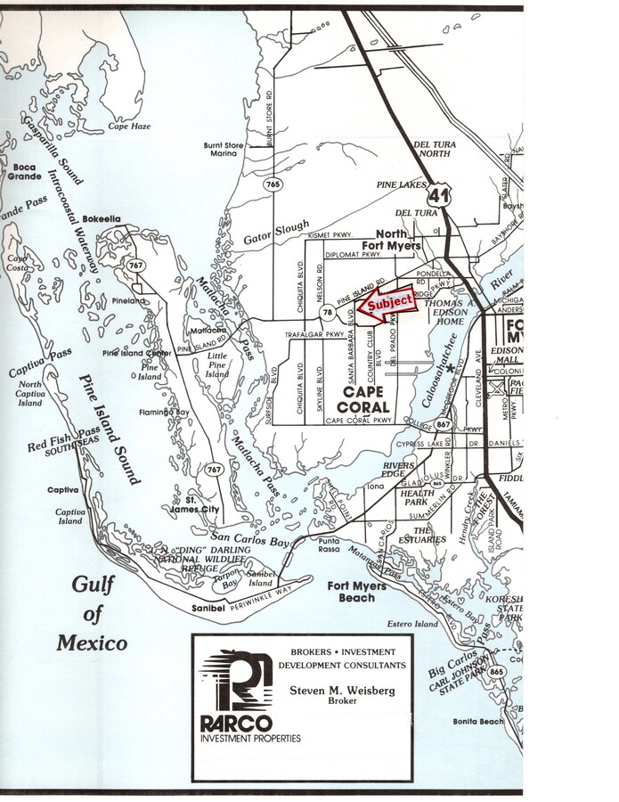
Cape Coral-Fort Myers, FL
Cape Coral
13-44-23-C1-01088.0260
CAPE CORAL UNIT 23 BLK 1088 PB 14 PG 46 LOTS 26 + 27
Residentialacreage
Lee
X
Florida
12071C0263G
26,27
2023
0.24 AC
2024
Cape Coral
010306
Southwest Florida
DEMOGRAPHICS near 209 Santa Barbara Blvd
1 Mile
3 Mile
5 Mile
2024 Total Population
7,956
71,036
168,363
2029 Population
9,413
83,966
199,674
Pop Growth 2024-2029
+ 18.31%
+ 18.20%
+ 18.60%
Average Age
40
41
42
2024 Total Households
2,791
25,519
62,766
HH Growth 2024-2029
+ 17.66%
+ 17.58%
+ 18.04%
Median Household Inc
$56,394
$65,620
$67,533
Avg Household Size
2.70
2.70
2.60
2024 Avg HH Vehicles
2.00
2.00
2.00
Median Home Value
$231,096
$258,357
$270,004
Median Year Built
2001
1999
2000
Nearby Places
- Restaurants
- Banks
- Shops
- Fitness
- Groceries
PUBLIC TRANSPORTATION
AIRPORT
Southwest Florida International
DRIVE
WALK
Distance
Southwest Florida International
37 min
22.5 mi
Punta Gorda
DRIVE
WALK
Distance
Punta Gorda
36 min
24.8 mi
Freight Ports
Port Manatee
DRIVE
WALK
Distance
Port Manatee
116 min
96.4 mi
Nearby Properties
Address
Land Use
TOTAL SIZE
Lot Size
Zoning
Address
Land Use
TOTAL SIZE
Lot Size
Zoning
634,872 SF
43.30 AC
C1-D
Address
Land Use
TOTAL SIZE
Lot Size
Zoning
476,419 SF
36.49 AC
C1
Address
Land Use
TOTAL SIZE
Lot Size
Zoning
507,243 SF
115.38 AC
A
Address
Land Use
TOTAL SIZE
Lot Size
Zoning
231,454 SF
14.53 AC
CC
Address
Land Use
TOTAL SIZE
Lot Size
Zoning
339,525 SF
38.30 AC
R1BD
Address
Land Use
TOTAL SIZE
Lot Size
Zoning
282,066 SF
39.45 AC
INS
Address
Land Use
TOTAL SIZE
Lot Size
Zoning
61,844 SF
7.31 AC
CC
Address
Land Use
TOTAL SIZE
Lot Size
Zoning
139,978 SF
10.75 AC
C-1
Address
Land Use
TOTAL SIZE
Lot Size
Zoning
101,204 SF
12.34 AC
P1-D
Address
Land Use
TOTAL SIZE
Lot Size
Zoning
101,999 SF
7.17 AC
P-1
Address
Land Use
TOTAL SIZE
Lot Size
Zoning
147,599 SF
5.72 AC
RML
Address
Land Use
TOTAL SIZE
Lot Size
Zoning
83,035 SF
19.01 AC
CORR
Address
Land Use
TOTAL SIZE
Lot Size
Zoning
153,651 SF
17.17 AC
R1-B
Address
Land Use
TOTAL SIZE
Lot Size
Zoning
101,110 SF
8.67 AC
VILL
Address
Land Use
TOTAL SIZE
Lot Size
Zoning
84,278 SF
5 AC
CORR
Address
Land Use
TOTAL SIZE
Lot Size
Zoning
62,119 SF
6.50 AC
CORR
Address
Land Use
TOTAL SIZE
Lot Size
Zoning
142,379 SF
3.27 AC
Address
Land Use
TOTAL SIZE
Lot Size
Zoning
76,042 SF
7.50 AC
CORR
Address
Land Use
TOTAL SIZE
Lot Size
Zoning
100,325 SF
4.86 AC
C-1
Address
Land Use
TOTAL SIZE
Lot Size
Zoning
78,298 SF
12.73 AC
CORR
Address
Land Use
TOTAL SIZE
Lot Size
Zoning
79,062 SF
5.15 AC
CORR
Address
Land Use
TOTAL SIZE
Lot Size
Zoning
102,818 SF
8.60 AC
CORR
Address
Land Use
TOTAL SIZE
Lot Size
Zoning
227,560 SF
27.44 AC
C1-D
Address
Land Use
TOTAL SIZE
Lot Size
Zoning
25.99 AC
RML
Address
Land Use
TOTAL SIZE
Lot Size
Zoning
58,339 SF
3.55 AC
VILL
Address
Land Use
TOTAL SIZE
Lot Size
Zoning
81,845 SF
5.53 AC
CORR
Address
Land Use
TOTAL SIZE
Lot Size
Zoning
36,649 SF
2.82 AC
C-1
Address
Land Use
TOTAL SIZE
Lot Size
Zoning
84,145 SF
8.10 AC
C-1
Address
Land Use
TOTAL SIZE
Lot Size
Zoning
78,988 SF
2.89 AC
C1-D
Address
Land Use
TOTAL SIZE
Lot Size
Zoning
58,318 SF
4.99 AC
C
The World's #1 Commercial Real Estate Marketplace
Connect with us
© 2025 CoStar Group
The information above has been obtained from sources believed reliable. While we do not doubt its accuracy we have not verified it and make no guarantee, warranty or representation about it. It is your responsibility to independently confirm its accuracy and completeness. Any projections, opinions, assumptions, or estimates used are for example only and do not represent the current or future performance of the property. The value of this transaction to you depends on tax and other factors which should be evaluated by your tax, financial, and legal advisors. You and your advisors should conduct a careful, independent investigation of the property to determine to your satisfaction the suitability of the property for your needs.