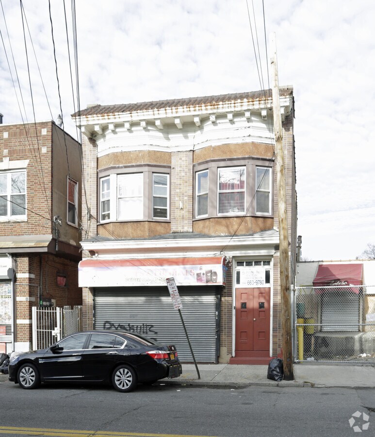
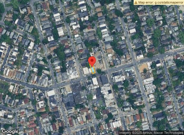
Property Record
209 W 3Rd St, Mount Vernon, NY 10550
NEARBY LISTINGS FOR SALE OR LEASE
Property Detail
209 W 3Rd St
New York-Jersey City-White Plains, NY-NJ
Map Of The Village Of Mount Vernon
0800-169-021-03018-000-0022
Westchester
Commercialofficeresidentialmixeduse
New York
X
22.000
36119C0339F
0.07 AC
2024
Southeast
2023
Westchester/So Connecticut
002900
DEMOGRAPHICS near 209 W 3Rd St
1 Mile
3 Mile
5 Mile
2024 Total Population
69,058
419,658
1,145,347
2029 Population
64,252
390,961
1,076,415
Pop Growth 2024-2029
(6.96%)
(6.84%)
(6.02%)
Average Age
40
40
40
2024 Total Households
25,449
155,136
420,847
HH Growth 2024-2029
(7.00%)
(7.15%)
(6.44%)
Median Household Inc
$63,174
$66,784
$58,986
Avg Household Size
2.60
2.60
2.60
2024 Avg HH Vehicles
1.00
1.00
1.00
Median Home Value
$456,179
$493,710
$518,412
Median Year Built
1948
1951
1950
Nearby Places
- Restaurants
- Banks
- Shops
- Fitness
- Groceries
PUBLIC TRANSPORTATION
TRANSIT/SUBWAY
Wakefield-241 Street (2 - New York MTA Subway (The Subway))
Drive
Walk
Distance
Wakefield-241 Street (2 - New York MTA Subway (The Subway))
1 min
9 min
0.5 mi
Nereid Avenue (2 - New York MTA Subway (The Subway), 5 - New York MTA Subway (The Subway))
Drive
Walk
Distance
Nereid Avenue (2 - New York MTA Subway (The Subway), 5 - New York MTA Subway (The Subway))
1 min
16 min
0.9 mi
COMMUTER RAIL
Wakefield Station (Harlem Line - Metro-North Commuter Railroad Company (Metro-North))
Drive
Walk
Distance
Wakefield Station (Harlem Line - Metro-North Commuter Railroad Company (Metro-North))
5 min
15 min
0.8 mi
Mount Vernon West Station (Harlem Line - Metro-North Commuter Railroad Company (Metro-North))
Drive
Walk
Distance
Mount Vernon West Station (Harlem Line - Metro-North Commuter Railroad Company (Metro-North))
6 min
15 min
0.8 mi
AIRPORT
Laguardia
Drive
Walk
Distance
Laguardia
25 min
13.7 mi
Westchester County
Drive
Walk
Distance
Westchester County
28 min
17.8 mi
John F Kennedy International
Drive
Walk
Distance
John F Kennedy International
31 min
21.3 mi
Freight Ports
NY - Red Hook Container Terminal
Drive
Walk
Distance
NY - Red Hook Container Terminal
40 min
23.1 mi
SALE & LEASE HISTORY
LISTING DATE
SALE/LEASE

Sep 23, 2016
For Sale
Sep 06, 2018
For Sale
May 31, 2022
For Sale
May 06, 2019
For Sale
May 05, 2022
For Sale
Feb 27, 2020
For Sale
Aug 08, 2019
For Sale
Nearby Properties
Address
Land Use
TOTAL SIZE
Lot Size
Zoning
Address
Land Use
TOTAL SIZE
Lot Size
Zoning
18,000 SF
13.85 AC
A
Address
Land Use
TOTAL SIZE
Lot Size
Zoning
201,590 SF
4.13 AC
BA
Address
Land Use
TOTAL SIZE
Lot Size
Zoning
1,132,500 SF
62.44 AC
R6
Address
Land Use
TOTAL SIZE
Lot Size
Zoning
895,256 SF
8.32 AC
R7-1
Address
Land Use
TOTAL SIZE
Lot Size
Zoning
301,156 SF
13.94 AC
A
Address
Land Use
TOTAL SIZE
Lot Size
Zoning
70,737 SF
1.67 AC
BB
Address
Land Use
TOTAL SIZE
Lot Size
Zoning
204,200 SF
1.68 AC
R7-1
Address
Land Use
TOTAL SIZE
Lot Size
Zoning
269,168 SF
0.19 AC
BUS
Address
Land Use
TOTAL SIZE
Lot Size
Zoning
617,567 SF
3.19 AC
R7-1
Address
Land Use
TOTAL SIZE
Lot Size
Zoning
545,388 SF
29.07 AC
C4-3
Address
Land Use
TOTAL SIZE
Lot Size
Zoning
537,208 SF
4.73 AC
C4-3
Address
Land Use
TOTAL SIZE
Lot Size
Zoning
707,353 SF
29.34 AC
R6
Address
Land Use
TOTAL SIZE
Lot Size
Zoning
Address
Land Use
TOTAL SIZE
Lot Size
Zoning
Address
Land Use
TOTAL SIZE
Lot Size
Zoning
18,445 SF
510.83 AC
PARK
Address
Land Use
TOTAL SIZE
Lot Size
Zoning
87,000 SF
455.70 AC
PARK
Address
Land Use
TOTAL SIZE
Lot Size
Zoning
64,165 SF
3.24 AC
B
Address
Land Use
TOTAL SIZE
Lot Size
Zoning
165,529 SF
7.05 AC
RA3
Address
Land Use
TOTAL SIZE
Lot Size
Zoning
269,100 SF
1.63 AC
R4
Address
Land Use
TOTAL SIZE
Lot Size
Zoning
785,230 SF
13.39 AC
C4-3
Address
Land Use
TOTAL SIZE
Lot Size
Zoning
434,650 SF
2 AC
R7-1
Address
Land Use
TOTAL SIZE
Lot Size
Zoning
61,055 SF
343.42 AC
R6
Address
Land Use
TOTAL SIZE
Lot Size
Zoning
493,000 SF
3.02 AC
R5
Address
Land Use
TOTAL SIZE
Lot Size
Zoning
1,028,976 SF
23.03 AC
R5
Address
Land Use
TOTAL SIZE
Lot Size
Zoning
1,038,034 SF
23.41 AC
R5
Address
Land Use
TOTAL SIZE
Lot Size
Zoning
12,150 SF
482.09 AC
PARK
Address
Land Use
TOTAL SIZE
Lot Size
Zoning
5,170 SF
9.08 AC
B
Address
Land Use
TOTAL SIZE
Lot Size
Zoning
537,765 SF
6.49 AC
C4-3
Address
Land Use
TOTAL SIZE
Lot Size
Zoning
279,749 SF
30.72 AC
M1-1
Address
Land Use
TOTAL SIZE
Lot Size
Zoning
103,158 SF
1.82 AC
R4
Start a new search to find other properties for sale or lease
Connect with us
© 2024 CoStar Group
The information above has been obtained from sources believed reliable. While we do not doubt its accuracy we have not verified it and make no guarantee, warranty or representation about it. It is your responsibility to independently confirm its accuracy and completeness. Any projections, opinions, assumptions, or estimates used are for example only and do not represent the current or future performance of the property. The value of this transaction to you depends on tax and other factors which should be evaluated by your tax, financial, and legal advisors. You and your advisors should conduct a careful, independent investigation of the property to determine to your satisfaction the suitability of the property for your needs.