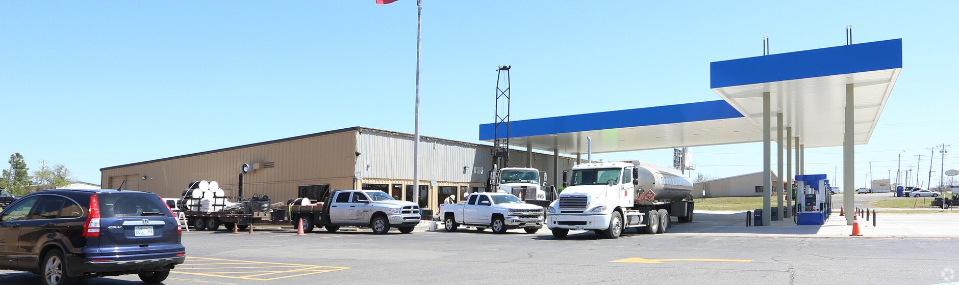
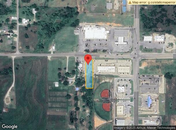
Property Record
20900 Se 29Th St, Harrah, OK 73045
NEARBY LISTINGS FOR SALE OR LEASE
-
-
View all Harrah listings for sale on LoopNet.com
Property Detail
20900 Se 29Th St
267141015
Pottawatomie Township
Storebuilding
POTTAWATOMIE TOWNSHIP PT NE4 SEC 14 11N 1E BEG 499.9FT W OF NE/C OF NE4 S350FT W76FT N350FT E76FT TO BEG
X
Oklahoma
40125C0025J
Oklahoma
2023
0.61 AC
2023
East Oklahoma County
108709
Oklahoma City
4,300 SF
Oklahoma City, OK
DEMOGRAPHICS near 20900 Se 29Th St
1 Mile
3 Mile
5 Mile
2024 Total Population
1,290
9,161
21,315
2029 Population
1,334
9,405
21,881
Pop Growth 2024-2029
+ 3.41%
+ 2.66%
+ 2.66%
Average Age
39
39
41
2024 Total Households
471
3,140
7,524
HH Growth 2024-2029
+ 3.40%
+ 2.68%
+ 2.72%
Median Household Inc
$73,096
$72,313
$73,456
Avg Household Size
2.70
2.60
2.60
2024 Avg HH Vehicles
2.00
2.00
2.00
Median Home Value
$230,232
$206,782
$203,868
Median Year Built
1997
1991
1988
Nearby Places
- Restaurants
- Banks
- Shops
- Fitness
- Groceries
PUBLIC TRANSPORTATION
AIRPORT
Will Rogers World
DRIVE
WALK
Distance
Will Rogers World
45 min
31.7 mi
Freight Ports
Tulsa Port Of Catoosa
DRIVE
WALK
Distance
Tulsa Port Of Catoosa
124 min
115.0 mi
Nearby Properties
Address
Land Use
TOTAL SIZE
Lot Size
Zoning
Address
Land Use
TOTAL SIZE
Lot Size
Zoning
28,054 SF
2 AC
Address
Land Use
TOTAL SIZE
Lot Size
Zoning
99,544 SF
7.91 AC
Address
Land Use
TOTAL SIZE
Lot Size
Zoning
52,620 SF
2.48 AC
Address
Land Use
TOTAL SIZE
Lot Size
Zoning
15,180 SF
1.84 AC
Address
Land Use
TOTAL SIZE
Lot Size
Zoning
77,668 SF
4.98 AC
Address
Land Use
TOTAL SIZE
Lot Size
Zoning
21,660 SF
2.70 AC
Address
Land Use
TOTAL SIZE
Lot Size
Zoning
54,140 SF
2 AC
Address
Land Use
TOTAL SIZE
Lot Size
Zoning
21,348 SF
1.34 AC
Address
Land Use
TOTAL SIZE
Lot Size
Zoning
15,624 SF
1.59 AC
Address
Land Use
TOTAL SIZE
Lot Size
Zoning
1,344 SF
0.14 AC
Address
Land Use
TOTAL SIZE
Lot Size
Zoning
10,140 SF
1.24 AC
Address
Land Use
TOTAL SIZE
Lot Size
Zoning
32,200 SF
8.59 AC
Address
Land Use
TOTAL SIZE
Lot Size
Zoning
12,000 SF
10.02 AC
Address
Land Use
TOTAL SIZE
Lot Size
Zoning
14,080 SF
31.56 AC
Address
Land Use
TOTAL SIZE
Lot Size
Zoning
19,286 SF
2.27 AC
Address
Land Use
TOTAL SIZE
Lot Size
Zoning
24,240 SF
3.36 AC
Address
Land Use
TOTAL SIZE
Lot Size
Zoning
3,492 SF
1.28 AC
Address
Land Use
TOTAL SIZE
Lot Size
Zoning
26.38 AC
Address
Land Use
TOTAL SIZE
Lot Size
Zoning
4,544 SF
1.12 AC
Address
Land Use
TOTAL SIZE
Lot Size
Zoning
6,724 SF
1.03 AC
Address
Land Use
TOTAL SIZE
Lot Size
Zoning
6,161 SF
1.02 AC
Address
Land Use
TOTAL SIZE
Lot Size
Zoning
12,040 SF
6.59 AC
Address
Land Use
TOTAL SIZE
Lot Size
Zoning
11,264 SF
1.90 AC
Address
Land Use
TOTAL SIZE
Lot Size
Zoning
4,200 SF
1.14 AC
Address
Land Use
TOTAL SIZE
Lot Size
Zoning
4,800 SF
0.82 AC
Address
Land Use
TOTAL SIZE
Lot Size
Zoning
3,858 SF
1.52 AC
Address
Land Use
TOTAL SIZE
Lot Size
Zoning
7,550 SF
2.49 AC
Address
Land Use
TOTAL SIZE
Lot Size
Zoning
10,560 SF
8.07 AC
Address
Land Use
TOTAL SIZE
Lot Size
Zoning
8,190 SF
1.47 AC
Address
Land Use
TOTAL SIZE
Lot Size
Zoning
2,680 SF
0.63 AC
The World's #1 Commercial Real Estate Marketplace
Connect with us
© 2025 CoStar Group
The information above has been obtained from sources believed reliable. While we do not doubt its accuracy we have not verified it and make no guarantee, warranty or representation about it. It is your responsibility to independently confirm its accuracy and completeness. Any projections, opinions, assumptions, or estimates used are for example only and do not represent the current or future performance of the property. The value of this transaction to you depends on tax and other factors which should be evaluated by your tax, financial, and legal advisors. You and your advisors should conduct a careful, independent investigation of the property to determine to your satisfaction the suitability of the property for your needs.