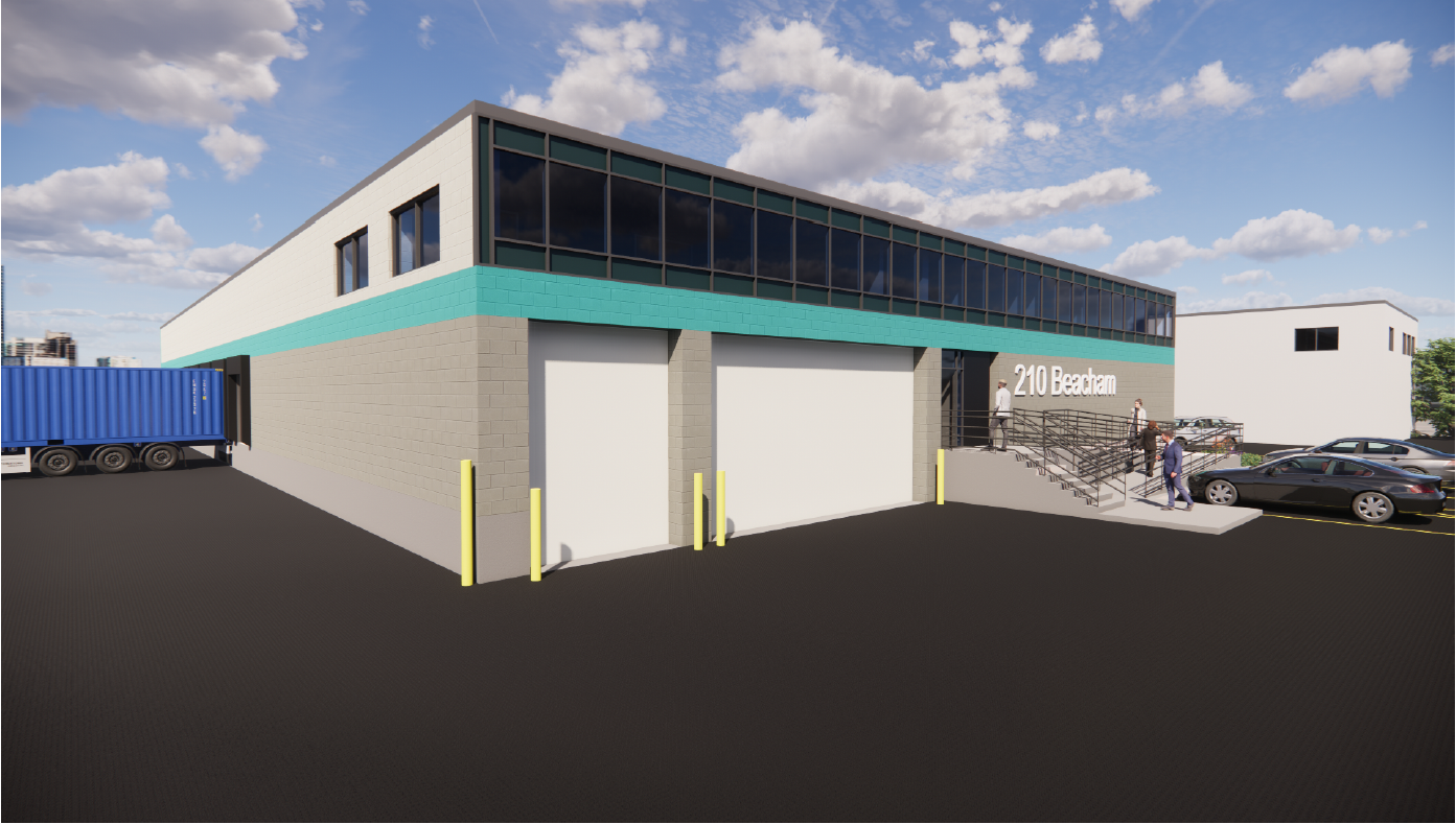
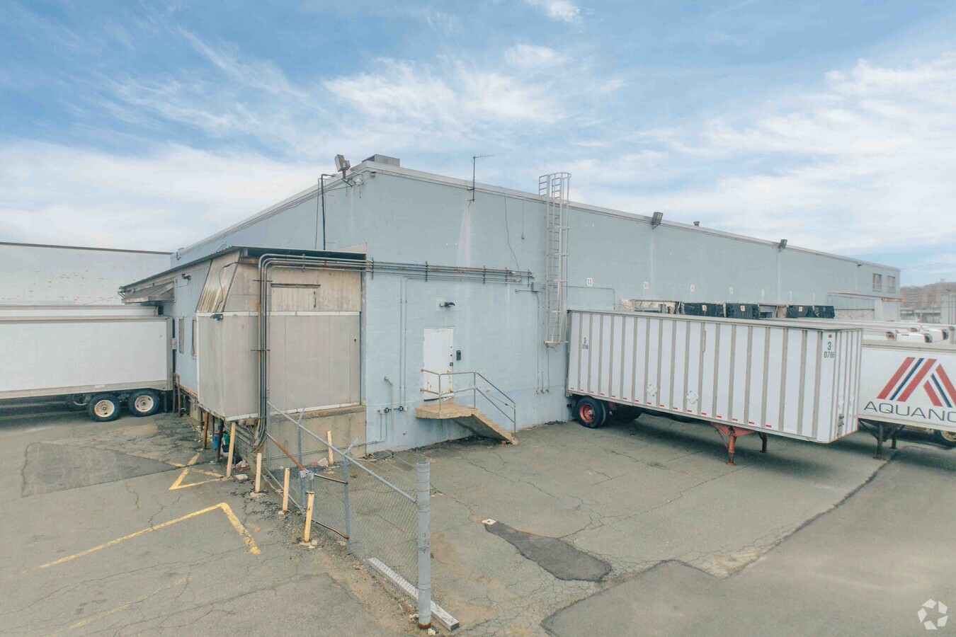
Property Record
210 Beacham St, Everett, MA 02149

Current Lease Availabilities
NEARBY LISTINGS FOR SALE OR LEASE
Property Detail
210 Beacham St
EVER-000000-H000013-000140
Middlesex
Commercialbuilding
Massachusetts
X
140
25025C0018J
1.56 AC
2024
Somerville/Chelsea
2024
Boston
342402
Boston-Cambridge-Newton, MA-NH
25,580 SF
DEMOGRAPHICS near 210 Beacham St
1 Mile
3 Mile
5 Mile
2024 Total Population
24,304
360,791
813,527
2029 Population
23,423
347,127
787,719
Pop Growth 2024-2029
(3.62%)
(3.79%)
(3.17%)
Average Age
37
38
37
2024 Total Households
9,254
149,369
339,443
HH Growth 2024-2029
(3.76%)
(3.75%)
(3.28%)
Median Household Inc
$73,713
$90,880
$95,245
Avg Household Size
2.50
2.30
2.20
2024 Avg HH Vehicles
1.00
1.00
1.00
Median Home Value
$480,975
$709,063
$755,748
Median Year Built
1948
1949
1949
Nearby Places
- Restaurants
- Banks
- Shops
- Fitness
- Groceries
PUBLIC TRANSPORTATION
COMMUTER RAIL
Chelsea (Newburyport/Rockport Line - MBTA)
DRIVE
WALK
Distance
Chelsea (Newburyport/Rockport Line - MBTA)
3 min
17 min
0.9 mi
North Station (Fitchburg/South Acton Line - Massachusetts Bay Transportation Authority Commuter Rail (Purple Line), Haverhill Line - Massachusetts Bay Transportation Authority Commuter Rail (Purple Line), Lowell Line - Massachusetts Bay Transportation Authority Commuter Rail (Purple Line), Newburyport/Rockport Line - Massachusetts Bay Transportation Authority Commuter Rail (Purple Line))
DRIVE
WALK
Distance
North Station (Fitchburg/South Acton Line - Massachusetts Bay Transportation Authority Commuter Rail (Purple Line), Haverhill Line - Massachusetts Bay Transportation Authority Commuter Rail (Purple Line), Lowell Line - Massachusetts Bay Transportation Authority Commuter Rail (Purple Line), Newburyport/Rockport Line - Massachusetts Bay Transportation Authority Commuter Rail (Purple Line))
7 min
3.4 mi
AIRPORT
General Edward Lawrence Logan International
DRIVE
WALK
Distance
General Edward Lawrence Logan International
9 min
3.7 mi
Freight Ports
Port of Boston
DRIVE
WALK
Distance
Port of Boston
14 min
7.0 mi
Nearby Properties
Address
Land Use
TOTAL SIZE
Lot Size
Zoning
Address
Land Use
TOTAL SIZE
Lot Size
Zoning
467,952 SF
0.86 AC
BPA
Address
Land Use
TOTAL SIZE
Lot Size
Zoning
488,832 SF
1.38 AC
BB
Address
Land Use
TOTAL SIZE
Lot Size
Zoning
230,394 SF
0.60 AC
MXD
Address
Land Use
TOTAL SIZE
Lot Size
Zoning
239,377 SF
0.71 AC
MXD
Address
Land Use
TOTAL SIZE
Lot Size
Zoning
379,172 SF
1.04 AC
RC
Address
Land Use
TOTAL SIZE
Lot Size
Zoning
1.13 AC
C
Address
Land Use
TOTAL SIZE
Lot Size
Zoning
435,381 SF
4.22 AC
LB-R
Address
Land Use
TOTAL SIZE
Lot Size
Zoning
399,897 SF
1.57 AC
Address
Land Use
TOTAL SIZE
Lot Size
Zoning
158,526 SF
1.13 AC
MXD
Address
Land Use
TOTAL SIZE
Lot Size
Zoning
646,546 SF
89.28 AC
ROD
Address
Land Use
TOTAL SIZE
Lot Size
Zoning
378,339 SF
3.02 AC
E
Address
Land Use
TOTAL SIZE
Lot Size
Zoning
241,400 SF
0.57 AC
C
Address
Land Use
TOTAL SIZE
Lot Size
Zoning
284,685 SF
0.61 AC
C
Address
Land Use
TOTAL SIZE
Lot Size
Zoning
386,825 SF
10.67 AC
Address
Land Use
TOTAL SIZE
Lot Size
Zoning
526,171 SF
8.39 AC
A
Address
Land Use
TOTAL SIZE
Lot Size
Zoning
248,000 SF
0.58 AC
C
Address
Land Use
TOTAL SIZE
Lot Size
Zoning
613,125 SF
15.74 AC
RC
Address
Land Use
TOTAL SIZE
Lot Size
Zoning
17,788 SF
8.32 AC
C-1
Address
Land Use
TOTAL SIZE
Lot Size
Zoning
223,214 SF
1.01 AC
E
Address
Land Use
TOTAL SIZE
Lot Size
Zoning
269,994 SF
2.88 AC
Address
Land Use
TOTAL SIZE
Lot Size
Zoning
282,112 SF
2.51 AC
IA-1
Address
Land Use
TOTAL SIZE
Lot Size
Zoning
370,000 SF
0.97 AC
Address
Land Use
TOTAL SIZE
Lot Size
Zoning
263,870 SF
0.41 AC
C
Address
Land Use
TOTAL SIZE
Lot Size
Zoning
755,000 SF
3.36 AC
C
Address
Land Use
TOTAL SIZE
Lot Size
Zoning
4.11 AC
C-2
Address
Land Use
TOTAL SIZE
Lot Size
Zoning
236,000 SF
0.84 AC
C
Address
Land Use
TOTAL SIZE
Lot Size
Zoning
167,625 SF
0.45 AC
C
Address
Land Use
TOTAL SIZE
Lot Size
Zoning
140,205 SF
0.83 AC
IB
Address
Land Use
TOTAL SIZE
Lot Size
Zoning
230,544 SF
2.25 AC
E
Address
Land Use
TOTAL SIZE
Lot Size
Zoning
401,310 SF
1.32 AC
C
The World's #1 Commercial Real Estate Marketplace
Connect with us
© 2025 CoStar Group
The information above has been obtained from sources believed reliable. While we do not doubt its accuracy we have not verified it and make no guarantee, warranty or representation about it. It is your responsibility to independently confirm its accuracy and completeness. Any projections, opinions, assumptions, or estimates used are for example only and do not represent the current or future performance of the property. The value of this transaction to you depends on tax and other factors which should be evaluated by your tax, financial, and legal advisors. You and your advisors should conduct a careful, independent investigation of the property to determine to your satisfaction the suitability of the property for your needs.