Property Record
2100 E Britton Rd, Oklahoma City, OK 73131


NEARBY LISTINGS FOR SALE OR LEASE
Property Detail
2100 E Britton Rd
134975860
Unpltd Pt Sec 36 13N 3W
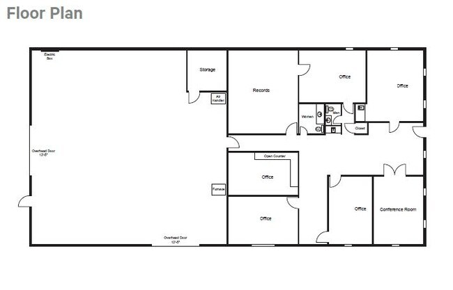
Lightindustrial
UNPLTD PT NW4 SEC 36 13N 3W BEG 440FT E OF NW/C OF NW4 TH S495FT E440FT N495FT W440FT TO BEG SUBJ TO ESMTS OF RECORD
X
Oklahoma
40109C0178J
Oklahoma
2023
6.74 AC
2024
Northeast
108301
Oklahoma City
9,500 SF
Oklahoma City, OK
DEMOGRAPHICS near 2100 E Britton Rd
1 Mile
3 Mile
5 Mile
2024 Total Population
477
17,663
99,809
2029 Population
497
18,165
102,291
Pop Growth 2024-2029
+ 4.19%
+ 2.84%
+ 2.49%
Average Age
49
39
39
2024 Total Households
203
7,185
43,051
HH Growth 2024-2029
+ 4.43%
+ 3.01%
+ 2.63%
Median Household Inc
$55,789
$52,799
$57,679
Avg Household Size
2.20
2.30
2.20
2024 Avg HH Vehicles
2.00
2.00
2.00
Median Home Value
$237,142
$203,593
$217,829
Median Year Built
1949
1978
1976
Nearby Places
Map Layers
Map Styles
 Street
 Aerial
- Restaurants
- Banks
- Shops
- Fitness
- Groceries
PUBLIC TRANSPORTATION
AIRPORT
Will Rogers World
DRIVE
WALK
Distance
Will Rogers World
32 min
18.5 mi
SALE & LEASE HISTORY
LISTING DATE
SALE/LEASE

Apr 20, 2023
For Sale
Nearby Properties
Address
Land Use
TOTAL SIZE
Lot Size
Zoning
Address
Land Use
TOTAL SIZE
Lot Size
Zoning
233,053 SF
18.93 AC
O-2
Address
Land Use
TOTAL SIZE
Lot Size
Zoning
777,727 SF
54.25 AC
I-2
Address
Land Use
TOTAL SIZE
Lot Size
Zoning
93,244 SF
7.54 AC
PUD
Address
Land Use
TOTAL SIZE
Lot Size
Zoning
399,688 SF
80.57 AC
PUD
Address
Land Use
TOTAL SIZE
Lot Size
Zoning
241,874 SF
36.89 AC
PUD
Address
Land Use
TOTAL SIZE
Lot Size
Zoning
105,426 SF
15.58 AC
O-2
Address
Land Use
TOTAL SIZE
Lot Size
Zoning
13,101 SF
1.22 AC
PUD
Address
Land Use
TOTAL SIZE
Lot Size
Zoning
43,489 SF
14.86 AC
PUD
Address
Land Use
TOTAL SIZE
Lot Size
Zoning
21,000 SF
2.64 AC
I-1
Address
Land Use
TOTAL SIZE
Lot Size
Zoning
280,970 SF
24.32 AC
Address
Land Use
TOTAL SIZE
Lot Size
Zoning
160,389 SF
16.48 AC
PUD
Address
Land Use
TOTAL SIZE
Lot Size
Zoning
145,124 SF
55 AC
PUD
Address
Land Use
TOTAL SIZE
Lot Size
Zoning
39,800 SF
4.10 AC
PUD
Address
Land Use
TOTAL SIZE
Lot Size
Zoning
316,358 SF
39.39 AC
PUD
Address
Land Use
TOTAL SIZE
Lot Size
Zoning
113,781 SF
14.06 AC
Address
Land Use
TOTAL SIZE
Lot Size
Zoning
59,307 SF
3.75 AC
PUD
Address
Land Use
TOTAL SIZE
Lot Size
Zoning
160,816 SF
16.14 AC
Address
Land Use
TOTAL SIZE
Lot Size
Zoning
39,883 SF
2.35 AC
PUD
Address
Land Use
TOTAL SIZE
Lot Size
Zoning
70,284 SF
9.40 AC
PUD
Address
Land Use
TOTAL SIZE
Lot Size
Zoning
36,251 SF
6.21 AC
Address
Land Use
TOTAL SIZE
Lot Size
Zoning
148,620 SF
15.78 AC
PUD
Address
Land Use
TOTAL SIZE
Lot Size
Zoning
51,176 SF
23.24 AC
PUD
Address
Land Use
TOTAL SIZE
Lot Size
Zoning
154,716 SF
15.12 AC
PUD
Address
Land Use
TOTAL SIZE
Lot Size
Zoning
44,419 SF
14.63 AC
O-2
Address
Land Use
TOTAL SIZE
Lot Size
Zoning
34,969 SF
6.86 AC
O-2
Address
Land Use
TOTAL SIZE
Lot Size
Zoning
138,774 SF
14.63 AC
Address
Land Use
TOTAL SIZE
Lot Size
Zoning
220,800 SF
14.55 AC
PUD
Address
Land Use
TOTAL SIZE
Lot Size
Zoning
58,293 SF
10.88 AC
C-4
Address
Land Use
TOTAL SIZE
Lot Size
Zoning
32,252 SF
3.33 AC
PUD
The World's #1 Commercial Real Estate Marketplace
Connect with us
© 2026 CoStar Group
The information above has been obtained from sources believed reliable. While we do not doubt its accuracy we have not verified it and make no guarantee, warranty or representation about it. It is your responsibility to independently confirm its accuracy and completeness. Any projections, opinions, assumptions, or estimates used are for example only and do not represent the current or future performance of the property. The value of this transaction to you depends on tax and other factors which should be evaluated by your tax, financial, and legal advisors. You and your advisors should conduct a careful, independent investigation of the property to determine to your satisfaction the suitability of the property for your needs.