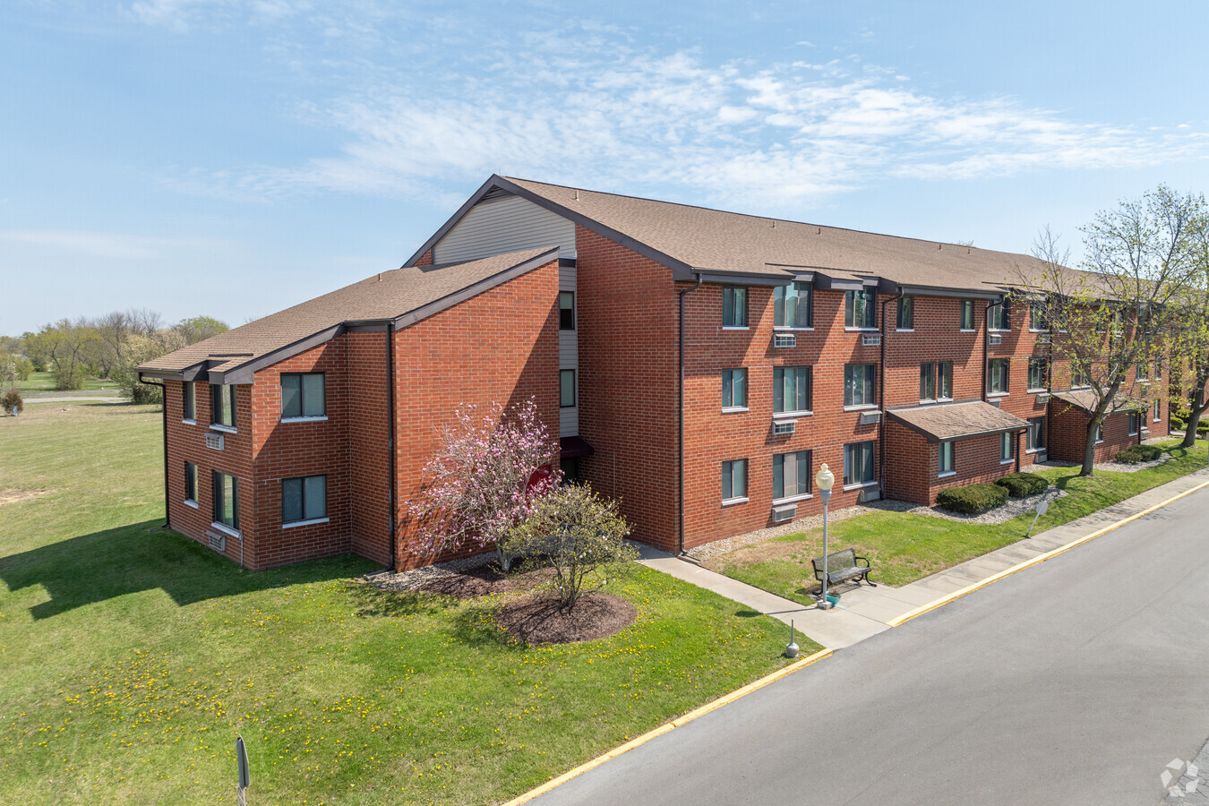
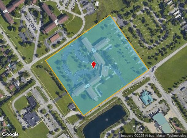
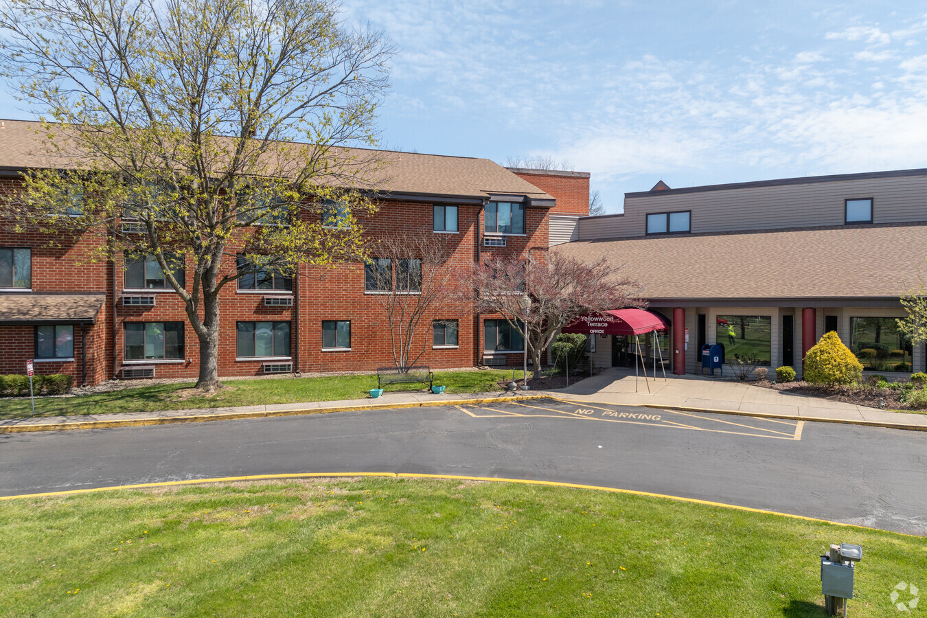
Property Record
2100 Greentree N, Clarksville, IN 47129
NEARBY LISTINGS FOR SALE OR LEASE
-
-
View all Clarksville listings for sale on LoopNet.com
Property Detail
2100 Greentree N
10-24-04-600-021.000-013
GT 46 12.161 ACRES
Apartment
Clark
X
Indiana
18019C0259E
12.16 AC
2023
Clarksville
2023
Louisville
050504
Louisville-Jefferson County, KY-IN
182,405 SF
DEMOGRAPHICS near 2100 Greentree N
1 Mile
3 Mile
5 Mile
2024 Total Population
6,789
57,647
139,261
2029 Population
7,231
60,324
145,549
Pop Growth 2024-2029
+ 6.51%
+ 4.64%
+ 4.52%
Average Age
42
41
40
2024 Total Households
2,906
23,933
58,158
HH Growth 2024-2029
+ 7.02%
+ 4.69%
+ 4.59%
Median Household Inc
$38,265
$60,145
$53,923
Avg Household Size
2.20
2.30
2.30
2024 Avg HH Vehicles
1.00
2.00
2.00
Median Home Value
$132,288
$169,186
$165,729
Median Year Built
1977
1978
1974
Nearby Places
- Restaurants
- Banks
- Shops
- Fitness
- Groceries
PUBLIC TRANSPORTATION
AIRPORT
Louisville Muhammad Ali International
DRIVE
WALK
Distance
Louisville Muhammad Ali International
24 min
13.7 mi
Freight Ports
Port of Toledo
DRIVE
WALK
Distance
Port of Toledo
354 min
306.0 mi
Nearby Properties
Address
Land Use
TOTAL SIZE
Lot Size
Zoning
Address
Land Use
TOTAL SIZE
Lot Size
Zoning
52.78 AC
Address
Land Use
TOTAL SIZE
Lot Size
Zoning
13,240 SF
20.84 AC
Address
Land Use
TOTAL SIZE
Lot Size
Zoning
120,337 SF
18.20 AC
Address
Land Use
TOTAL SIZE
Lot Size
Zoning
109,470 SF
2.27 AC
Address
Land Use
TOTAL SIZE
Lot Size
Zoning
2,208 SF
26.20 AC
Address
Land Use
TOTAL SIZE
Lot Size
Zoning
4,178 SF
10.39 AC
Address
Land Use
TOTAL SIZE
Lot Size
Zoning
7,268 SF
13 AC
Address
Land Use
TOTAL SIZE
Lot Size
Zoning
136,949 SF
36.89 AC
Address
Land Use
TOTAL SIZE
Lot Size
Zoning
2,000 SF
13.11 AC
Address
Land Use
TOTAL SIZE
Lot Size
Zoning
128,269 SF
10.18 AC
Address
Land Use
TOTAL SIZE
Lot Size
Zoning
256,500 SF
12.87 AC
Address
Land Use
TOTAL SIZE
Lot Size
Zoning
11,695 SF
18.33 AC
Address
Land Use
TOTAL SIZE
Lot Size
Zoning
17.57 AC
Address
Land Use
TOTAL SIZE
Lot Size
Zoning
56,775 SF
5.30 AC
Address
Land Use
TOTAL SIZE
Lot Size
Zoning
1,276 SF
3.78 AC
Address
Land Use
TOTAL SIZE
Lot Size
Zoning
12,752 SF
13.56 AC
Address
Land Use
TOTAL SIZE
Lot Size
Zoning
75,560 SF
8.18 AC
Address
Land Use
TOTAL SIZE
Lot Size
Zoning
173,121 SF
15.82 AC
Address
Land Use
TOTAL SIZE
Lot Size
Zoning
9,900 SF
11.23 AC
Address
Land Use
TOTAL SIZE
Lot Size
Zoning
1,377 SF
22.66 AC
Address
Land Use
TOTAL SIZE
Lot Size
Zoning
204,750 SF
26.96 AC
Address
Land Use
TOTAL SIZE
Lot Size
Zoning
131,510 SF
14.62 AC
Address
Land Use
TOTAL SIZE
Lot Size
Zoning
34,760 SF
29.13 AC
Address
Land Use
TOTAL SIZE
Lot Size
Zoning
76,929 SF
10.03 AC
Address
Land Use
TOTAL SIZE
Lot Size
Zoning
58,884 SF
7.92 AC
Address
Land Use
TOTAL SIZE
Lot Size
Zoning
1,679 SF
7.87 AC
Address
Land Use
TOTAL SIZE
Lot Size
Zoning
204,428 SF
9.82 AC
Address
Land Use
TOTAL SIZE
Lot Size
Zoning
91,311 SF
7.04 AC
Address
Land Use
TOTAL SIZE
Lot Size
Zoning
32,850 SF
9.21 AC
The World's #1 Commercial Real Estate Marketplace
Connect with us
© 2025 CoStar Group
The information above has been obtained from sources believed reliable. While we do not doubt its accuracy we have not verified it and make no guarantee, warranty or representation about it. It is your responsibility to independently confirm its accuracy and completeness. Any projections, opinions, assumptions, or estimates used are for example only and do not represent the current or future performance of the property. The value of this transaction to you depends on tax and other factors which should be evaluated by your tax, financial, and legal advisors. You and your advisors should conduct a careful, independent investigation of the property to determine to your satisfaction the suitability of the property for your needs.